The Zybach Collection · Elliott State Forest
David Gould editing notes on the November 8, 2017 Elliott field trip oral history interviews with Jerry Phillips
November 8, 2017
A transcript Bob Zybach filed with the Elliott State Forest oral histories: November 8, 2017.
Cite as David Gould editing notes on the November 8, 2017 Elliott field trip oral history interviews with Jerry Phillips
Provenance
- Creator
- Dr. Bob Zybach
- Interviewer
- Bob Zybach
- Participants
- David Glae Gould, Bob Zybach
- Recorded
- November 8, 2017
- Transcript source
- scanned image-only PDF (no embedded text layer) of a laser-printed draft carrying dense handwritten pen annotation
- Text recovered by
- pdftoppm -r 300 -gray then tesseract --psm 6; PDF pages 77-80 are bound upside down and were rotated 180 degrees before OCR; the running footer of PDF page 77 was read by eye from the render
- Original transcript
- http://www.orww.org/Elliott_Forest/History/Oral/20171108/Transcript/Zybach-Gould_Edits_20190910.pdf
- Source file checksum
- sha256 9425c9617bab2c1d9d662d455996ebcd60d1c93aaca3a684f9ecff453f3f9da5
- Described by
- OSU SCARC finding aid, OH 047
- Accession
- Accessioned from Bob Zybach’s upload to the shared Drive, 2026-08-23.
What those passages are, page by page
- Every sheet carries David Gould's manuscript corrections, insertions and strike-throughs. They are NOT transcribed in this record. The OCR text below is the typed draft only, and fragments of the handwriting have bled into it.
The day
- Date
- November 8, 2017
- Participants
- David Glae Gould, Bob Zybach
- Interviewer
- Bob Zybach
- Photographs online
- 38
Route maps
- map Elliott Forest oral history tour route, Zybach & Ross, November 8, 2017 JPEG · 1.3 MB
Transcript
Pages are numbered as Bob Zybach printed them. Each page number is a permalink. this document has no pagination of its own: each sheet carries the running footer of the DRAFT November 8, 2017 transcript, '<Tape n-X>. Phillips-Zybach 20171108 <page>'. Cite it by that draft page, and read the final text at zc-el-s20171108-phillips on the same page number.
5-A
5-A 0:04
Tape 5-A. Interview with Jerry Phillips and David Gould by Bob Zybach, with Amber Ross and
Part 1. The Big Burn to Bear Wallow
Haynes Inlet. 0:04 The Big Burn to Bert’s Cabin Photos. No Photos. we
They [Larson family] were here when the 1868 fire e. Then built this barn from the timber on what was left over later. They cleaned all this bottom up. a TEE as Weaphainash een FB ag call there tocatthesmff. L/S¢A7% Avgs, 2 ee S wnt 7 i-slhn and Lb rwthed Lian re Likconre leg ~te Atal age
But I have a recording taken by ape mani teen and semeetsthe r [John and Maralee] Brelage trams, aft fx Brclages bought the ranch from [Herman] Larson So they took the recordin said the fire of 1868 and talked about it and said it s in : which I don't know if that's ecauze fr KOS ae rey Fe Tener ° goles g KIS a [Field LEE
I think it's true. That's the facts. “iF wr (G1 & + a lob el -,
Epahenatmejn Seman Boscbntcerepecttinly(,, BE #4 rf ln It 5 Re we pag che med ane
Yeah, that was the one we argued about. ih kh i LD 9 qd 4 {ok iro, %
Scholfield Creek. Yeah. 77% 7°" ny ephgas 7M /s 4d. befer /3?
Jerry says Scottsburg, you say Loon Lake.
Well, it depends on which fire you are ii about. T as KGttO= fe u
Anyway. + # / Aphories!a4e kk dn lk enh ead Mery (fen Went
Well, he's Saying the 1868 fire started on Scholfield Creek. There's no See fh cbrsig way. e or baste 34 wthepepn @
Nope, there isn't.
It might have come down from Scholfield Creek before it hit the Lar$ «/7 pal ace [silence from mle until 01:44) AN: oa ta
... Survey made a record that say that size of 6 inch trees, and talked about the fire and everything on that survey. My aunt [Aileen Rickard, The Goulds of Elkhorn, 1982] never knew when the fire was. Ta.beriteonid shasecboorrFS6t-ort886.
5-A
They just called it the Big Burn.
Big Burn, yeah. § ot peat plow
Now one thing about the Larson's, they said this whole/area up above the house was all skunk cabbage. So, that was a major native food. That would have been people in here and where the terraces are px age es Do i you know anything about artifacts or things of thay nature? rere © a bere poh Piha Chats a. pogte ceatae tdars +
I don't. They talked about it wa and they were just mainly making a / living. Started out that way. erhat~ Loin did bureg a off Zt dim Cody an q Korres
And that was on the terraces’ ; he b bared Lorre Hayne TT
Yeah, and on down from-#héte. ee a
Hey Randy,
Yeah.
You think we could pull the tire off?
Yeah, I was just thinking the same thing. Place to pull over and --
Maybe that left shoulder.
David one thing we did last time was at the beginning of the tape said the date. What's the date? November 8th. And identified everybody, al! four of us have been identified, and then OK'd using this, putting it on the internet or transcribing it or using it for education and research. So I'm assuming that's okay with you as well.
Yeah.
Okay. well, we got it on tape now,
It's okay.
Jerry all those recordings from last time came out real well.
Oh, good.
And the photographs came out pretty darn good too.
Glad to hear it.
5-A
So we've got a real good record.
When the people first come up in there they had to get cross the bay ina boat, they didn't have any roads in here. And the Indian canoes was a little bit of use.
Well that's what I was thinking if the bay was back there where those terraces were, with people traveling around in canoes, those would be ideal —
That would have been a long time ago.
Yep.
Now they’re filling in.
Yep.
See the base level would have been about 50 feet below the field here, this is all ar in. Alluvial. a// came +n fre Lhe [reFars feo ze if) S = 2
From how long ago? ef ynil) Cer Ps aa ar
Well, several thousand years, a million years, whatever.
Ah-ha.
See the that there. Took some --
| think they are moving a tire around or something.
Well I ran across another picture, | have no idea where it came from or who wrote on it, but I'll give it to you.
Ah-ha. (affirmative)
| brought a bunch of copies of David's pictures so we could compare them. Cabin photos.
Well, that must be the. . .
Cedar cabin?
Where is there? Oh that's Bert's cabin, what they called Bert's cabin.
Yep, Bert's cabin.
5-A
| got a million pictures of it in here, I'll show you later.
Well this is good quality one.
Yeah. | got another book in here.
Now Jerry | can take this and scan it? And return it?
You can have that one.
Wow, thank you.
| got one up there.
Dave says he doesn't recognize any of the people there, it seems like he, well | shouldn't say anything at all.
Well. Bert's the one that did the survey. I have the survey with it.
Yeah, I know that.
In...
I got plenty of stuff up here. | got this other stuff, too. [silence from 05:47 until 05:57]
Ah ha. The one, will you hold that?
This is the Colorado River, look at that. 1 was on a conference trip with Advocates for School Trust Lands, back in Utah. “tet
Uh huh. (affirmative)
Representing school children and that's the Colorado River, look at that. orp?
Is that after the big spill they had on the --
No, that's --
Normal? Anke be Lprgl Mernmen /
We were up in the park up there and it was raining real hard and it come et Lhas vir prs a, looks 744 : = runs off, | mean tats the var - fra? ore4f2 Sand ofer&
5-A
Wow.
They can get away with it but we can't. Look at it, it's orange, looks just like OSU.
Well | think the word Colorado in Spanish means --
Well, here we go.
Red or colored,
Yeah.
It's a color word. Yeah.
Can you believe that picture?
Yeah. What's what 1... the Colorado.
I mean when we pet something looks halfway like that we'd fh fined up : here. Pv/e4te Pipe ly ewner ave fi¢ fe olf FetA i ~* 44 otf Cpr tA i? proper? 4 y Fripes Deptt!
Wow. o & 5 é ete P oras <
Federal government's doing that, that's off a national park.
I think that's something that’s probably is there before the federal government, though. If you look at the soil there, it's always eroding.
Oh yeah. Here | t to show you this in that picture. It's that same cabin For eee -@ "a oatot Pew Creek
Ahb-ha.
You can recognize it, it's got the straight rungs of up here. And this comer, this comer is bent down, but this is the same photograph but a different time.
Ah-ha.
And these horses here, these are George Gould's horses. Two white horses. I got pictures of them here also.
Ah-ha.
This is the Allegany but, might be these same people here. Stone @6p 1 E95
5-A
5-A 8:42
Yup.
Could be.
Can you identify any of them?
I don't really know who they are. | know this one here is eo aly Bait, /4E9 bead fren Aorses. at the bay Nez) x0 iS pe Pith & fore while tok ig sie "4 w.
Ah-hane B “) broil Gell or WaTPKfa Bend)
He could have had the camera, | think. I got this also, look at here.
Ah-ha, you've got the same photos. OA ZY tO cee Sith sd
#s packed in here, setting up the pack foomingin-e trails. That's how we got into Elkhorn — it's all by horse.
Still going to make noise. But —
Well, it's not quite so bad.
Well, there's the original photo. There's the one I was familiar with, y) J A J =o 1 tthe Ahiverside Rach ot ALG orG
That's the boat he built/to cross that tives’ Sounds like we got a flat tire.
That's the rack behind us.
Behind us is —
Stop #B-1. 8:42 Larson Ridge Road to Bear Wallow
Now this, we're going up here and there are going to be several, used to be, people living up here and they used to come down, the trail come right down the ridge right in front of us.
Sign that says Phillips photos.
Anyway the trail come right down the ridge in front of us, this is where d Jerry Grossen_lives here now. I went to school with him. at Wor Ber
So this trail here would be what -- Be at hha H. oe
Well, the one that goes up to the place [E#teesa-Ragch], I can show you where the trail was up on top, up on the hill in the Elliott.
5-A
Ah-ha. (affirmative)
Came out at this way, the trail went right up this ridge, up over the top of Hing it. Turn right. eating Lens ac} cowlty Kd, 7 land yprthe gor fine Jn wf)
Turn right? Okay.
That's where we leave the county road here.
We're starting up the 3000.
We built this road. The State Forest.
So we just started up the intersection of the 3000. What did this used to be called? What was the old name of this road?
This is state road here.
Larson Slough.
Larson Slough Road? )
Larson, man named Larson slough. It's got a county number but --
Uh huh (affirmative). Let's see, it’ . yeah just download that folder, all others are irrelevant, or, thee (TH RA
There's ttek redwood vet ahead of us, real thick planting. Oh, when they living in there, used to be a house rig ht in where the road it. I i A played ... See the trees right there? A ELLER ra . i ph the eF ; F2B Say a Le ae os Bob Zybach: Yup. J Lf - | qh David Gould: About six, eight, six, seven gt jn diameter here. = ae ie P / Fat < py:
When did they plant those? They planted a lot in the 1880's in western gon but —- . Ps erry Grete sq M's pd flhn a oe nly
. i ey went down to see the redwoods and (922 rouge some Se to plant them. Aag & That ynakes thon Fa eh 46 old kes wood sf] y :
Yeah, those look a lot newer than thay/ “ as rt
The Grossens were not happy to give us this, right away through here but, they understood the way we needed to have it.
5-A
So if thi is Brelage’s property theygot it from The Larsons? ‘David Gould: _ Oh,-well-Larson's-isdowneBrelage's is out in the field below down there, Pee his propertystopped tht back-where the roadstarted here.
Okay, but would the road rights come from -- / ih ad
Well this belonged to dois. mated Hutchinson. hs iy # aeret Yn patsy [hg f broceen- pYy
Ah-ha. ,
Their son does still live here. Jerry Grossen_was over there. I went to high school with him.
Ah-ha. the oft
We used to hunt up in here, #87 bought all these, where these homesteads were, a few apple trees and stuff. Hunt down through there, hunt for elk.
Ah-ha.
Well, Jerry on your map you've got several little cabins in this general area. Here is old building sites. That was a question I had. David just brought up old apple trees, those would be --
Oh I've seen —
Well all the old homesteads had apple trees.
I'm wondering if any are left now.
Not very many are left, of the trees currently now. Partly the age. Most of . them got too old and died. 0“ ¥4e@ @q Mor pa hohe pa pr at led
I'm kind of interested in them, they've got historical value of course, and cultural value. But, also they got a lot of wildlife value. Deer and bear and a lot of people hunted the old orchards for lots of years. If they are still j around it seems like those would be things worth preserving, or # maintaining, anyhow.
You can see this is pretty steep country in here. The people lived back in L i 4 came down rg ag Se Fane down the draw here. “Ar7c. “O4# — Grrr Gée ret Ceh - Le be YS
This was a trail right through here.
Was a trail here too?
5-A
Yep, there's supposed to be some up by the school teacher's cabin but we won't be going there | don't think.
And wine bottles.
And wine bottles?
Some of them.
| thought those went down the outhouse, | thought. When you did the archeological reconnaissance of the forest, did you look up the historical location of cabins and stuff?
Well we tried to. We didn't find very many. Definitely went to the Elkhorn Ranch and the Benson Ranch and tried to take a look at them.
One thing that happened was all these foothill ranches all went to the county for taxes.
Well this started in the Elliott Forest about here.
Well, there was no Elliott Forest in Range 12. ‘ Oo a
Mileand ahalt--snavFer 7
All of our ownership in Range 12 came after we started work, All Weg: da Elliott Forest was in Range 1] and 10. 74/7 aeves ia
So you acquired those lands, the ones in Range 12 by trade? Or purchase?
A little teeny bit by purchase, but almost all by land trades.
Ab-ha.
This road needs rock here.
We widened this road out, several years ago. It was 14-foot nght-of-way initially. 1 believe.
Pretty wash-boarded. J J C = j 254) < Pad ve et
That's because it’s . steep , fr a giwy
| had one of the first excavators in the forest. | had one and tried it out and it worked real good and everybody started buying them after that. Sloped the banks with it, before you had to climb up g the bank, and it was really,
5-A
See David, you want these back or you want me to put them back in the box here and store them?
Put them in the box where we can get them. Does that trail end below here Jerry?
Right about here. Right about here.
They must have used that to go on the places up here I used to hunt.
So there's a trail along the ridgeline and then there's also this trail, side hill through here? Lath er nee Lhe hed ot fh : ' Ah A ralnege
| know there's on top of the hill/I don't know what's on top of here but, ? they had these steep parts to step=ea. Fo ashore.
What if you're on top, the Grossen’s kept burning it off, because they were trying to keep good deer pasture up there. Sip d C4 Hf
Ah-ha.
So they were burning it off for deer pasture? Wow.
Uh huh. (affirmative) That's in the 40's.
Ah-ha.
Weren't they using their own grazing animals on it too?
I don't know that.
Ah-ha. Wow.
If these ridgeline trails are the same as south of Allegany all the way down to Rogue River, they are all pretty much ancient Indian trails. They have trails along every ridgeline that I've been able to document so far.
At the same time they were also elk trails. That's how gat mostly traveled where we were working all back in here was travel the elk trails.
It's how my grandparents got around with the horses on the elk trails.
5-A
Well my hypothesis would be the elk were following Indian trails. Probably for the same reason. Those were the easiest and most accessible points.
Now these trees in here these followed the 1868 fire?
Yeah.
That's right.
This is something we acquired through land trade from Weyerhaeuser.
Ah-ha.
A lot of alder benches in there, that's where they were burning through for farming.
So the alder benches in here are the old pasture land?
Well, some of it is, yeah.
Now in your report you say that there's fires between 1868 and 1910 that weren't documented.
That's night.
Well they are documented though. In the survey notes from Bert Gould, it says in there specifically that landowners there continued burning regularly.
That's right. /
Yeah | know. We know they existed we just don't know what year they were.
Well he wrote that note in 1905 and talked about four different areas in that township, which two of them were the Gould family areas, that burning was still taking place.
Sure. That was all deliberate.
If you have 100,000 acres of snags, you're not just gonna just let them go on, you're gonna re-burn and re-burn. j 4 4 wa ] i feo VTi ae-k
Right down there is grass ground right out there, see that’s where they were living.
5-A
Ah-ha.
All it takes is strong east wind and a few dry days and there it goes.
Mm-hmm. (affirmative)
One thing I'm curious about here is everybody says the Coos Fire is about 300,000 acres —-
That's right.
But you've got it mapped out, maybe closer to about 120,000 acres or something.
See you get, a lot of this is north of the river, north of the Umpqua.
Oh okay.
| didn't try to map that. | just try to draw a map of where | was working.
Ah-ha.
This would have been only cedar and timber trees there.
Yep.
It was all open when | was growing up.
We logged all this right here about, oh maybe '68.
Down in there. A lot of alder in it. 6? Z ,
So if this was logged in '$8 how did — Cis bs Dey 5 Sor: S$ ra
68. Te
‘68, so it was a lot of salvage. From windthrow?
No, this was .. . we acquired title to this ground from the county —-
bess part where trees are on the ground. We just entered Common School and.
There's sepa this ridge here because | came down it when | was elk hunting.
5-A
5-A 22:52
What's this, is it called Larson Ridge or something?
Larson Ridge.
Okay.
Then I, shot an elk, didn't know where it went, and several of us went down that away. Now we had to follow a blood trail and my granddad was leading the way and he showed me how to track the elk.
Ah-ha. k- fi bs 14 adj é d b4°/)
I can look right over there's a repeater/ Can't see out but I guess somewhere right over here, most likely. We owned that over there and when we were logging we could look over here at this opening and see the elk and we built a road on top of the divide out here. Just a jeep trail and we used to come out here and go elk hunting. I think we were trespassing, bul we —_ out here. ine
Now what's this little spur here goes up what landing? Is that it?
Yeah it's the landing area.
It's just right there.
Stop #B-01. 22:52 Bear Wallow Homestead & Plantation. Photos (5): 0946; 0947; 0948;
Down in here yg used to be place that people lived and then further here this was all open up ahead of us. I can take you down and show you where the spring is if you want.
I'm interested in —
Bear Wallow.
Pardon?
Bear Wallow, yeah, let’s go a little more, you had to go a little more here. this... Okay.
Looks like this is replanted maybe eight, ten years ago?
Mm-hmm. (affirmative) Yep.
5-A
And then up on the left here is that seeded in? Arial seeded, or naturally seeded?
Up here?
Yeah.
I think that's something up on the ridge. That looks it’s like it’s logged out.
Bob did you want me to take points? About anything you are talking about just let me know.
Okay.
It's all been hand planted.
Well there's a lot of seeding in here too, in addition to the hand planting. Maybe not, maybe it’s just planted really close.
Maybe justthin it. This Nee ds ge bey A et
Yeah.
Yeah.
This used to be a big open area down here when | was growing up. Turn right down here, we can go right down where the spring was. Bear Wallow, where the people used to get the water, but when they burnt this I can show you the trees when we come back where the fire started. We Thing used to burn on the slope up here.
So what people would have been burning here?
What it was an escaped slash burn. ett halbmnth Oh +AL eae, Zt C7 ttca ™ ~
_ __Uh huh. (affirmativey 7A 7% 7p poe gf abA-DPAh, Ted W§ oyy ep ~12 phe fG3CLAZA katie fees fect
That's when the State logged to ... Where ould house is down there.o* 7 é e
Uh huh. (affirmative) e Sut
That was a , quarry. They had a lot of old growth in the e Mt > Ay Lt-° $4 °Gaged be Shega fe ‘
Is that the road ee 3 7 i ¥ A r " MAH ick
Yeah.
5-A
It's got gravel on it. wert IJ ; L sf / P & y)
You want to go down that? fke old G1 tx A Eh a ¥ comp ore here
We can if you want to look at where the Ow is or not. aa
After they logged the efkareweth ey . (< I'm not sure if they did it on purpose but it all burned and the fire burned into the state owned third growth timber. So we logged all up in there. It was all butt-burned.
Hah.
So the -
Do we want to go through this?
I don't know it you want... Did you want to see the water hole or not?
Yeah, I'd like to. We'd like to take —
How far in is it?
Just right ahead of us.
How muddy --
We can get out and walk. Short walk.
Okay. I'll get my camera. Get started with that.
I'm pretty sure that's okay to get through that, I'm not sure either.
I want to go walk through that.
I'd rather walk to make sure. Find out how to --
Undo yourself? That one's sticky too? bet
There we go. | 4 ~~}
This is all called Sullivan Ridge up in here. Jer vd . borer tinite—te fh x Weekloebee, er
Sullivan Ridge?
Probably because it was adjacent to Larson.
5-A
I'll leave mine off too, too hard getting in and out of it.
You're a little sharp on the side,
Well, I'm trying to get a good line up the hill. I think we're good. This'll be the day that one logging truck comes flying down as you're trying to back up on the road.
Well there's another old growth stob.
Not very many old growth trees out in this here.
That's only two I saw —
Clear?
Good.
You go out this way, to get turned around.
This used to be a big opening. I mean it was just open,
It was.
Trail went right up that way and up and it was a sled trail, you could drag a sled on it. Four-foot wide sled, on a horse.
What they call those, a fro? To widen those roads?
No. See the trail, our road went right down below where we are here. Went right down into there from here. We tied the end of it right here. That spring right there, | don't know why you can't find it.
I think we just need to go one more ridge over.
It's been long after it opens up, knowing --
What was that called — froes are for splitting cedar? What did they call that for widening roads? Did they call it a “furro ee VP, A ory.
You mean? tac h end. ls Lor Mier pe ‘s ypaeta He eg.
They ran behind the horses to widen the Grad e th vi f v He LU,
No, that wasn't. No — they alge usek TP L parr afrshe a} my hoor far a FY hter FAY en .
5-A
Are we turning around? o A r Hho 2300 +4 bebu- eon G0? F ke
No. he Te ci br / a Cravk, LY Cpuars OZ PATHE
Do you know’yet?
Do we want to turn around or?
Well we can take a good spot on ahead where it opens up.
Okay. Gotcha.
See all this stuff here? This is natural, this came back gfter the people were _ in here farming. CK nbn - Jor hee A pi /y iwlere of 4 h44 g nal sie lier $i" with optings yak gh? Pier
So these qe | 5 less than... these are eengee3 aie 1890's or . . .?° co GR [0A nen NM shy Hite 4 1F4©5 LAL
Some of it. Our road went right on top of this hill here. Just went up and down, up and down. r F ) Bp Che L | ¢ | Jerry Phillips: This is ten acres of privately owned by here. feud Aine ~ y mk Ce. ALLS
Mm-hmm. (affirmative)
So this isn't school property?
No ten acres is privately owned.
Now we're back on this spring, yeah.
Yeah, there's one little wide patch.
Oh, — here. Here the only, they don't have any idea of ur the forest _ is.yele** corer Hot fork hes - Me Kil pe (4) Gi statd. Ze Fost. £44
Uh-huh. (affirmative) Flelt
That land over there is thefforest. Above the fog, even down over on this side is private ground there in the bottom.
Ah-ha.
Now this plantation here it this — j y wb F P Ls tue 4 g/se~
They logged here twice. C2 2300 ofti¥? het ce
5-A
Wow. So this was forested but when you got up over where the waterhole was, that was open.
Yeah, but there's open spots in this.
Oh I see.
Winding through here. See the road gone right up on top over to where that, where that tower is over there. A ~f ahs ‘ + G5 Ao
Ab-ha. (affirmative) i /| dion £ /; vA te wer VF “4- 04 Ke hi
We had a spar tree over there Whrneveddie and logged about 60 acres under farthing. Pr ore 7 eC Pe 7 ry Pi -you-can see-the old-grovwtil here thats-why we-eame . -putherc. + Sty Nee that xy did bh hi dpe Tt 443 Lh jd 2 Pruth tht praaetln th. ebb #
We've had some cedar thefts over here. ZL yy y
Some what? i
Some western red cedar trees cut and taken.
There's some land over here back behind the hill.
Yeah.
Somebody came in and cut it.
You want to go look at it?
Oh no, it should be cleaned up now.
It's cleaned up now right? Had an awful time of it, got under it one time, | come back and they'd moved it. Got under it, finally came back and took a chunk out of it.
Jerry, when we were talking last time, you said about 85% of the Elliott had old growth, evidence of earlier burns, that had snags on it. Now of those 85% of those acres, what was the stem count on the old growth? Any idea what was the density on those?
You know I really have no idea. It was fairly dense. Similar to the first year, when I counted the ages, and it thins out. So it would've been not as dense as this you're driving through.
Yep.
5-A
Well, maybe like this.
Yep.
Maybe like this. But it probably wouldn't have been more than, oh I'm guessing, 35, 40 trees to the acre.
Of all the large diameter ones?
Uh buh. (affirmative)
Well, that's pretty packed.
I don't know that there very many big trees down on the south end of there e now. _
Ah-ha. (affirmative)
Look, just some of them, they're not very big. This is a little distant, but when it goes across the hill and I'll show you when it'll stopped on the trees on the other side. Trail comes right up, well, through where we're at. G36
Turn right? 2 40° 7 sa
Turn right now.
Okay.
Reason this timber is here is --
Oh, let's stop right here
See reason this timber is here because --
See the fir on the sidehill, with the scar on the side of it?
Yeah. 74 Feber Fhe x
That's a fire scar and there are several of them. t S- a! ; : q 5 fr SF 1¥ Tape 5-A End. 47: oa - << TOP De Ninel ak Burr tvabhpr bg er Bok state of wh G A a © fle i 5 hee 2 aa et Oe at 1930 (279P7 y sal . Pe Ss yo A. WL yr SF? nea flow ad taney on? . ) : 4h? ee? ¢ +e Lb ath
5-B
5-B 0:04
Tape 5-B. Interview with Jerry Phillips and David Gould by Bob Zybach, with Amber Ross and
Part 2. Burnt Ridge to Trout Creek Canyon
Stop #B-03. 0:04 Burnt Ridge to Trail Butte. No photos.
This was A 70-acre patch of sword fern and bracken fern, and snags. You can see elk trails here from the aerial photos. You see elk trails all through this.
What's this area called through here? Are we on the same ridgeline?
We call it Burnt Ridge.
Oh, this is Burnt Ridge? Okay.
We've got to go a little bit further to go here.
To get to Burnt Ridge?
Yeah, it's a little bit further yet.
Burnt Ridge is basically almost flat ground. Almost flat.
Well, with bracken fern in it, how many stems of Doug fir or other conifers were in the bracken fern?
Well, there were . . .
We've got a photograph of it.
We didn't think there were any when we walked through it. But, as it turned out they were all below the height of the bracken, bracken fern, and sword fern, and salal. There's heavy salal there, too.
This burned, I think the last time about 1940. People who lived down here in the West Fork would come up here and burn it to keep the deer and the elk herds going. } on Kent Uruk
They would burn it when we was logging out hgee, cut about '52. |.4eerk. You can see smoke out here at one point.
Well, the bracken fern prairies, those are probably pretty old. People used to burn those every year for food. But, it seems like this would be part of the area that people occupied pretty regularly.
5-B
Well, they came up here from West Fork. They didn't live here. They came up here.
This is where they got their dinner. < ’
Well, if we took a ridgeline down to Allegany, how far would we be away?
Six or seven miles.
Six or seven? Okay.
Not very far.
Okay.
Right down there.
So that'd be a fairly reasonable walk to here from tidewater.
Yes. Where we stopped there at that Bear Wallow, the guy that lived there used to walk . . . It's a trail on a ridge back here that went down. And my Lh grandad was logging in the bottom a he ye for my grandad. jy yy at Nest Fer 190s- PurTyg aight.
You want to go left?
Lefi.
I want to go left.
Okay.
It was all bare country out here. You don't find stumps any bigger than 4, 1969 that [shows circle with hands about 24” in diameter]. Sf {rm t4g 2 jfv Jerry Phillips= The CCG meant to build these roads, but World War II came along and fée they shut it all down. They did start from different directions, including on ke Te tome where Gould's place is down there. And then they had a spike camp G down there. They started in, they didn't get very far. [Ze $g ip a C o tp 0) ows sA 4413 eigce+ site 7 /9F52 Bil pag S #4 7
It sounds like, when both of you have been out here that there used t sy 2 Za trails down all these ridges that were still being used. s re. -
There were. But by the elk.
It's coming up on Burnt Ridge, right now.
5-B
ai had corte here in- the “50s. That road there goes way down towards the Ar. % nee Te who} pot has bee grown in. Jt's so nidigslats about = \ / \ utting them down. Down here on the left, it opened tip in here to burn it.
So, it's called Burnt Ridge because of the burning of the bracken fern?
Yeah, they burned down here and then they called it Burnt Ridge. Nobody lived aap here. 4
Are we on Burnt Ridge now?
Yep.
Right.
Where is the bracken fern at, mostly? Up along the ridgeline?
Yeah, just over here on top.
Okay.
70 acres.
About 70 acres of bracken fern?
Bracken and sword fern.
I've got a picture of this in here, let me find it for you. It was taken here, once you get up on top.
I marked it back, just where we started on it.
Oh, good.
There's a picture in my book. It’s a diagonal, aerial shot of this ridge as it looked down then.
So that's the ridge top right there?
Yeah. Now this has all been thinned in here. Almost all of the ground we could reach with cable thinning was in about 15,000 acres.
And so this was part of the 15,000 acres that was thinned?
I think so.
5-B
Oh, there we go. There's a picture of Burnt Ridge. [955
See what I'm talking about? Those aren't very big stubs.
Well that really is —
Not much bigger than this tree right here. /, Zz #
So, here's this part of the . . .
This was taken probably just around here somewhere.
Oh, okay.
That's where this was at. This was all open and called Burnt Ridge.
And we're traveling down and around through here now?
Not too far below us.
We're at the west end,
Okay. You've seen the pictures, Jerry?
Yeah, | took that picture.
Oh, you took it?
Mm-hmm (affirmative).
Oh, well you have seen it. Oh yeah, photo by author.
You see that? They're saying there’s 400 year old old-growth up here. See what I'm saying?
Yeah, they look like . .. If | was going to guess, there might be 8 or 10 older trees, but they look like they're maybe 100-150 years old.
Yeah, they're not that old, apparently.
wig do you think, Jerry? It looks like they're invasive and then they burnt off.
Well, those are probably 150 years old. In a few years, they burn off again or burn around them again, so, they keep getting smaller.
5-B
Yeah, but it doesn't look like there's an earlier. Like, a lot of the snags we're looking at have big old snags and then they got an understory, A second age group, like at the reserve there where there's an understory of hemlock to the older Douglas Fir.
Yeah, they was burning it off before it got grown.
Well, it was bracken fern prairie that's why it looks like these have invaded probably since people used to burn it every year. Let's see, what's this one right here? Oh, that's the trail, okay.
That's another photograph of further out here, | can show you.
Okay. re : phe oe aqs 4 [juke war biker pler ef
See how small ae 27 ‘4 £ = oele pt ent te ke world Fenir Puck lar ‘nF7 a4
But see there. There we got the scattered, larger trees and then they got smaller diameter trees. They're also snags. Jerry, you were estimating that the 1868 fire .. . That that burnt trees that were about 300 years old?
Well, the ones | had sampled. A ring-count sample. They were in the bottom, those were in the West Fork bottom.
Okay, so those don't cover 85% of the forest or anything? Those are just in some spots?
It varied a lot from place to place.
This end didn't have big trees that had been burnt before.
That's why | was curious, because it looks like a lot of it, it hadn't been an older forest that burned. It looked like a younger forest had invaded openings.
That's what I'm showing here in this one. There's another fire in there.
Dean's Creek was a little younger.
The what?
Dean’s Creek. Where the elk pasture is up there, off the highway. That end of the forest. That corner of the forest was somewhat younger.
When it burnt?
5-B
Mm-hmm (affirmative).
Ah-ha.
That’s what made these old rotten stubs up there.
Ah-ha. So, it sounds like the west side he ae ae bung \ . Lt th ' y older trees. / Qldvl CAME FL ae GEES Peho Clie tLe fire of /$l4-~ are Gorgas
~ Tthink it was kind of like it is here, a lot more alder and open. r Ale,
And then what you're saying is a lot of the alder have invaded in to what had been basically a pasturage before? Lace Jet é PGS Dd cotferat t+ 2¢5 uw) th a lder be
| think a lot of it is just kind of like it is now, you get bigger trees br #' = f + pata eae Somat Ne = to Vata mg. Big lids HeYfebad- hd Ye Cone kites 7A bP teas: they wo. be tha,
It's curious, these alder in here is the curious part of it. That alder, we ee know that it's quite old. The old idea was alder when you get more than, > le maybe 100 years old. Well obviously it gets older than that. We've seen it. ag 60 years ago it was about the same size as it is now. q > aa
Yep. It just grows up to a certain size and then stabilizes. %
It seems like it.
That's what I've noticed, too. About 50 or 60 years of age it pretty much stops growing.
Now you're coming back to kind of an opening.
Well I'm curious, too, there's a lot of records about all the boomer colonies, and it seems like they might have been . . . There was so many of them that they must have been here for hundreds of years.
Well | think so.
They would have had to maintain openings just to maintain their colonies, wouldn't they? I've never seen any colonies under dense conifer.
Well they seem to, a do okay just eating fern. @” 4 erg Sear —.# Thak pt 4h FAO TP Pie, wns |;
Yep. JI a*
But if you plant Doug fir, oh! They prefer that.
5-B
See this was all pretty open all the way through here on the way down. by deg The trail to Elkhorn came up that ridge over there, and on down. ¥o the hot ge
This is all timber that blew down in '62. And we built the road to salvage it,
So these are 70 year old trees, so they came from about the 1890s when there was people up here burning.
Yep, they did.
So they must have stopped burning about that time, roughly?
1890s,
1890s.
Yep.
And the question is, was there a forest here before, or were they burning open bracken fern prairies and that?
Well, that's what you get when you burn it after the fire killed the trees. That's the one that killed the trees. The trees weren't any bigger than that is all I'm saying. If not, they're not 300 year old trees up here. 7, | oO hy
Not here. T he old 47. uth tansabitled I, 139} ¢ 970 [26¢ Tre Meas G Sefer 0 hg 4\
So if you g d around Elkhorn that big basin in there, that weed vs LY bigger stand of timber, of like old-growth. That was killed by two fires. One killed them inthe "l868Jire comethrough. And we have lots of proof of that in the photographs.
What it's looking like, and maybe you guys got a different opinion on it, but it looks like it was old prairies that got invaded with conifers in about the 1890s. Or no, they had merch trees before then, didn't they? Because they had snags, but it looks like the snags are maybe 80 or 100 years old.
Yeah, | don't think some of them are that old. Looks deceiving when you get down closer to the bottom of the draw. You get up on the ridge it's a little tighter. That kind of changes your diameter of trees real fast. They , logged this in here, and-they didn't replant it_did they Jerry?
This was all replanted.
This was?
5-B
5-B 13:40
We realized by 1960 aerial seeding couldn't be relied on. Either too much or too little.
So where we got alder back there. those are failed plantations? There's a deer right there.
Pretty much.
How's the road doing through here?
No, it's good. Good shape.
Our road contractor does a real good job.
Guy with a shovel does a better job.
Yep, but all in all, on the contracts --
I got these holes filled up so we could drive it.
Stop #B-05. 13:40 =‘ Trail Butte and Flag Peak to Stull Falls. No photos.
Well, this is Trail Butte right here.
Trail Butte.
Oh, this is? So, one thing | was interested in about Trail Butte. It used to be called Flag Butte.
Flag Peak.
Flag Peak. So, where were the flags at?
Well on the south slope.
So, how many of . . . was there any kind of acreage to them? 0 Jerry Phillips: It was just your wild irises, that's what it is, wild iris. It just grows like in a \A ° field, open ground.
Well, somebody had to put that field there. And so, and the Indians raised wild iris for the rope. It was really valuable. So, if they had a flag patch up here, it looks like it's all real accessible to Allegany. But, would it be like 3 acres or 10 acres?
I would guess probably 10, 15.
5-B
Oh, wow.
And of course now, it was the Gould's that named it Flag Peak. Because they were . . . This is where we come to a main road here. 2 goo Zoce
Did somebody die there?
You want to turn left now,
Turn left?
There's all those flowers up there, in that little-
I don't know.
There's a cross right there, too, it looks like.
Well maybe somebody had a problem there.
Yeah, there's a cross.
So maybe they have.
Look at that.
Yep. Something happened here. Say you want to go left here?
Yeah.
Okay.
Now right in front of us, this was about 50 acres of pretty good old growth.
Right here?
Right here on this side. That's timber that built this road. We used $10 per thousand to pay for building this mainline road. This was all old-growth, and it's now being thinned, or cabled. Mostly cable thinned.
We're on the 2000 road now.
So where we turned on the intersection was 2000?
Yeah.
5-B
Yep.
Okay. Are there any of the flags left? Any of that patch left?
I don't think so.
Okay.
They were shaded out.
All right.
Where we see it now mainly is down in Curry County.
At where?
Down in Curry County. These wild iris. They're really meadows.
Yep.
=e ee sh sre ae beg vr ment up raya sa = ridge as we
That's exactly where it was.
A horse trail.
For a long time you could still walk that trail, right on top of the ridge. And that's how they hauled the organ into the ranch.
On that trail there?
Yep, that trail right there.
Wow.
Look at that.
Look out towards the ocean there, a little bit further you can see it there in the distance. See, it's just out there about as far as you can see.
There's a dune right there.
Yeah, you can see the sand.
A little bit further, Randy.
5-B
Then, of course, it didn't come back to that and it doesn't seem to be a natural pattern to have reseeding that heavy.
Some are in the openings, and start over.
But see, you got to figure also, all the seed changes. Over there, the seed came from clear over there.
From the east?
Yep, the east about as far as you can see. So there's the south east winds that brought seed in here, and it was spotty.
Must have. See, the trees up here got the seed on them as Pe! a and, eft “of ey seeded some of the in-between stuff. Geerye GO «> w oS that the Fen frst Gir Gri a ad seued4vdi £4~+
Yep, it's erratic. Joe-e Sf) fr pater on. Ll
The road’s holding up pretty good.
Did you build this road in here?
No, I filled up these holes. I got to come back again and fill in all the holes.
See these roads here, well after a little more here, then we hit CC roads.
So we're still on the network from the Columbus Day storm?
Just about the end of it.
Okay.
Where it met the old CC roads. That's the head of Trout Creek. f C4
McCulloch [Johnson Creek homestead family] was telling me they teek Cc the camry right-of;way pwn about this far where theei@eaid. 7/e</ ° Fhe conch rsthiin Clee
That's where it was. Covey
Because they had to climb up over that to get outgg the trail in places.
Pretty amazing, that's what it was. Cuts the right of way out way ahead.
Or down to here somewhere. Now this ridge here goes down to where the Millicoma folks comes in on their trail and, what-wasit}JekaserrGreek? Shut 4
5-B
Yep. Ths V Aft
And over here is where the Stull's property is. Trail used go dowryand lead us right down to it.
I'm guessing the Johnson Creek over here is a different set of Johnson's than the Indian Johnson's in Indian Point?
[ think so.
Okay. ; ; sei / ] re)
The gue weilego clear down to Stull’s and up to Elkhorn, it's called the, Sparking Trail. \_ bait fox C £o Lire pf Gaon, ] G9 ZA Gen pothir. eh Srhaye d fi
The what trail? rs
The Sparking Trail. That's where the Stull boys went to visit the Gould girls. For a little sparking. ; )
That's like about a 20 mile jaunt wasn't it? Veo Sam he Ly
It must have been!
And you were asking why people would go from Allegany to Loon Lake. That's your answer.
Well, those were Indians there. , a9 fn Wet,
Yep. tera Nef) rm keofrik- iE hes / ee A /
Terry's used to have property over there by [inaudible 00:22:30] and w. 74, Terry married one of the gals.
Uh-oh. Let's move that [limb in road].
I'll get it.
But anyway, that was quite a deal. The old folks didn't really like the Terry boy, but he ended up marrying her anyhow. They sent her down to school down to California to get her away from him once. But imagine walking all the way up here from down there.
Got to be pretty motivated.
5-B
There's a lot of timber in there that can be logged that they're just playing around with. Crazy.
The part I keep having a hard time understanding is how you can take a forest of this dynamic, with landslides and wind storms and wildfires, and say we're going to rotate it this many years. That doesn't make sense.
That's about the stuff they run through Southport [Lumber Co.] right now. They're bringing logs out of Canada. They pretemieky just spent $5 million on a barge. Bought a barge so they can bring wood in. Because you can't buy it from the Elliott.
He seemed pretty satisfied with that, though. He said he gets 100% of his wood from Canada where it's a major outlet and they don't need wood from the state or from the federal government. He seemed okay with that. I guess that’s being realistic.
I guess it only makes sense.
The state can't export any of their logs.
But they can export other stuff though, can't they? Once it's processed it's alright to export, isn’t it — it's just raw logs.
I don't know the answer to that.
He’s right. It's just raw logs.
Can they do cants?
I think so, I don't know anybody doing that, but I think they could.
What time is it? Let's see.
10:30,
Stull's is probably right down over there. 4 Z ov of Teen
We're probably a couple miles from the turn.
See right down over there was the Stull's property was. It came up pretty close to the road here.
The white patch? // ashes Ag q f A + ff) af
Yeah, it’s at the end of the road.
5-B
Is that where they had the sawmill and everything?
They had a mill there for a while.
Will we be going by there at all, or just lowing over it from an way? 4 & Coumby fs 307% Hef Lu org
It's at the end of the road. There's a picture of that mill inmy book here, 4 va “3 too. ag fo
I was interested in getting another photo there, but I can go back on my own like Indian Ridge or something, or Indian Point. Well, Jerry's got a picture of the old sawmill and development there, and I wanted to go back and get a picture from about the same angle. Show what's there today.
You'll have to get a key to get in there, I think.
Oh.
I don't know, does [Mike] Vaughan still own that, Jerry? I think so. | think they got fivg acres or sma ot in there. b
About 15. i a 4 Na
inaudible, road sounds wen) —
So that's the same family that had the sawmillinthere? | _
inaudible, road sounds 00:26:30] A
Just for logging basically? \—>> ye
inaudible, road sounds 00:26:52]
Well they eventually had the equivalent of two homesteads plus 80 acres they got from the county.
Looks like they got a fence coming up with green firs, growing too close.
I keep reading that that's [“critical habitat™] really valuable property. So the Stull sawmill, that was the one down there in the white area that you've got there, okay.
It was the Vaughan [Cooston Lumber Co.] mill.
Before it was Stull, or after?
5-B
It was long after Stull's.
Oh, okay. So, the Stull property, is that still owned by the Stull family?
No, it's 17 acres owned by Mike Vaughan.
Oh, okay. By Vaughan, got it. Then he owned the sawmill for a while, also?
Well, that's long after that. Mill was long gone when he came. It was his parents that had it. | would have had the whole thing. He told me he'd give me the whole place, then before we got the deed signed, it was a complicated trade, he stepped on his front porch and he fell on a sheet of ice, cracked his head, wasn't able to function anymore and his wife told their son Mike that he could decide. So I got him argued down to 17, we all looked at 17 acres. Jean [npn and oF An
What do they use the 17 acres for? J O“aq 7+ Mown- UW Kt) Yom burner
Nothing. There's ay ofd houseon. & ® Lf fe, Be a Th ef) es £ gle Blades Aveesl 20 ae,
Oh, still? JAA Liped ayer 5 ? fey: B. ie recd pet th cn phy)
They have lived in the house. It's like that movie, The River Runs Through 4 It.
Yeah.
When I was a kid we went up there one time and went swimming there. | just about drowned out there in the river. | got down in the water, | couldn't swim. I went to jump, and I'd go further out and jump. Pretty quick I was going underwater. Somebody finally come got me out. | won't forget that.
See one of the marks that shows on some maps Stull Falls, Stull Falls was obviously on the Stull Ranch.
Did they use that as a way to power the sawmill?
Nope.
Did fish run out all the way to the Stull Falls?
Oh yeah, and past.
Oh, they could get over the falls?
Yeah, see that's what I'm wondering. You see those trees there? They're invasive. They come in there and it looks like those snags --
That's the stuff that keeps growing over here on the side.
Yeah, and it looks like this stuff here invaded an old bracken fern prairie, and it looks like maybe a stem or two larger. And that looks like a pretty standard pattern. So, it looks to me like, here's a big old wide bracken fern prairie, then you got fir that invaded, and it looks like it went a lot of years without being burnt, then they ee it and killed those trees at that time. , 1h ose vet @
The fire was 1868. Itklled allthis. 4/7 / 4 4 In 4G 5 dh a ed —Beddd Mabel Lb on ea pyle Mus re pets
So you think those date back to 1868 fire? 7” 3 ‘= penefiom 4h |[S%y
I'm sure they are. Most of the trees grow now after the fire. ; rr D be" ny
But it just doesn't look like there's an older stand that crowned out or ae anything. [t look like it was an old prairie and these invaded.
Most everything from here back to the Coos Bay isn't that big of timber, when you think of it. there wk ?+ /Flow Cre fh “AD Jidims bem (hes OM pol. Yl
Yep. f ; <5 Hare
You have another fire and it just doesn't grow back ar whatever.
We're getting close to our turn, Randy. It's going to be a hard right down hill. Dore > 4 2 300
Okay, solid.
Hard right down there.
You start seeing the bigger stumps when you get down there.
Well, I guess the point I'm trying to make, let's say those trees are 70 or 80 years old and they invaded a bracken fern prairie that had probably been burnt almost every year, when the area was more occupied by people. Now it looks like somewhere maybe around 1800 or 1810, when the population crashed the people, it looks like those fir moved out into the bracken fern. It doesn't look like there's an older stand in there that they —
See Bob, when you use the term prairie, to people who live in Coos and Curry County . . . = } & | : Jf sy Ta 4S. Phillips-Zybach 20171108 43
We're on the Elkhorn Ranch property, here.
That's right.
So was this all cleared?
Yeah this was cleared and the grass was all on it. The old maid, Oela, and my great grandmother was out here with a saw cutting up logs to get wood once in a while. Crs C€ x 3
Now in the summer there's campers in here all the time.
You got the people with four wheelers who just love to come in here and tear it up, too.
That's right.
We had trouble with that on the other side. They want to tear up my grass and we didn't like it, but I've got them trained now.
It was a popular place for the hippies back in the *70s.
Yeah the Elkhorn Express got their name a sere A thy VV ashe L Oh Pest Og PE i
That's right, music group a Sac for it. 4 // = LL,
Which butte? és
This place. x
Music group.
Elkhorn Express.
There's the waterfall there, see it?
Okay, so it's just more of a ripple.
Yeah, that's where they have the hole, that's where the kids would come swim and stuff. | brought Chief Brainard of Coos out here and told him about the stories of the Indian families that were in here when the fire went aps in the water, and one of the daughters died there it got | so hot. vA St LAC Cpe was a ‘ Wsvrdey rea tte Me tag $1 coe SS Amana ZF ET. Fhe.
So that's right at this spot here? And where'd you hear that Story from? 6 elothe, saate Ere hts & Tape 6-A. Phillips-Zybach 20171108 61 SI-t fen
Pretty productive farm ground here.
Grows good hay.
Oh | imagine.
Potatoes. : ; 1 fh wofer
Just about anything you wanted. ¢-1
Raspberries.
Let's see, | got to get some pictures out of here so we can see what we're talking about.
He headed down towards the apple trees.
Should we head down there and pick him up?
Probably.
Okay. He's down there. I see him, he's quite a ways down there.
Here's a picture of my great-great-grandmother. 7) {
What's her name?
Jane Gould. AA.
Jane Gould. ef | gi id Neer Sat
Yep, her husband died they came across the plains in [18]62. He | died after about seven months. They'd been to shis mill, and he was working there. She worked there and married‘a guy at the mill a little later and then she had three or four more children.
Wow,
Som dparents, his dad had half- ers. This is the BOT pe ‘ i Chany ronertbe? oftuek when she wie-a ihn yorkevee tthing a VA i) a phot of LA, in; H ave ¢4e Tape 6-A. Phillips-Zybach 0171108
This bridge had a problem so they put it up higher next time.
Glad we got the road fixed when we did. Had to fill in some of the stuff with four inch. Be able to back up here.
This part of that same road is on Beaver Creek.
You got a 4% grade or a 6% grade, or something? You can haul logs on it I know.
I think we planned it for seven. It's whatever the roads, the trucks were able to run adverse loads on them.
It needs maintenance here. This bit of the pri here, too. ig / °F heal 5 eo Ae W)oneg fer Markerte ON Z 300 v
We had’one of the roads that ran an adverse of nine percent.
Wow.
Coming out of Elk Creek. 72"
Now EIk Creek is where the Gould Lake is, isn't it?
It is, it is.
Yeah. We need to go down here.
It's interesting if. . . 65 years ago it was a nice little lake. Now it's all totally gone.
Is that right? Wow, but filled in with sediment?
Yeah, and vegetation. Just it never was deep, we landslide lake. refed the rq tons Frye! / J
Some of the landslide f it. Pe-m | Hk. /e de djs". Ct ect-e Sond prem YA. 5 ,
Well, the lake had fish in it, didn't it? \ Lapog oe (7 Lie 5 tai ‘eal = SV thy
Oh yeah. @ ‘] pis iF. ohne. GIVY Spadetnd ez ey QP GxeOTi
think one of those stories, | wasn't too clear if it was Gould Lake or Loon e but they caughit like 160 fish out of it or something.
That's Gould Lake, there a lot of fish in there. | never got-to go fishing | ew ete, Le 6 [fe “ag 1894, net fa fish bhp re cat yfhr ol Lyoals salmn F seme “4 cou hd MK } 7 4 , Gch up he Fah, Inile UP ep eter ‘ Tape 6-B. Phillips-Zybach 20171108 86 J 4 + (ovclf c /gimed E[hO eck Aq 5 Le bes cyt = Lobe pad ighhg@ Strat, pte veh prot,
I think somewhere in there. I saw some true old-growth hemlock one time, Mount Rainier, and it is quite interesting to look at. The bark looks quite different.
I saw a couple of them, too, on Kentuck.
Hemlock? Uy YZ Q luv # Jk / th dle Ogi
Yeah. £ ey were yi / in
wowr™ ° ) x d
About four-foot on the butt.
] saw the picture of you and your grandfather with that one old-growth.
That's real old-growth there.
That looks like maybe eight-foot diameter.
No, it was bigger than that,
10 foot?
Yeah. Somewhere around there.
Wow.
| wouldn't say how old they were.
That must go back to what. . . Lionel Youst was saying that went back to the 1400s.
I don’t know
I don't either. I don't know where he got that number,
I don't think so.
I want to know .. . To the left, isn't it?
Yup.
The other road goes up into upper Elk Creek and that's where thex-heul those things through-here -- now is where they were running vit te f 4 fof te Seal oT [840 Joby a5 phat Ge vas ad 4 he Fy om dhe Phe HG CAA VF fo it Tape 6-B. Phillips-Zybach 20171108 98 tf
We're going to see an ol pom down here. */° "7 : pr aon on He, FOr J eefi™
Depends on how good the ground is. On the H.J. Andrews Experimental Forest over there. That's typical Cascades land, it's not all flat. It's pretty decent ground, but not flat. And that is a 400-year-old stand.
Ah-hah. J : = %
Sure glad | filled the holes on the rest of it. F} ke nf, e4tf Inn fd ; : ) i] 4% Dyk wt
Could've been a bad trip. Zz: k ag “6 Gee ti Js fe Ie ts here fk. GO “fora ‘
| just got up theressvtth trying to save rock and go the other way. Did all the way up to 5 to 9000, 8000 here out sertwespheusand |. pe O he Zoce (pn tt, Yrarre7 ,
Looks like you've got some more work to do. ig David Gould: Well, it's kind of out of my area now. To get rid of these, you just put some rock in them and then if you grade the road and try to tell them what's here, it just keeps coming back because you can't get it back good enough. Next guy comes over and makes that hole again and the water sits in, you got the whole package. Water splashes the stuff out of it.
Jerry, some of those trees back there look like they have a different type of moss and a lot thicker than the other trees we've been looking at. Just that one patch. I was hoping to find some more that look the same to ask you about. There's a real, thick, curdling moss, just pretty solid patches on those trees. I'm not seeing any more.
Nice little waterfall in here.
Pretty little waterfall right there.
Oh yeah.
That's beautiful, I'll say that. Every one of these little side draws has a waterfall in it. You don't see that much vegetation. That's what happened here in the middle of the storm when they tried to open the road back up. water going everywhere and boy you really see a lot of stuff. Right there is where I was talking about, see that little ditch we went across? N Amber Ross: Yeah.
tr oe tt te oe to ries there to the raneh: 7 - » Lhef ee? The Goal reed har af te Om hy Tory ay “< - om iW) tr Fis low ridye ge caf OV a 12°9 nem Ler f Pigs eee r, rahe phate Zybach 20171 108 107
Jerry, it looks like this area might have been planted while you were managing the forest.
Oh yeah.
It would've been one of your last jobs here, | would think.
Oh, probably be a little --
Small log mills just loves this type of timber.
What's interesting is | did a history of mills in Oregon, they were almost all tie mills, small log mills, nobody could handle old-growth. Ate ne" C4 ¥ ;
It was after the 1868 fire when they. were-aguine. Right after the war, that's when they started coming. thy 60 Yer ©, “ie bree.
Because the railroads were in great need of maintenance ties, so there were a lot of tie mills.
Two things changed that, creosote and automobiles.
Yes they did.
Well, the story you were talking about, mythology, it’s a story was that they came in and cut all the old-growth, and they didn't. They came in and they cut as much second growth as they could handle for the tie mills. They couldn't handle the old-growth.
Oh, did you want to go that way?
No, we want to go the way we're going. } o ~~ ) uth
Oh, okay. ver L, 00 ar,
Up there, there are some bigger trees down there that we'll show you, if you want to look at bigger trees.
See, there's genuine old-growth over here to the left, just a handful. And you can tell that the bark is different.
One right there, and some on the right, too. There's a bigger tree there.
There's a. . . you see the bark is starting to form.
Here's one right here, see? 44? I re Tape 7-B. Phillips-Zybach 20171108 11 | al 7 “}.
5-B
5-B 34:16
Stop #B-06. 34:16 Cedar Cabin to XXXXXXXXX
Can we stop here just a second Randy?
Sure.
There might be a cabin site.
It's over here.
We're going to go down.
Can we go that way? Right over here to the right.
We did turn to the right, yeah.
That's the old trail that went down to the Elkhorn Ranch. 252) o yan 4 F 4 dry
Right there, that's it. | opened the ends of that trail nde I can walk in it and go up the hill now.
Now where was the Cedar Cabin, because we've got photos.
Right about over here somewhere.
Right where the road is. Right in the middle of the road.
Oh, I see, so we're driving over it here.
And this is as far as the CC's built the road. Where Dean's Mountain stops, that's where they stopped.
Okay, so the CCC road stops here, there's a cedar cabin right here, there's the trail to the Elkhorn, and now we're going down to a newer road?
Yeah, 400,23 ©
So the 9%) eats the Columbus Day Storm, or is that CCC's?
We're going down Trout Creek now.
Trout Creek?
Trout Creek.
This was built after this one, too.
5-B
I think it is in the book.
That's night.
Is what?
The Vaughan Ranch, or the Elkhorn Ranch?
We're going to the Elkhorn Ranch.
Elkhorm Ranch,
I think the Vaughan Ranch was the one that we were talking about the Stull sawmill. GZ garge Lweghm Seu mill 49 6d
We've been following the trail that was on top of the ridge and then goes around and drops down that grade there. It stays pretty much on top of the ridge, and then it just dives off down into the ranch.
There never was a Stull sawmill. That was built after Stull's lived there. It was built by George Vaughan. The mill was George Vaughan's.
Okay, that's the part I wasn't getting clear.
Yeah, it was the Vaughan mill on the old Stull place.
Got it, okay, I thought Stull would have the sawmill there.
No.
The Stulls were in here when my grandparent's were in, wasn't it?
Yeah.
When they built the boat up here and took it down the river they had to stay in the Stull's house all night because they were having trouble getting over the falls there. They had to rope it over the falls with cable. J
Where is the bridge from here? Best fe Croll tail -
Weittsnecn Eben Mer
The one with the 70-foot span.
Oh, we're going down there.
5-B
Oh, okay. Good.
It's down in the bottom.
I didn't want to miss it, but the Cedar Cabin, that was one spot.
That's right here.
We know right where it's at and you got --
It was still here when we built the road, the Cedar Cabin was.
Well I think you took a picture of it, even.
Yeah, | didn't take it. It was another guy took it.
Oh, okay.
| looked at it when we went by there. My grandad brought me on the old CC road and we stopped at it then, and walked in and stopped at the Elkhorn. I think I was about eight at the time.
So just right up there next to the Cedar Cabin. You walked in from there? oo
Well, actually | think it's souls yards further down, where the CC’s built it, and we drove to the end of it. It was pretty rough and it was mostly sandstone, which breaks down easily. There's a lot of rock in that road.
Amber, when you were doing the archeological survey would this kind of information been helpful to you at that time?
Yeah, it was mostly based off of Jerry's historical sites that he listed in his book.
Okay, so basically we're just rerouting that then, in certain ways . - -
A little bit. All the major sites. Yeah, but all the trail information, that would have been helpful for Gary [name?], for our archeologist[s?].
Well anything over 50 years now is considered a potential culture resource. So all of the road network we've been going over has been pre- 1880's trails to 1968, say? All over 50 years of age.
... we're coming into it right now.
Well, things change. Still some old snags out there.
5-B
There’s trees out there, no problem growing trees.
Does that little peak out there have a name?
No.
I don't know. There's a place over there, but you can't see it anymore, down there. When you come around the corner look and you'll look and you'll see some old snags in the bluff up ahead of us.
The snags I'm seeing here aren't from the fire though, they're newer.
Here, on that hill right there.
Okay, you're right, David.
You can't see them in there, when you turn the corner see if you can see them.
Okay.
Do you want to stop? ¥. SF Saat Cf 2-4 4S
Those are a little bit bigger. 44 fate abe the Free ~iere not,
I can see them, yeah. | just saw one stob there.
What blows my mind, | built road in all this kind of stuff and you can't dig this rock up with a cat no matter what you do. This was all pert gut here by nature. Cf ee Q [ong o re Cre /
As far as?
Anebthat-burrcame-qut-afhere. What you can see is that this rock was all connected over there at one time.
So you're saying wie Hes in here,is...? S§ a” saa /; 4 vk eh a aer fArch ox Mor.
The rock matches up on both sides. O¥ LK ing He YU -
Wow. So you took geology in school, I only took soils class, I think. But what do you think happened? Do you think there was some ”. ofa.. o
_ There was some erosion out here. fh i uh rhe oe ol pen Ss f LA? 4 5307-4 $n an ein p! oS
5-B
So it was a gradual erosion process. It wasn't some kind of catastrophic . . Py
It was gradual, it's been forever. ! |
The Tyee formation goes realy from here clear up to Corvallis. “sek ¥
Yeah, it's all up there. Each one of these layers is an important find. It va aay happened someplace. I mean, that was all on the cliff's epsion. oc ay(t 7 rides Sim fin ti Corey pened 5/ a r Pupvhe J.
That was the question. This all moved one, it was an event, not a ual process. Some kind of .+ 9 7. —— Fesonad eb er : - G . « f he oO Cc im Cha
Well it had to be because it's all moving downstream. +A Cournd yy “4
See, it was all sandstone so it was all under the ocean.
That goes all the way up through Lincoln County, all of Lincoln County or the Yaquina drainage, it’s all sandstone. There's no hard rock in it.
Just isolated places like Seal Rock.
Or the [OSU] school forest. That's the Siletz formation, that's furthest east I think, it’s McDonald Peak, that area. Coffin Butte, that's it.
Sure a lot of alder through this country. Was that fir and then logged off and went to alder?
In some cases it was. We have really spread the alder. It wasn't quite as much when we started to work on it. We spread it.
Jerry, when you first started working out here you were doing part of the inventory process.
All of it.
Wow. So where are the records from that? That was one of the things | had on the list to try and find your resulting inventory maps-
You know actually, I'm curious of that myself. Those were very hard created maps, all that work, and they just kind of disappeared. I don't know whatever happened to them.
Were they there when you retired?
5-B
5-B 47:38
That is the idea. If you add fertilizer, aerial fertilization, to poor soil you get great results. As the soil gets better and better, and keep adding it, it has almost negative effects. It can't stand anymore if it's already too saturated. As an example.
How old are these alder through here, about?
Some of these are fairly young, maybe 40 years old. This whole canyon's been logged. We logged this whole canyon here.
What's the name of this canyon? a — ee Si? Lh i) > y en bg YZ. hefee, area ud
TroutCreek. 5 € Fa9 pithan rey LL, 19] os fen / . ; ret Elkhorn
Trout Creek. i al vk, Q100 LE E . \ L _ ie
We logged this whole canyon in about '66 maybe. Somewhere in '66. J
Took up rock and put it on the road here, hauled it in and filled in the potholes toward Elkhorn.
This was one contract that built this whole road, from up on Elk Ridge, the 1000 Road, clear back here to the 2000. All one contract. Lev! | yy
Who was that [Name?]? Jd A é lil Wi / B pool, jin
Al Pierce bought it, and they had [Name?] wantedit. [Name?] loved to build roads. They tried to build them so the trucks would have an easier time hauling on it.
That made sense. Had to spend that much money and then widen it. Got into rock and it got expensive, though.
That's where you got involved, wasn't it?
He didn't want it --
Tape 5-B End. 47:38
6-A
6-A 5:32
Wow. Well we can keep going Randy.
Okay.
And then the question here is, it's pretty low here. If this was up higher, it would tend to be broken up by the strong wind.
Snow’s a big hazard for it too.
Yes.
There’s a lot of snow-break.
Even snow will do it.
When was the last ice storm you recall through here? I've never heard of one,
Not many.
I can't put a year to it.
But they've had ice storms through here?
Oh yeah.
Oh yeah. And one winter, back in *69, we had about 20 inches of snow. Heavy, wet snow.
Stop #B-08. 5:32 Bob Jacobson Fishing Camp. Photos (6): 0951; 0952; 0953; 0954;
They still get big fish runs through here now?
Oh yeah.
Yeah. Ms L Vd
When David's dad was building this road we were concerned about his family that were going on to it. So we called him up and he said “one's Lost Creek and one's Bgim Creek.” Those never made it on to a map, but those were what convigced his family we were going on. Ring
6-A
Right here, you see the rock formation? That's kind of where it is. Then it kinda goes out and then you have a water or a puddle, a place where water sits. That's where [Bob] Jacobson’s catching them fish.
So he wasn't on the North Fork he's on the West Fork? } Js . "4, , } ye
That's for campers. beLr oo FD aA Cys I = by He > ha Cc
This is the main road, if you oobi there you can see the hole. When | came in here, when I was a kid*these holes would have maybe one or two big fish in them and maybe 16, 18 inches long. And they kind of ran the show | think.
I'd kind of like to take a picture here.
Yep, okay.
Kind of an elaborate process here [getting in and out of vehicle with gear].
For some reason they started to fill up the gravel, it has something to with slides in the creek down there.
So this is where Jacobson used to fish?
This is one of the holes. The other one is up *hsplece. abe me E, Kor,
Okay. EtZ
Someone locked the doors now.
Will you unlock the doors Randy?
Oh, sorry. No you guys can't get out.
Childproof and old guy proof. Quite the maneuvering.
Probably not a good shoulder to get out on. Oh, he's just taking some quick photos?
Yep.
Want to see where we're at?
Sure.
All right, we are. . .
6-A
Should be right in there somewhere, shouldn't we? Those numbers are awful small.
The Elkhorn Ranch is in [section] 26.
Flip her over. 8100, so is this the 8100?
That looks like 81, I sure can't read that.
So we left the 2300.
And right below there we built the road it was all full of brush and stuff.
We turned down here and then we're following the river here.
Oh, gotcha.
And we're heading there.
That's another campsite here that people use.
Yeah this is a pretty big one too isn't it?
Yep, they really enjoy that one.
Yeah.
This got pretty bad here for a while.
Yeah the brush grows quick down here. jv 4“ rt FoI vt
¥tRetia cyt the brush which my daughter didn't want us to do so | didn't Mm 1 do itson's Bis brush cutters. He got a permit to do it, and she got the notice cause it's her property and then she said , “Yeah, | want you to#ut the brush." End of story. ot
End of story.
I got a sciatic nerve that's just going crazy all the time.
Oh no. Sitting all day might be no fun.
Now there used to be a trail, we built a trail up the road here from the Stulls, win have been the CCC's. THf4urg
They hesothatdie telephone line at the same time.
6-A
Yeah there was a telephone line coming up the trail up the river. It was a wide trail too. | came up it one time. And then my grandparents had a telephone line on top when they were here, they had a phone here. They had a place down in Alegny, and then they had the phone to connect the two. a Rives Stade Rony L
Oh, wow. re fine beeta of “idling
They had a lot of trouble with ee caftsand-walking up and down. 9s Coding cfiwe.
Oh I'm sure. oe Ae
Where'd Bob go? He must be fishing.
He went up the road aways.
When we get down here in the water you can see these great big trees that are the same age, just the grains are a lot tighter, a lot coarser.
Yeah, there's some huge trees in here.
Yep. That's some make-believe old-growth trees. - 4 A Sai se 7"
Make-believe? Just cause there's so much water? 4” “a a dhe Re 108 tyne] Py
Yeah so much bigger. | started calling @athem on the old-growth stuff when they came back with old-growth characteristics on me, figured that one out.
Yeah, you can't go by size or height. y go by gh cAl byron
I've been fighting this thing for the school for a long time, not getting anywhere right now.
Ready to get back in.
| didn't see you coming. He's like a squirrel.
There’s some really nice timber here. There's a bunch of posts in the road next to a real nice camping spot, they even got some firewood there, but they're posts, they're upright.
Oh yeah.
What was that about?
6-A
Just for the campsite I guess.
Oh, | read something about that once.
Somebody put something in there for some reason.
I think they were going to try and establish a real campsite and it just never took.
Well, it's pretty nice still.
Yeah.
It's got a a little road hooked down and then it's got this real nice timber through here. So is this timber date to the 1890's natural seeded?
It's *68.
That's 1868.
Oh this goes back to 1868? Wow.
That's what the environmentalists call 'old-growth'. Old-growth characteristics.
Well some of them, like this right here, that's still 1868? The larger ones?
Yep, it is. You can tell by the bark.
There's your big alder down there. Looks like it's breaking off, too. Looks like it is coming apart. Is this thing still on or are we talking?
Yeah it's still on. I think we missed a little bit back up there before we stopped, but at the same time | think we repeated most of it, so | don't know how much we missed, if anything.
Now this brush you see along the road didn't used to be in here. That came back here after they started logging I think.
After the road building.
Yeah because they didn't used to have that.
I'm interested in solid patches of salmonberry that might have existed before the fire but like you're saying this all came in with eS i and traveled around and salmonberry kind of ..¢ //i~+~ LA~ 0 5, a plinsyy
6-A
It used to be pretty open juskip-pasy
Was it Scholfield Creek, Jerry, that you said had some big heavy patches of salmonberry on it?
That was Tenmile Butte.
Oh, Tenmile Butte. | pat / fx A aldo bof beer cat up Yer ON
Let's hope we don't have one of them fall down behind us. es Le Foe
Right? Y
Well Jerry's got a chainsaw doesn't he? :
We're all [OSU] Beavers, we'll get it. | got a pocket knife. Stop #B-11.14:36 Potato Patch & Elkhorn Ranch (14): 0957; 0958; 0959; 0960; 0961; 0962; 0963; 0964; 0965; 0966; 0967; 0968; 0969; 0970
Right down here is what they used to call the potato patch. They grew potatoes out there. Water here, right out in here somewhere.
So this is a potato patch here?
Yeah, the potato patch. They grew potatoes out here.
Can we put a marker on that?
Quite a bit of water coming off the rock up here and they use it for their water.
Wow. So even with the alder and the salmonberry here, before then it was just a field?
Well they grew potatoes in this part, they had to clean it up a little bit. They had fern like these here and they had to get rid of the logs. Plowing it up, he had a plow, and then they found a scraper tool they used, and the kids would throw them up over the bank.
These alder here, did they grow up after the potato patch then?
Oh yeah that's all grown up since then. This wasn't here at one point, just snags.
So we're on the old Elkhorn homestead right now basically?
6-A
Just about, yeah.
Okay, so the potato patch was - . .
Down here, yeah.
Okay, just a little bit off the land ey 2 ate
You gotta realize the whole down here was to build a ranch. To run cattle on it was the main aim. + Sef the c oHlp hae ol + bse hole tate ghee
But when they made the claim on the land it didn't include this necessarily,
No. I think they got the timber sale over there now. The Elkhorn Ranch timber sale was logged. Protestors tried to stop it, but we ran them off so they got to logging.
We got that covered in, that story is in your [SWOCC student] report [Big Fires, The Elkhorn Ranch, and the Elliott State Forest, 2013). - a , on thy
I visited those same people that was in the orn, in the valley hewea couple weeks ago. [Ic a Drs WAL 2 ec v
Was it the same group or the exact same people? J %
Well the same group. Forest Service was there they Gidn't do anything. j
Jerry the whole time you were managing this was there any protests at all ever on any of the logging sales or anything?
No, there were some complaints, very minor ones about aerial spraying.
Ah-hah.
I made it a point to go out personally and talk to all those neighbors every time. Tell them when we were going to do it, ask where their water source was, and happy them up, and we didn't have any major problems. We've got accommodations from our state office on avoiding that. Because of course, every forest has people that live around the edge.
So any conflicts are mostly just neighboring landowners, there weren't any organizations or anything like that?
No, nope. We didn’t have any problems like that.
6-A
I heard that from m pet about the Indians. wh ere LA, te |
That's the-feldetgat comes down there from the ridge,
So when we turned off way back there that would have connected up to here? 2es0 AZef 2326
Yeah that connects here yeah, | opened that up a bit last year. So you could find it and people can walk it if they want.
So it would be the trailhead basically, the story was that the Indians were here in the 1868 fire and a little girl drowned in that spot? Wow. Nn = Ag b ae r
0 that's the ranch there?
The last of the apple trees are still bearing apples.
But it’s on the other side of the river?
That's right.
We can go over there if we keep going. I'm pretty sure we can get across. WEY
Oh, and of course there's ts of apple trees there. We want pictures? My book shows how many.
Is that the apple trees over there?
Yep.
Okay, goow es,
The are farséd up on apple trees.
Beavers th them too they were cutting them down, we had t put wire around them. I got up here too late mer a bunch of them. a OL a
One of the orchards that 1 documented on a school forest went back to the late 1840s and about two years later half of them were wiped out by beaver.
There's no gravel at all in there [West Fork Millicomal], if you look at it. No sand either.
That's why they keep dredging Coos Bay.
6-A
Yeah. That's one of the loads of silt that come in to Coos Bay. & 5 “
Exactly.
That's what the old-timers talked about, They run around out there in boats and knew when it was coming in, too. A
Well that looks like a plantation over there now. $4, 44> % ide Creepy
My daddy cleaned that off in the *60s. It had been inne. they plowed it until the end of the field, right there. And ‘ comes in here called Shake Creek. That's where we got a lot of shingles from, right here. gtk This stream here is another slide come in, this all slid in there. Some of tsa 1?them come B&kthe ridges ifthe 2000 down here. Took the culvert out, CIS! Ay Mand you can see the big rocks out in the river and that would have been six A Ore feet high in the river there at one point.
Wow.
Washed out here.
Is the island still in Gould Lake?
Yeah it's there, but it isn't an island. You can see the rock. I've been down 0 ewan the rock. This is about the other end of the property, 160 acres egethe Aah.
So we've been in it up through that whole draw back there?
Oh yeah, just a little ways past the potato patch. We got to turn right up here somewhere.
Do you see a place to turn around, Randy?
We can go across the river I think, and go to the other side.
Oh we can go across the river?
Is that it there, Jerry?
Yep.
That looks like it. Yeah that's it there.
You turn here?
6-A
Now we've been passing some older trees do those go back to when your grandparents were there or great grandparents?
This whole thing was burned off in 1868.
That's right. You see that in that ar a axa _/9 9 r hk An.
The pictures show you that. © /:
Okay but I mean these trees here then were allowed to come in or did they come in after . . .
These all came in after ‘68.
Okay, but not after the Goulds left?
No, no.
Okay so these were growing while the Goulds were here?
They left about 1914.
Yep.
Well the field was pretty well cleared. There was just a few openings TJ ___when opened it back up. If you look over there you see the alder stubs and how open that is? So I'm saying the alder die and then you get that. see? See what I'm saying? You got the opening there. 7 // Arsh
Yep.
Then you see one of the big snags up there.
Yep. Are we actually gonna cross the creek?
I think so, let me go down and see how deep it is.
Yeah, that'd be a good idea.
I'm sure it ll be okay.
So there's no road into the old homestead? You got to cross the river here?
That's right.
Wow.
6-A
Hang on to your hat, just in case.
| went across there with my daughter. Coming back out we went sideways about eight inches. Scared the piss out of me.
That's right you can't swim.
Oh I can swim now, but I mean just not that summer.
Might not be anymore apples in the apple trees.
I was hoping to get a picture of one. | can at least get the tree.
There might be some up but there pretty high, is the trouble.
This is cool. | haven't been over here.
See they had fields way up where we're at and they had a ditch down through here that went to the mill with water. When we get further down you can see where the ditch was, they cut the road on it. See this is all growing back since the “60s when my dad was in here to clean it up.
The fir?
Yeah, fir, alder, and everything else. This was all bare out until the Sr the river. Planted it back into grass.
He was a man who was full of ideas. He was gonna rebuild the old house.
There wasn't any old house to rebuild.
Dave is a good son. Also full of ideas.
But you're not gonna rebuild the house are you?
No. J had to watch my dad fighting with people and I knew it didn’t work very good. | don't mean fight, | mean just argue and sometimes lose. Got the battle of the Trust Land now, and | can't get much headway. Jim Paul knows what I think, there's no doubt about that.
Here's one apple tree right here.
Some right there.
There’s a little bit of land that they built on there.
6-A
Where's the rose bush at?
It's right behind us.
Oh okay.
Continue on?
We can go on across and we'll turn around up ahead and come back if you want.
It'd be good to get oriented where the house is and everything. A lot of silt built up on there. Looks like somebody's got a water line in there?
They'll be down here in the summertime so I can build a fire in here is what I do. Just enough water | can do that. It's going a long way up the hill, here.
Up the hill?
Yeah.
Okay.
We're going to show you where the logging was.
We're still on the five acres.
Wow. So the five acres, does that include water rights?
ia *, The water comes out right there. It’s on the property.
It starts on the river and comes this way.
Probably going to have to turn around not too far past where we're at.
Okay. Continue on or stop?
We're just a little bit more. This is pretty good spot here.
Good here?
Yeah, the corner of the property’s right over there, and the other corner’s right down just by the water at the bottom on the left side over here, and comes back to the river.
6-A
No that was just in the burn. Like this, see it was open, there's no snags in here, this was all open the same thing over there. We're actually in a stream meander here, you can't really notice the stream went up around here that's why its high right there. A long time ago it was a stream meander. If you looked, there's actually river gravel in this hill up here I've looked at. And you go on up the river and you have a lot of this stream meandering around and big, big bends and they were asking me how come the gradient was so steep. It was hard for the fish to find us and that's the main reason, because of the meander’s would break out. When it broke f through the meanders, you see them on the maps. 74¥ Graft of ot th Ae Lecawn per.
What ee deesahs like slides? e she - Aroke
No they just Bese through here after one took off. | can show you several of them in Elk Creek. There's a good example up there.
Oxbows.
So we're over in here, we're gonna come back down around on the return. Can you tell me when we get near the homesite?
Yeah, we're going right through it.
Okay, yeah | wanted to get a reading there and a couple photos. That and the orchard.
Well, the logged this unit here, so it was Elkhorn Ranch original property here. It was a 40-acre piece that went up here they actually got a few of them up here, that’s why they needed access.
How come they didn't take out some of these bigger trees?
You mean now? Well they grew back after they were here.
No I mean for the sale.
The sale stopped at the property line out there.
Okay, so this is on your five acres then?
Yeah, when they logged this they had a tail-hold tied to two of these big trees behind us. They did it so it didn't kill them, I told them they could go ahead and do it. They run a skyline up through here. This was actually kind of a road up here we didn't have to do too much work to it. My dad wanted to build a house right on the point of the claim in here. It never
6-A
No, its not even money. It's all politics.
The reason why this is like it is is because this is kind of like an alluvial fan out here and a little further up it's actually boggy up there. And you dig down in there, it's a lot of gravel in it too. I was telling him the barn was right here and that little bench up there is how they got up to get in the loft of the barn.
Oh is that right?
Yeah they cut hay here and put it in the barn.
So the foundations and everything are gone?
Everything's gone, yeah.
It's gone? hiv oO" ge
Well it was all set on . . . it might have been set on a piece of rock or something.
Okay.
It was all built on cedar, red cedar, but then after they left the house burned down, people would come and just take pieces of the building part and burn them for firewood.
The house was here until 1945.
Is that right?
Then some hunters got to messing around, they'd built a fire and burnt the house down.
Chimney fire. Some of the relatives had just come over the hill when they seen this thing go up.
Yeah what a shame.
Yeah.
We have the same issue on our side.
But anyway, there's a lot of things happened here at one time. First time I come in here it was still part of the barn. It was laying down but sticking up 10 feet or so and a couple of the sheds were knocked down and one
6-A
David, can I get a picture of you guys with one of these apple trees here?
Oh I guess.
I gotta have at least one of you on the old Gould homestead. That's the road right there, isn't it? There's all kinds of elk crap all through here.
You want me to back out of the way?
His doors open.
I know.
That apple trees got a hole in it.
Somebody put some flagging tape on top of that apple tree.
Bear damage.
Is that what that is? Ly Oap f- y Ly A a
Probably. frmagsdl Aw, Ver hue r That “43
I'm trying to find pictures of the house here.
... one of them from the distance there and I think I got it covered pretty good. Let's see here.
We're going to take a Junch break here?
You want to take a lunch break here?
It doesn’t matter to me. It’s up to you guys. Should we take a lunch break here David?
I don’t care. Whatever you want to do. I’ve got some grub.
We could pull up here maybe. This little cover of trees up here in front of us if you want to get out.
Oh there's the picture. There’s the mill right there.
6-A
There's the apple orchard. And the house is right here?
| think the house was from right here to right here.
Oh, okay good, and that's where we stopped.
There's the barn there.
Okay and there's where they loaded the hay.
Yeah, that was up on the bank and this is all the sawmill and everything.
Wow.
They had a water sawmill and then they had a lathe and a band saw and a washing machine all driven by water. Did all the washing with it. George®
So none of the material from the building is left?
Pardon?
None of the material from the buildings is left onsite?
No, it’s all been gone. I had a lot of pictures of this, inside of the house, someplace. He did the furniture and everything. o7 $ ‘te.
Wow.
He had a lathe, he'd turn stuff on.
I'll be darned.
Yep. See the elk horns there? And the cabinet he built?
The cabinet, too? He was an amazing person.
He was.
He was a carpenter, had his dad’s tools.
He was a carpenter and a mechanic and did home construction; an orchardist.
He traded the elk meat or deer meat or something to the mill in town, for stuff they weren’t using anymore, andthe shed and everythise, and had to
6-A
6-A 47:43
Oh, two men. | <p /nh
I don't kejamv4¥ it was two men G&#Fit was driven by water power.
Oh wow.
Water power, because there was a stream and a chute up there that come in high enough to run a water wheel.
Did you get all the pictures you wanted, Bob?
This right here was part of the ditch for the water to come in high enough to run a water wheel. They knocked it down when they came through. It used to be a hole on this side.
I wanted to get picture of the homesite and accidentally got one when he showed me where the home was. And now I'm good.
Okay.
We got the bridge, the apple orchard, we got the truck in a couple pictures for scale.
There's quite a few places out here for people to camp if they want.
So you don't care if people come and camp on your property?
No, it’s easier to let them do it than try to fight it.
Yeah.
Most of them clean up pretty good and I put those logs in there cause when I first planted the grass people kept trying to go in and squirrel around and tear it up. | put a couple signs there and it kind of kept them out. Now I don't think they could hurt it so bad.
Between Jerry's book and Rickard’s book I've always been wanting to go to that place so it’s kind of nice to actually visit, and what's really nice is its way different than I expected. | didn't expect we'd have to cross the river or I didn't know the bridge was right there. I thought it was closer to Alleghany.
Tape 6-A End. 47:43
6-B
Pick one of the campgrounds or something?
Yeah.
Or, campsites.
Once you get a big rainstorm, you'll have water coming off this rock here.
Wow.
Seems like it just penetrates that and comes off these rock faces like this. I'm talking about the specific fill of six-inch clay, you know?
That was amazing that they came here and that they prospered, both.
Well, they had the place for the cattle and they had lots of deer.
Yeah.
And they never owned a single acre of ground when they were here. After they moved down to Allegany, someone said “you might as file on the place. It might be worth something someday.” So they -
They filed on one day and sold it the next day. prs ‘ is the one that bought it, guy down the river here.
Yeah.
When I came here it was 65 years ago, it was owned by John Queen. Custodial guy down at the high school. He worked summertime for the Coos Fire Patrol.
And during the school year he was a custodian?
Yup.
Wow.
He offered it for sale. He offered it to the state, and to Glae.
Yeah.
That's a big alluvial fan you'll find there, too.
Glae found out what we offered, and so he bid a little more and he got it.
6-B
Maybe this spot here is flat enough?
Got your lunch back there too, David?
No, must have to let me out | guess.
Oh, well I can get out on this side.
Okay. I'll go.
The camera is . . . 'm more nimble than you.
Not going to drink that, huh?
That rain is just constant, isn't it?
It is. Makes me kind of nostalgic. | don't think | needa. . .
... then the timber coming out of the forest, then going into the river -- e Z Bob Zybach: Yup.
I've got it right here. Here it is here. = Bob Zybach: David, some of those photos that you've got there, you gave me copies that are on paper, and then I scanned those, but if 1 could at some point get together with you and scan some of the original photos we can get better copies.
Okay. Yeah. See this here? This came out of the timber sale, down here. Came out in the river, and this is following on down the river. Here it is. [\s y kk There, see they put an obstruction there. There it is, right there. Fish and Wildlife people did, and here's where we stopped, you know? That's going re Rp to be your spawning gravel for a long time. It works down, but that’s what T, aca i that's all about.
Jerry, you had photographs from all the landslides from '61 to about '82. | wonder if they still got those. Were they still there when you retired?
I don't know.
Jim Paul says they have about 40 boxes of records that they have to go through and organize. I'm just curious, I'm hoping to find a lot of the things on that list there that they were able to keep.
[ hope so too.
6-B
Too much of that stuff got thrown away after people left or retired, or got borrowed and not returned.
Yeah. That's what happens.
Had my lunch packed by Walmart this morning.
What?
Got my lunch packed by Walmart. Did you bring any food?
No, | just ate before we started.
You want a banana?
No, I'm okay.
I can't eat all this. Last time I didn't even eat any lunch - or half a sandwich?
No.
Are you sure?
Thank you, no. I might eat the banana. I'm half gorilla. That's why you offered me a banana, huh? Okay.
... When you're cutting, the try and pull you.
Well, in the winter though, if you got ice storm or snow break, the snags don't come down, just limbs and tops. Jerry, the back side of those pages there, I've just recycled them. | think those are from an old oral history I was doing.
Yeah, | was just looking at them.
Well, you got me going pretty good. They kind of scared me. | thought we were going to have all the woods on fire.
Dé you want that?
/ No.
Are you sure?/ +
Yep.
6-B
I can't eat it. 7
Here is wh we got to come up here and plow more/Get ahead of that hill. j yf : f 7? ‘ j ; f J ; j
Wow. / J / / / /
| knows / / j / f / / 4 f
There's one ofthe old over there, all on that hillside. f
Weill, that interesting. That was quite a bit differen what | imagined [7
elt, that came in adidhes water's a bit stagnant. They made it a comfortable place to live.
Amber, when you did the archeological reconnaissance out here did you register any of the sites, or just kind of document them and know they're there’?
I'd have to ask our archeologist about that. There was a full report done.
Oh, good.
We didn't set foot onto that property. We know we didn't because it was private. It wasn't part of the state's property so, | mean, we did accurately look at it.
Okay. That seemed like it'd be a wonderful project for a historical archeology class.
Yeah. Well, and then the campsite areas we surveyed a little bit, but they're really disturbed.
That's what | forgot back there. What was the water source?
| don't know, but it would have gotten out that stream right there I think.
Okay. It was just... there wasn't a well or a spring?
No, there was no well. I don't they even think had water in the house. It was all...
Do you know where the garbage dump is there?
6-B
This is the old trail?
Yeah. They built it for the fire patrol. 1930s or whenever it was.
The phone line was right along here.
Pardon?
The phone line was right along here, too.
Yeah. The took out the wire in here. I don’t know what happened to the wire up on the top, too. Disappeared somehow.
The phone line they put in on the CCCs to the lookouts, did that follow the same line that George Gould put in?
No, that came up the river I think. That may be just part of it going up the hill there, | don't know. Maybe that's where the wire went. Maybe they took some of it. | know they had to pack it up somewhere.
They came up to the Stulls on up there.
For the 3-C's phone line?
I know the original wires went to Allegany came up Kentuck and came around there, because we ran into that over there and at the trail there also. They didn't just start building roads in this country, they started building trails. | got a lot of that history down in San Jose where my grandparents came from. As Ted Sees /t (Tourtillott 1961) tells all about that.
Well, it seemed like all these roads we're following, used to follow pack trails, used to follow foot trails. It seems like they're all riparian or idgeline. v fre The” 7) dye dp nent “pard coun Fo Pg
Currveyintesomeplacemtconlii(makeseale ¢ e, ©
Well, the elk trails turn into foot trails. Foot trails turn into wagon trails. Wagon trails into county roads.
Ab-ha. Car dk e2asyg be fos
State came in and made their own roads. & / h Z J OCH T+
Well the roads the 3-Cs put in, were those just automatically state roads rather than county?
6-B
They were just roads.
I mean, who was the owner of them?
Well, I'm not sure because when I came to work here in '52 . . .
Yeah.
... it was the time the Coos Fire Patrol was trying those maintain those as fire roads, all the old CC roads, that they were on BLM and they were on private land, and whatnot. They had two tractors, they set those cats out in the spring and spent the whole summer over these old CC roads.
Did those roads belong to the county after they were built?
I never heard anything, who actually owned them. No one maintained them unless the fire patrol did. Now, they were crossing county owned land, which they often were -- that didn't require any easement. They just : | abar€ dhe Gr site Cary
k # the water over there. ¢71 a b of re er a ae fle Party green ts Aer’
The [spawning] gravel, i$ that what you're 9 ae: out? zy j. é, Donia m4
Yeah They i, oi ke iB Sarde dg Ve Zh Eatin 0 FEE partie
Ah-ha, but it's not very much gravel that we’ ve seen anywhere. f PP et fe oa pre
No, there’s not much inhere. J cos 5 a]
That's how it’s always been.
Wow. yall 7 e “a a David Gould: T+ sy goes down the water when it fills. 45 F f she
How could so many thousands of fish be spawning if there's [no gravel]? jf fhe oF river 914 elke Cheek.
Wall jney een Op the-ri . 4 pce hed . 4 GS TK ear¥ ate 7 Pot e/ a@ $
On the tributaries. To the west.
Left?
Left.
6-B
We had that happen in Lincoln County where you had the Slide Lake coming in, create a large, about 90-acre slide, created what we called Slide Lake, and then about three years later | took my boat up there and it was just loaded with large fish that quick.
Recent fish head was a gift to Slide Lake [???].
Slide Lake?
Yup.
| heard that get formed, that formed the day before Christmas that year. Called it Ayers Lake for a while, after Ray Ayers. They blamed it on the clearcut logging, but what happened it was starting to go, and they went in there and clearcut to get the trees out before they slid off the hill, and then when the slide went we were planting trees, and loggers are shut down. We just heard a giant boom, and we're all trying to figure out what happened, and then we found out afler vacation when the loggers went back there all their stuff was isolated. — \ (4 —Deeideaaks———2aGht. Pe,
All the trees planted on it, my crews planted it.
Is that right?
That was pretty easy planting.
I used to hike in there as a kid, high school fishing quite a bit.
I took my boat in there and left it, and then somebody else took it, so.
Yeah, I remember there was a boat back in there. We never did use it but | remember seeing a boat back in there.
| had a 14-foot aluminum boat.
Yeah. We packed a little canoe in there.
Yeah. We're talking about the same Slide Lake in Lincoln County right?
Yup.
Okay. Yup. It sounded like a supersonic jet went right over so it went kaboom, and we were like . . . there was a reverberation and everybody, it
6-B
Yeah.
The next year.
That was the same with us. In fact, it was the next year when the guys came back from Christmas break.
This was a big slide ei Bal come down pretty often. | bet Jerry had — fun laying the road out. - ; SU ide fy becky ghat Ain ‘ly oh Fi 700 ra.
Did you lay this road out Jerry?
Yup.
Did you have fun?
Sure.
He had to walk in a ways.
What year did this road go in?
We sold the sale in '58, built the mainline road in '59, and then logged it all off in 1960.
Before the Columbus Day Storm even?
Yup.
Wow.
There’s not a switchback in the whole road.
Wow,
Big sale. It was like 220 acres, and we had allowed them to cat log it. We would never do that anymore, but we were new to the market. Loggers all knew how to deal with BLM, but we were a new marketer.
Yeah.
6-B
How come this didn't get logged?
We just like to look at it. f . ;
They didn’t ns to log it. Ww 4 L oteit- fc a ghoa J ye _ Fetty, ATR one ae Git fomies vo hoe 7”
Are4ve on Jerry's Reserve right here? So gar So0x a a ,
No. .
No. This is one of mem/he sf % a oS -
Okay.
This is the same age, but it's . not q spell - wer! .
Wow.
Real nice stuff.
We're kind of close to there. | think it's that square down there [on the GIS map].
Uh-huh. Yeah, I know it's that 40 there. We're there where the red dot is?
Yup.
Wow, so that's right along the --
-- head of Beaver Creek.
Randy, we're going to pop out on the 1000 for a short distance.
Okay, go left? David Goulds: Turn left here.
Yeah.
Okay.
I didn't realize that there's still another patch of old-growth through here.
I think you might be above the log trucks.
Okay.
6-B
6-B 34:06
Stop #B-13. 34:06 Big Saddle (2) to Gould’s Lake. Photos (8): 0971; 0972; 0973; 0974;
Okay. That's a big roundabout.
Big Saddle.
I don't see any truck hauling in there.
Big Saddle.
Big Saddle.
Then south section, we logged all of that in 1960. It's all old-growth. Then that's all grown back, then we went to log it again, and then somebody found a bird in there.
Yeah, we're at the 10-Mile [road marker]. We should be good on log trucks.
Okay. It doesn't look like they've been driving on this.
It doesn't.
Nope.
Okay. | think they're from the seven and a half mile to the south.
What's this ridgeline called through here?
Elk Ridge. Elk Ridge.
This is Elk Creek down here. jor
This is our original main road. {006
The West Fork's on this side. The divide is here.
What are the two creeks on the . . .?
I don't know. One of them's Beaver Creek and Trout Creek and now Elk Creek is the one we are on now,
We're going to take the next major left.
Okay.
6-B
Next major left, okay.
Do you see all this shale in the bank here?
Could be a gate on it.
Yup.
That's top pifagste the sandstone. That's what makes the loose spawning gravel on it that comes off here and goes on down to the river.
So it's the shale saa a the spawning gravel, not the sandstone?
No, It's linaudible 00:35:42] A t << Kare owe di down’ there.
Yup, this is our major left.
This is Elk Creek. We're down Elk Creek.
Now we're heading over into the Elk Creek drainage right at this point?
Yeah, this is it.
On the 9000 Road.
How come the gate's back there? When they're logging or something they lock them up?
No, that was from the protestors. All of the interior of the forest was gated out. / oi Dy sh -
Wo Jt aay fo 0 dict y eth fo on ie fre ky the PG igen pat YEAS Le
The put one downthere at Elkhorn, where you go into the Elkhorn. They had them waiting on them when they did that. The judge said they couldn’t go in there or hang around, so they put in gates to keep them oul. Spent a lot of money and jit just went down the drain. be Ceute ye ¥ef a Liu tly not peck $A, he
Yeah, so this is the 2000 whefe we started. Y ORCS
Ah-ha.
This is the 1000, Any of these interior drainages were all gated, so that's where the protestors were.
6-B
That's right. People say they lived in, on Glenn Creek over there. They'd walk over this trail.
They'd come right down on this ridge noe Apore 7
A good trail.
It's not bad. My dad brought mgnqmerertines_or my mother, up here when they was dating. Took her fishing. She kept getting behind and she would come up over the hill to Silver Falls, climbing on the tree, she's getting behind. He'd just say, "Oh the bear's getting closer" pig lt take V4 off. That wore her out I guess. sA € we
She married him anyhow?
tegeress. She told me about that later.
There's trees out there but they're a little bit bigger.
Well, that looks like a lot of the snags is what we're going through. It's like two basic age classes with an older story and then the second growth underneath. Is that Doug fir, hemlock, combination mostly?
That's 1840 stuff.
Uh-huh (affirmative).
If it has hemlock in it, it's probably that 1840 then.
The other area didn't have hemlock, did it?
That's right.
Wow.
Which means that there was still a hemlock seed source available when this was open, and later there wasn’t any hemlock seed source.
And earlier there wasn't any hemlock seed source -- if the 1750 trees didn't have any hemlock in them.
Well, it's hard to tell with those. Hemlock doesn't live quite as long.
According to the Weyerhaeuser specs, very few of these trees ever make it to 400 years. What do you think on hemlock? 200, 250 maybe?
6-B
It's a town in Scottsburg in 1850, when they built the county road three years later. But then it burnt down in the fire.
Well, it's interesting to kind of figure that out. The main thing though, | think everybody's in agreement is the 1868 fire either re burnt the 1840 fire and probably did, and extended it, it looks like.
Yeah. The 1840 fire was right there when this burned, You can’t tell where the lake is here.
Uh-huh (affirmative).
Here's where one of the guys had a home built here, a rancher. had a building here. He never proved up on it though.
Right at this spot?
Right back there, yeah. That's where the lake was. The lake was out there and went down.
Well, the cabin back there, was that Gould? ke
Geonsefeul had a cabin there, yeah.
But that was the younger |George] Gould?
Junior, yeah.
Younger George.
Yeah. Him and his dad partnered up in the cabin. We can go ahead a little further and stop there, if you want.
Okay.
It’s in there.
That's where he put his cabin, is back there.
Yeah.
If you look down there you should see a little bit of water.
A little bit of water.
Not much anymore.
6-B
Is that when the signs came down too with the protestors here, or was that?
No, the signs came down because we have no longer a managed forest.
Ah.
All this timber on the left - . .
Another deer.
Another one, that's almost the one we saw earlier.
Yeah, he might have just hopped up the hill.
Yeah, wherever.
This one looked a little bit larger. Of course, my eyesight’s going so. . .
All this timber on the left, all along here we thought was so nice looking we didn't want to cut it. We just wanted to look at it.
Straight trees!
It's now about 130, 140 years old. Very high quality.
Would you sell it today?
Probably, yes.
It's worth a whole lot more.
According to the environmentalists.
Well, they'd say it's worth so much you can't afford to cut it.
Almost certainly it's full of birds.
Yeah.
When you leave the trees, you leave the habitat.
People would just walk in from Allegany up and down this ridge to go fishing in Gould Lake.
6-B
Well, it —
The waterholes should be labeled on these maps.
Okay, let's see. One of the maps. - -
Hey Randy, our truck just sprung a leak.
It did?
Yeah.
I'll be darned. It must be . . . yeah, from the new window.
Yeah. If you . . .
Got this map there. | thought I had it down in there.
You should. That's my copy.
Okay, yeah. We don't want... . Let's see.
There, these are more copies but | highlighted through these. So | don't really see that waterhole there.
Here it is.
That waterhole is not labeled.
Well, we can just --
But | can mark it.
Okay, good. There's the map. There's that. Not a very good functioning office space here.
] should have brought it in my car, and we could have used that, too.
There we go.
Alright.
Good?
Yep.
6-B
But you never know.
You never know. We'll find out.
Yeah. This is the road we can take to Allegany.
This is one of all the waterholes around here. Do chain checks? Randy Wiess: Oh yeah?
Yeah, still some water in it.
Yup.
Is that rain or just . . .?
Yeah, just a spring.
Wasn't some of this timber in here a little bigger when you were logging?
1000 over here?
Here, you want this stuff bigger in here?
This half section here is where, Board of forestry ownership.
The half sitting right in front of us.
Okay.
The head of Silver Creek.
Jerry, we just came by a spring there. Can we mark it spring on the map?
Pardon?
You want me to go back to it?
I think we're close enough.
Okay.
It's too much trouble really to get out, but I wanted to get the springs marked to kind of get them —
I can turn around pretty easily and go back if you want.
6-B
We're part of a co-op, and International Paper, and BLM, and ourselves, and there were test sites on all those ownerships.
Uh-huh (affirmative).
Then all the . . . actual plantations then went up to St. Paul after the seedlings had grown and the seed bearing progeny trees.
They weren't grown here on the forest?
No.
Okay.
They were all grown to a seed processing plant. That may have been over in Elkton, for the extraction, seed, then they were all grown up at St. Paul.
I thought there was three test sites on the forest?
There are.
Okay, so —
Those are the, I guess bigger trees in here. These are some genuine old- growth here.
You're saying old-growth but they go back to —
These are...
Oh, there are some big trees.
... go back to 1750.
Okay.
This is genuine old-growth here. We just left it here just to look at it.
Now, this grew up after the 1840 fire, or what?
The 1840 fire as far as we knew was all in the southeast part of the forest, Cedar Creek and Owl Creek, and Salander Creek. These are all like 1750,
Wow.
Very fine timber.
7-B
7-B 0:39
Tape 7-B. Interview with Jerry Phillips and David Gould by Bob Zybach, with Amber Ross and
Part 5. Old Maid’s Cabin to Roberts Ridge (47:27)
... “Let's just leave the alder standing. Nobody wants it. It's not good for anything. Let's just leave those alders standing over here.” Inadvertent riparian buffer.
Plan was clear over on Big Creek. This is a. . . this is still standing.
That's the alder?
There we go.
Sixty-five years ago.
Wow.
Stop #B-23. 0:39 Old Maid’s Cabin, Spawning Gravel & Old-Growth. Photos (7): 0979;
So what you don't understand, Bob, is that this is the trail went right up the hill over here.
Yep.
This hits the top in just a little ways, then it hit the trail that goes to Loon Lake.
Uh-huh.
And she had two sisters.
Randy, can we just stay for just a second.
Oh you bet. Sure.
Let me get. . . kind of get the story.
She had two sisters lived over at Loon Lake. So that's why the she was here. She was trying to find somebody to marry her, | think, bless her. Anyway, so she ended up living with her sister just to help with the kids 4 and the ranch, and teaching the kids’ school, and then she got the fencer OK from the bees, the-beehtres. Pan CY a Men '
7-B
Yeah?
And they were selling 12 hundred pounds of honey a year, once eo aw That's a lot. Lene + , oo “p Cen,
But her cabin was right here and itAvaewethetrad between the Elkhorn tr Le and Loon Lake. seca siat AS gel DE |
Yeah, yeah, the trail goes up here. @O fo s+ I PEaT Air,
Oh, that way. a fh—Pteabe 75 Cw Fert
Yeah. And on ahead lee is where the main trail crossed the head ef4sis heewanenyens! the Ingian & val First Indian trail. ¥¢ FAY Cddin gag,
And that's what I've been . . . I've had mapped out at the beginning is the Indian trail went from Allegany to Loon Lake through --
There's that little . . . probably on Elk Ridge.
Uh-huh. Now there's another . . . the Fern Cabin.
That's up here on the Umpcoos.
Uh-huh?
Or it was, up on the Umpcoos. It divides the Umpqua water and Coos River water.
And that's where the Fern Cabin was?
That's where it was.
So that was in another bracken fern prairie?
Yes it was, uh-huh.
Is that bracken fern prairie still there?
| don't think so. | think it’s all young fir right now.
So we could see it on an aerial photo, but from the 50s probably?
I think so.
7-B
ees ce se exh is ws ae one : I nou nt where it was, but is was the area that they le t riparian er]. g
That's right behind us. 4 2 47 fh olf Mats Ca bern |
Uh-huh. Isn't that where the guy said that if we're going to leave those trees, Fish and Wildlife should pay for them? Or is that the planned one?
That was over on Big Creek.
Uh-huh. Okay, good.
That was planned, over there. This wasn't planned.
Those berries | was talking about, talk about George come in here to Ey nd Vi the cattle and take it back to the ranch.
Uh-huh?
And it took him like, what, six hours or something.
Wow. So that was the 1908 diary?
Yeah. Yeah.
And was that George's diary?
Yeah.
Oh, okay. Good. Pt cere ad et Sa feng
oor bat % PM honestad pete ¢7¢ ) Fok,
You know where we're at Randy?
Yep.
I guess we're ready, huh?
We're right here.
We're on the 8000.
7-B
Eight thousand? Okay.
Well that's two birds with one stone. The first riparian area, | was wondering where that was at, and the Old Maids cabin, | was wondering where that was at. And they're both here, so all good.
Yeah, the Old Maid’s Cabin was where the alders are growing here. So if you want to go back -—-
We're going to turn around.
We're going to turn around.
Oh, see, | didn't know that.
There used to be a big culvert here and they put this bridge in for the fish.
Holy cow, this is tight in here. ree:
Right here | had a reload pile right here.
It is apparently up here, was open ground for grazing because Bert called - 4 Sol the ber#ederrire fence right here, sort of above her cabin, and so it must've been a patch of . . . opening up, it had something for the cows to chew on - there. It's all trees now.
I think the way their land lays there, they didn't want the cattle to go on up that way because they could've just kept going. That's why they put that there, to keep them out of that draw there. There's another draw just over this little hill here. Cut that draw off with the fence, and then there's more fence in here to keep the horses and stuff in when they would run around here.
So this was basically pastureland up until about World War |, maybe. Well probably up until World War II, maybe. the
Oh, iat kind of got out of here in the 1920s or whatever.
But, well, that's --
I think this has always been timberland.
They were grazing the cattle, though.
In a few places.
7-B
Okay.
But not just everywhere.
I see.
I thought it was open pretty much. And a lot of places in this ate t the meanders on ie a we have yet to see. “FAs c 4 fe before les fret fo Seem on th Ce.)
Uh-huh,
There's a lot of gravel down there for fish.
I was going to say that back there, at the cabin site, there's a ton of gravel.
Look at this tree here. That's a --
That's a beauty. gree
That's after the 1868 fire, you see why they want to call it old-growth. See fh )S ere one had natural alder and stuff to knock the limbs off her, probably. / 04 Pr
You can see the . . . yeah.
It doesn't have the plated bark, though, that the true old-growth has.
That's what, maybe 250 to 300 years of age?
Yeah. It's right in there.
Yeah, you can get that at about 200 years in certain places, like | think the Olympics and the Cascades. But maybe those trees are older than I've estimated, too. J. y, Caq/?e A
The real old-growth amy granddad ssidethe Yellow Fir that wes = had F Gellrl6A Sefer SoE+ Cire Wash CoG €
Yeah. That's what it's called.
And it even smelled different.
Kind of a yellowish-plated bark.
Yeah. That's where you get the six- and eight-foot trees. Ten-foot trees.
Well, you might.
7-B
So they just cut a neweekannel invbuh? & / le Luk =) short C4 —bhouf YM each
at's how they would . . . they just went up over that humpysemesienes. Think it was very easy going. and that was the plan. My granddad talked about it some, not sure what it was.
You know, a salmonberry patch like this, nothing is going to grow in there.
Yeah?
I mean you're not going to have alder, fir, or anything growing in there. You're going to get burned off.
We used to cut those with chainsaws and spray them when they'd sprout. That was the only way we get to handle them. And it didn't take care of them, but I was wondering, those salmonberry patches, now we looked at some before that had alder in them, and then the story was that the alder die and then it's just pure salmonberry, but . . . so those aren't relict salmonberry patches, those are invasive salmonberry patches?
There wasn't aoe gi ha my grandparents were in here. Hay Yur, fe pre CHAE tf be AL Cire OMSse, 7
Okay. That's what I was curious about. But it sounds like on Tenmile Ridge, that those salmonberry patches might have been pretty firmly established.
We've seen the old-growth snags around here pretty getd.7 °"?
Yeah, yeah.
Thats-about the same size as timber ag you have now. These trees aren't 4, old-growth according to me, so they weren't old-growth, except a few of 4” them. Bes his definition. There's a lot of salmon spawning gravel in some of that down there. Gi,
The definition I've always used on old-growth is 200 years, but in your report, you used 300 years. And Jerry, when we were talking last time, you said that they called 140 and 160-year-old stuff they called old- growth.
We used about 170 as our cut off. But that's a bad term. Old-growth is a bad term.
Yeah?
7-B
It's a logger's term, not forestry. Logger's term, meaning large, usually fairly old timber. It's a very fuzzy term. But today, the environmental wackos, now they apply it to anything that’s large. If it's more than 18 inches, it's old-growth.
Wow.
To them.
Wow.
It becomes more and more meaningless.
Those guys don't want to cut anything, so they call it that.
We already know that true old-growth is the Yellow Fir, probably it's 3- or 400-years-old.
It's a pretty good patch over there.
At Oregon State, they did a study in the late 1940s, and at that time they were arguing that old-growth should be 400 and 450 years of age, like you're arguing.
That's right.
Which would be equivalent to probably a 90-year-old person or something. You'd be old-growth.
Yep. That's night. That's right. ’ é He Se Ah Je. fir
Here's how we got started. When the people came here, ineyeiere eee py “A the older timber, which is a bigger timber. And then they get that cut, the Sed nipudeaacakdebo Uae} we called that the old-growth -- the next batch g A. wertd he phesim-—ersecond- or third-growth, andachatever. [heseeond-, ec = v a : é ae it a, a Ke cof A exiiges of / i 5/ t ‘
Yeah @ qe £ #f. frte Sk thf Gi vee $y
Second growth, and you keep going down until you got the third-growth. The third growth was smaller by like this.
That's right. The timber being logged in the 50s by the gyppos was all third-growth. Almost all third-growth. ‘ [ Ae ma f YAY Sroff nil 5 Gen ~ €Gq Zt vag “44 —
7-B
So we had state forest timber when my dad was logging, it was small, but it piel ey for small mills because that's what they were desbaemauith. V219hed Je Cats
Uh-huh.
And very little defects. Very little defects, whereas true old-growth has quite a bit of defects.
We're having trouble getting the rings to be six rings per inch, whereas to make good lumber, you never have trouble finding that sometimes. because it's too porous. Like railroad ties, they have to have that on them, also, so it's kind of hard to get it sometimes.
The other is called "fast-growth." The market adapted to that. It was first believed there was nobody would want to buy fast-growth. Oh, that’s all gone away now.
I'll tell you one thing, what they're doing in the drainages [adding trees and rocks for “structure™], until you get the gravel, it's hard to fill in.
Well they have a big patch of it back there and it's been at Old Maid's Cabin, there's a lot of it.
It's working, whatever they're doing.
Aha. Well that's interesting. I've never seen those logs actually function before, where there were — i~24 iy fack Keefer / radbudt 76 be
You a be a gravel in order to catch it wr tty 7 ir ey £ Solifh 3 meu horned both.
Yeah.
It's coming out of side creeks, most of it.
Another place where the alder died. See it over there? Where the alder died and that's what you get. Big old maple there.
Yup.
Yeah.
Unless you get a burn there or something.
Looks like a plantation from here.
I need to come up here and patch these holes up, I guess.
7-B
Yep. Ah, that's a nice sized tree.
Yeah. | wonder if they had environmentalists sitting in it or not. It looks big enough.
Have they ever actually found a murrelet in a tree anywhere near here?
They have.
They have? In a tree?
It's a rarity.
That tree right there? There's one. That tree over there, that’s what they want to see out here, those dead trees now.
Yeah.
One thing | did was go after these. Fires have burned most of these trees.
Yep. I just did an editorial in the paper and I've been getting all kinds of holy hell from people with anonymous names.
Oh yeah?
For wanting to cut everything and use deadwood for --
Here's a true old-growth down here, with the bark like it is. See it there?
Oh yeah.
See the fire burn on the . . . | mean, the black bark? It's from the fire.
Yeah, that's a fire scar?
Oh wow. That's a big tree.
That's probably about a 7-footer there.
The one right across the creek there, too.
There's three or four of them that's not quite as big above us. They're all . . ‘ right here is where thesskaad.ef .. . the fires let up enough that they didn't ¢ 4 kill them. Lk 5h n~ Wides ally el 9 »
Yeah. G1 A
7-B
Wow.
Yeah, it was -. . Some kid came in at night in the dark.
Risking his life doing it.
Yeah.
Bad scenario, felling trees at night.
Wow.
And especially head high.
They come in here when they're sawing off the big trees in the road and they cut them out, then they 4gg wogd in rs cn to the car. Stand of alder. (? a
Then they'd been logged off and then came back to alder?
For the alders, yeah. You don’t see any fir in it. But that's good, they keep the roads open.
Amber, who did you take your GIS classes from? I took GIS in '88, and there was a guy that did tessellation [Jon Kimerling] and he was really well known. | can't think of his name.
Oh, | think my teachers would've been a lot younger than that. | don't know if I can tell you the names.
Oh, that's the trouble I was having. He was really well known, and having international influence. I found out I could do GIS with a two-year learning curve at that time.
Hmm.
Old-growth right there.
There's another one here that died. Somewhere right in here.
It's still a pretty steep learning curve. The certificate is 21 credits as a minor.
Wow. | took it and | got a B because theoretically I'd been using mylar sheets and I knew exactly why you use it, how to interpret it, how to use aerial photos. I never got to the part where you put in a point here and
7-B
7-B 26:14
Yeah, they started to put boulders in to start right over the bridge here. You see what the boulders have done. Go down here, just a little, about halfway down to the Elkhorn anc They had a big pile of boulders and hadte-getthemferthem. J he? 2¢ € hell por ycouf a aac chim Jott? Set
Stop #B-25. 26:14 Pheasant Cabin To Joe’s Lake. No Photos. 4 <
Okay, now the Pheasant Cabin was right there.
The Pheasant Cabin?
Pheasant Cabin.
They're all in the back there somewhere.
There's actually nothing here anymore.
Uh-huh.
I tried to show my sons where it was. It was right on the upper edge of that turn pass there.
It kind of went back in the ground, didn't it?
Well, it was all made of young fir poles.
Oh wow.
And they all rotted away. There's a picture in my book of that cabin, and it was still used. Still probably sleep overnight in it. When it went away, it went away.
Uh-huh. Now that's Pheasant Cabin.
That's Pheasant Cabin.
All the others are built out of cedar shakes.
That was “Baldy” [Baltimore or “Balty”] Crane’s. It probably wasn't any cedar wood around here.
Uh-huh. So this is the same guy, Baltimore guy.
7-B
Baldy Crane.
Balty Crane.
And Cle Wilkinson.
Look at the boulders there.
Are they capturing gravel?
A little bit.
A little bit.
And they put those boulders in the creek ae
We blew them up and trucked wee We're coming to this part of Bert's property here. Bert's homestead.
Bert Gould, the surveyor, he picked this land.
Yeah, we're on it here, now.
That's right, I'm inclined to think it's here, but that picture says, mouth of Joe's Creek, which is a little bit further. And there’s no landmarks in the picture.
What was the main thing he was trapping through here?
This here looked awful suspicious [for a cabin site] to me. Feel like we couldn't get them up here, but maybe not.
We built that road to cewegzibat Elkhorn Ridge. FSO id
What do J know? Looked like it could've been part of this clearing here.
Uh-huh.
That's where I tore the tree stand down, up here. Zip zip.
Now what creek is this through here?
This is West Fork Millicoma.
Oh, okay.
7-B
Main West Fork. E kh bea
How far is it, about five miles down to the ranch from here, by river?
Now...
Two and a half.
Two and a half. Wow.
Dave says, he wonders if that cabin was right in here because this is about the mouth of Joe's Creek. The general area.
So this might be the Pheasant Cabin here?
No, the Pheasant Cabin is back there.
Okay. Bert's?
No. The picture | handed out earlier.
Uh-huh. Oh this is a nice stand through here.
Mm-hmm (affirmative). People use this as a camping area quite a bit.
Uh-huh.
I’ve got a picture of it right there. See that it's got three drainages down in here?
That's where it might be, right here.
Right here?
Yeah, Joe's Creek, Otter Creek and Deer Creek all come in right here.
Deer Creek?
Deer Creek and Otter Creek and Joe's Creek all come right in this area.
They do.
Ah-ha.
He had a property on that stream. A central area.
7-B
And that's why he chose it for his homestead?
I'm sure, yeah.
And he would drive these livestock up, up, up from the Elkhorn Ranch Y down there, up through here, and then up this ridge and over Dean's Mountain to market.
Aha. So over this ridge, the market --
It blows my mind. And we never knew who Joe was, if Joe was an Indian or just . .. who Joe was.
When he drove them over the hill to market, was that market in. , .?
Reedsport.
Reedsport, okay.
This is the end of the 8100 right there, Me Hef Mas I, y k er. Het boiglt Ether t Ipe/ 0% SuGesc
Joe's Creek. "4
Joe's Creek right there?
Yep.
And Joe might've been an Indian guy?
That's just a story | heard one time but, | don't, we don't know that.
Pile of boulders right there.
Often they assign one name to idiots. The lt-epr ‘3
, go rhs di there a long ways and put a lot of them in there. I put stuff up Je®? this<deasv, too. Right down below here is where they had a bunch of Crzefbechives.
Oh, is this where she kept her bees?
It's one of them right down, across the river down there.
Well, they had one right up at the Elkhorn Ranch where they said they had a glass wall where they could see the bees.
7-B
Yeah, those are just for watching them with the kids.
What were the bees . . . was it clover, or —? fi} /
Oh I don't know. They were able ie 2 ‘ ie 7 ped
Fireweed? j
Fireweed or whatever. | don't know. Huckleberries, everything. L pabrby
Salal, would have berries, flowers.
They got a lot of honey out of here. It’s recorded.
So is salmonberry.
I think the biggest problem was bears getting in there. They had to work around that, too.
Uh-huh. That would question . . . you kind of laughed last time, Jerry. but there's an Indian myth and | think, that a grizzly bear challenged some people that were digging camas in Ash Valley. And it looks to me, driving through there, Ash Valley probably had camas, but I've never heard of any grizzly bears in this country.
No. As far as I knew, there never were. These are all brown bears or black bears.
How about you, David? Have you ever heard of —?
No, | haven't.
Yeah?
| didn't know if you wanted to go to Dean's mountain or go somewhere else? | don't know where you wanted to go.
We're headed towards the 2000, towards Dean's Mountain.
Oh, Dean's Mountain, yeah.
Have you decided whether you want to go left or right or what time we want to peel out or whatever.
Well, let's see, we're making some good time.
7-B
Jerry used to say there was a myrtle patch down there both ways.
Well I'm interested in that. Is that on the way to Dean's Mountain?
No, it doesn't go that way when you go back. But it's not that far.
Let's take that. | haven't seen any myrtle patches on the interior here. It looked like there was a couple of myrtles on the Elkhorn Ranch.
Yeah, I don't know if they're still growing down there or not. Buttry stitthinks we have-plenty there.
Uh-huh.
It's cold back here.
Let's see.
I think here, they used to have a little dam here for storing water with the beavers.
We had five million gallons of water in there at one time.
Wow.
Stock pond?
Joe's Lake.
Joe's Lake?
Yeah, you got sand in the bottom here.
I think the beavers did knock out the dam. We put an earthen dam across the creek.
The next thing I'm seeing up here is Mud Spring.
Now that's the old CC's side camp.
Yep.
Turn left up here.
Turn left? Okay.
7-B
This is just to the east of . . .
Is that where the myrtle on, too? That's on the same turn?
Yeah.
Okay. Yeah, those are the —
See this corner here? My dad had two trucks meet here head-on after the guyystopped to load a log truck going around the other side.
Wow.
Talk about somebody pissed. Dump truck driver.
Yeah, there's Dean Mountain lookout, then there's Mud Spring Spike Camp.
There is an old foundation of Dean Mountain lookout.
Of what?
Dean Mountain lookout.
Oh good.
If you want to go there.
Yeah, that was one of the places . . . | didn't know if we'd have time enough. Looks like we've got a bunch of time.
I think it’s just right there, if you go right. ) : mV Tre ye? bel om
The spring for Dean's Mountain lookout was d4ee-Springs. / kK 6 dp get ot re
Oh okay, so it's the same one as for the [CCC] spike camp? /
Mu-hennrtattinative). /(Vé
Okay, yeah, that was one thing I was interested in. The spike camp and Dean's Mountain, and the myrtle grove.
I'm going to look up where Dean's Mountain really is. Probably further up. \
4 It’s about 8 o'clock. SN /
7-B
7-B 36:16
Two o'clock.
So, the ridge over there used to have lots of myrtle on it. Lots of huckleberries.
What ridge is that?
That's where Joe used to have a huckleberry patch.
Well that makes a lot of sense. Indian Point has got huckleberries all the way down the ridge.
To get over in there, it's kind of . . . it's not open now.
See that?
Hang on, Randy.
You okay? Where are you at?
This one.
You bet.
Stop #B-32. 36:16 Old-Growth Alder to Roberts Ridge. Photos (3): 0986; 0987; 0988
This patch of alder right in front of me, this looks just the same today as it did 65 years ago.
Wow,
So | believe that this is a patch of alder which is at least 100 years old.
It grew up hale 1868 fire.
But there it is.
This isn't a very good filing system, but it's kind of working.
And it's very hard to determine the age of alder when you do a ring count. Very hard to separate the rings.
High rings?
Mm-hmm (affirmative).
7-B
Randy, let me get a picture here of these alder.
Oh you bet.
So we're about two and a half miles from Dean's Mountain, three probably with all these curves.
Uh-huh,
This was so much of this west side wy, ike. It didn’t a old-growth on it.. tLe A) hor prs WL 5 Pw wf qrmz, FO an, aff phe E i
Yeah? ‘ke
I'm not sure which way you want to go. One has some stuff down there and one is like a big mountain up there, so we can go one way and come back and go the other way.
Yeah.
It's kind of which way you want to go out.
So, | was going to ask you about the exit.
Probably want to exit out Benson Ridge, | would think.
Point out Benson Ridge.
It comes out of Lakeside.
Oh, down here?
Here's Lakeside.
This one's Benson Ridge. Okay. Yeah, we can go out Benson Ridge.
So if we do that, then you want to see Dean's Mountain and want to see this, now we probably just go, we either go up here and come back and go over there, or through here and come back and go there and come out this way, or...
Okay.
Otherwise you're going to end up over in the Umpqua and this is all too far out here.
7-B
Down here.
Dry Lake.
And where is Dry Lake?
It was down there. iw
Under the road here. (xo
I kind of filled it in one dgy“ We've got to start by saying we used the spread going downhilMhere, and then they came in and dumped a bunch of [inaudible 00:41:33] in there later.
Ah-hah.
Now that used to be a baseball field down there on that bench. Water was down there.
This was just a cluster of cabins by the road.
So they had a cluster of cabins up here, but they had a baseball field below?
That's right.
And the water was down there?
That's right.
Wow.
This is called a spike camp. It's a side camp from Mud Springs. And Mud Springs, by the way, was a side camp for Scholfield Creek, where the main camp was.
What was this spike camp called?
Dry Ridge.
Dry Ridge Spike Camp, and then Mud Springs Spike Camp is in another location.
By Dean's Mountain lookout.
Okay.
7-B
Well this grove, it's a lot tighter.
It's nothing like an old-growth forest, but some of it could become like the old-growth. Doesn't have the limbs on it..
Yeah. Well, it's too late for that. They're not going to stop limbs.
Over where that boulder’s sticking out. My granddad came through the pack trail and down trail through to the top of this ridge. I'll show you where the spring was back there. They packed meat from there down to the smokehouse.
Uh-huh. 4
There was a place down there [ina e 00:45:11). We used to scare him to death jinaudible 00:45:15]/Sand was in our [inaudible 00:45:17]. —
I came through here with a pickup. It's part of the old CCC road right here.
Oh this is?
Yeah,
Uh-huh.
We found it, to the Cedar Cabin. They didn't mean to stop, but they did. The war came along. They were headed for --
Is this Robert's Ridge here? | think it is.
I think it may be.
I think this is where you're thinking about, it's up on this hill here.
They were headed for Trail Butte and Kentuck, but they stopped right here because the war came.
That was Robert's Ridge.
Yeah, that was Robert's Ridge, I think. Somewhere in there is where the myrtles are.
Well they were 40 years ago.
Can you remember kind of where they were?
7-C
7-C 0:08
Tape 7-C. Interview with Jerry Phillips and David Gould by Bob Zybach, with Amber Ross and
Part 6. Divide Spring, Dean Mountain & CCC Mud Flat Side Camp (47:20)
Stop #B-32. 0:08 Roberts Ridge Myrtle Grove to Divide Spring. No photos.
Jerry, I've watched this all changed over time. I'm not quite as old as you guys but I've watched all these meadows fill in and then | come out here with people that don't understand the woods and they think this is old- growth or native forest or something ancient.
That's what they call it, native forest. That's — Tape is silent from 0:24 to 0:51
We don't really know much about that.
But then we have trappers and settlers and grazers and loggers and sawmills. And we got some pretty good clues on the Indians, where they were and what they were doing, by trail network and springs and certain types of plants.
Do you want to come down here with Jerry or not? Is it further down or further up?
It’s through here.
It's a good road going up and down one way. Now when my grandparents were running cattle up here somewhere on the far oe Sek 2 they YF 0 rar fe packing horses full of meat forderrrheow.*¢ 2 4.6, e/ WW Kak is poke free te Core 7 Cor sh Ce// -~
Yup. This one's going to be rough.
This one hasn't been maintained. This one’s a bird hae (7 2?
There’s another one.
That's what happens anywhere the water sits, you get deep holes.
That's nght.
You got to put something big enough to stay in there. See how this is opened up? There's not much through here. You've got a bunch of bigger
7-C
A hundred and twenty years old.
Yeah, that's about right.
So the burn then, Jerry, that was a question we were having before, if a majority of the burn or a large share of it was like a hundred to a hundred and twenty year old trees rather than three hundred year old trees? olfer
| think the trees were o¥@Pin this basin a little more.
Yeah. But, it —
Well, | suspect it was a mixture. So areas were, like off the Umpqua Highway, the whole face there, even there there's variation in there. I've done a little bit of ring counting in there, and there's probably variation just right around that Umpqua River face.
Those cleaned up pretty good, but the alders are what cleaned them up.
The lower levels here?
Yep.
Well, some of them were growing pretty tight together, though, too.
Yep. id 3 sar and there. See, there you'ye got a clump, and. 2 f for f es few er big [ilk
Those isolated ones. . .
I'm pretty sure that most everything over on this side, and the further you go south the smaller it was.
I'm going to guess that the myrtle grove is down and around through here somewhere maybe, or a little bit further? Just beyond these fir here?
Yeah, it was. . .pretty level ground, but out there a ways.
It wouldn't be in the fir.
No, no,
Looks different than it used to.
What's that’?
Looks different than it used to.
7-C
There was Indians around the mouth of Charlotte Creek.
What's that?
There's Indians at the mouth of Charlotte Creek, | heard about that one, They were in the water along the Umpqua, before the sailing rie Fs hh, that so here. Before th wih G burn aaise ad Mbp pve and Lhe, peep aes: poaker 2 Soot TF
Just found an‘elk trail on the left bank.
There were stories of the fire going over, the Yaquina Burn 1849 of Indians going into the water, but you check out the sources on it, and there's one guy named Chief Nestucca talking to an Oregonian news reporter in 1890, so that's where the story came from. It's probably based on fact somewhere, but . . . It's really hard to document those things.
When you did your archaeological inventory, did you find any pre-1800 sites?
Probably not. We didn't find anything that was prehistoric. There's just too much vegetation, and we have data for the Indian allotments. | know that Gary [Name?] pulled the list of them, and some GIS sheets show them, more along the Northern boundary on the Umpqua side, along where the Mill Creek stream runs. So not inhabitable.
That's what's so unusual about it. I didn't even know they had allotments here and then they picked places that aren't habitable.
I know there was some on that boundary, a couple over here, but yeah they were all too steep to do anything.
It’s called Dry Ridge, but that looks like a wet camp though.
| might have a map on my thumb drive that | can show you of allotments.
Well they look like they're in Douglas County.
All the ones | know of --
Are in Douglas?
Are in Coos except for the one on Big Creek. And that's right along that Coos - Douglas line.
Want to continue up?
7-C
Yeah, go straight.
Go straight here? Okay.
Look at all that old-growth. / J. se
That's just big old alder there.
Down below that ground up here is a stream over to the west here.
Now this stuff didn't follow logging, this followed the 1868 fire?
Absolutely, yup. h J ure
And that ridge, there's the ones that had the +#re berries on it.
So that's Joe's Ridge over there? e > Lheef}r fe +
Yeah. And you have a lot of what you call peavine up here on tare STE iy 8 Deer just love that stuff. Barer d f)ter Wht p-“9C
So do people. That's Peavine Ridge or Peavine Mountain down by the Rogue River. There's a big huge Indian ground and pey turned it into a grazing ground. Cog
Up ahead here, they called it, le "Divide Spring.” Because this was the divide between the river%€re and then the spring's higher than the divide. This is where they used to camp. They didn't have a building here but they camped right out here b uorsage 7 See between here and where the road turns off. pp Khe ki Ge
So, right in through here . . . L
Somewhere in here. My granddad wasn't sure where, it was. be Lagsk vo i Ce 64,4 PA, dowd phi 3 sFe
And Divide Spring, he wasn't sure . . .
Divide Spring, yeah.
So they ... 7? 4 en fot faey cf
Begeduted thaugh heo-7u0h TOPE a Oe Ee nw Lin, LG Year
Take it to the right, here.
Can you slow down just a second, Randy?
7-C
You bet.
But do you know where the spring is through here’?
Yeah. it's right there, see that's higher than the divide. see?
Yup. But it'd be right along the ridge line?
Somewhere in here where's they used to stop and camp. To hunt and camp.
Right along these springs along the ridge lines, or. . . "ied
And then that way is all Peavine Ridge that way, more than acres of clearing.
So along this ridge we got myrtle, we got peavine, and then we got a spring.
And you got huckleberries.
And huckleberries.
We can go to Dean Mountain if you want to keep going.
To the right? But the spring is just over there a few feet?
Yeah, it's right ahead of us, a lot higher than the divide is here.
Can we mark that on the map? The spring? TAR 4 whe +
A used to shoot the tops off the fir trees out there to practice shooting.
So the spring's right here?
It's right up here, yeah. There's water right back there.
Boy, that sure. . .
That's why they call it Divide Spring, it's higher than the divide. Cawse-tke Hides. seth West Forte sid
Good?
Yeah, good.
7-C
... Water pjp. you can turn on the water from there‘G@eahe other side of the ridgé. Lots of alder around this country.
Lot of salmonberry.
Yeah, lovely. | was up here one time with the kids in town.
Thimbleberry. Myrtle, peavine, springs, and the travel route. And huckleberries.
This is a pretty nice area through here.
And a pallet!
Kindling.
This country had a lot of what you call peavine out here and kind of went off to Dean Mountain and spread out from here.
Well the peavine's just like bracken fern or flags, you need open sunlight for it and you can't have trees in it, and you c juvenate it by burning.
You start looking for snags up here, (you don’t find big snags up here either. | mean, big 7 P04 snags. od
Well that's one of the things I'm really curious about. It looks to me like in the open areas, like peavine and that, there's no big trees around them, that they've been mostly invasive but they might've come in in the early 1800s, about the same time that most of the people died off.
You don't see any snags, big ones coming down through here. You're not going to see any,
So that spring back there, would that have been the source for Dean Mountain?
No, no.
No that’s up ahead.
Straight ahead.
Straight ahead?
Yeah, and then to the left.
7-C
7-C 16:46
Okay. poe / qo*% fo
We'll come back around this way here. That, onc.outen Huckleberry Ridge there...
Oh that's Huckleberry Ridge? Do you call it Huckleberry Ridge or Joe's Ridge?
Joe's Ridge, that's what it is. Blackberries or whatever . . .
Black huckleberries is what some people call those evergreens.
Yeah, I don't. My grandparents used to put them in sugar, and barrel: layer of sugar and put them in barrels and they'd cure by the end of the wintertime. | saw a fox here one day.
Well when | saw you the other day we saw an eagle, and then you said you saw an eagle down here. How often have you seen those?
Well they come in when the salmon are up here at the time. They come in here, not too many of them for the past few years.
Stop #B-35. 16:46 CCC Road to “Dean’s Mountain.” Photos (4): 0989; 0990; 0991; 0992.
Part of the CCC route, here.
So this is the CCC road up to Dean’s Mountain?
It is.
It doesn't look too much different when my grandparents brought me out here. Except it’s got rock on it, it didn't have rock then.
They're filling [forested] holes. See how much opening you get in these groves? Guess that's what those birds need to land in.
It still amazes me, when they built their camps, they swore they were not going to lose a single day's work, ever. And they didn't. They carried that out for seven years. They never lost a day's work, and they took Sunday off. And they never killed a man. Here are all these 18, 19 year-old boys, no hard hats, no canopies for the tractors, using explosives all the time, never killed a single kid.
Wow.
They got a lot done, too. It’s not a very big camp where we're going.
7-C
| might actually have the original panoramas here.
I've got access to most of them, I've got 35 or 40, including Chetco Peak. I got them online, on the internet.
Really!
Could you stick your head out there and see?
Yeah, if you swing right. . .
I don't want to hit that foundation though.
It's been kind of a hobby of mine to go around to all the old lookouts and take the modern pictures and then get the older pictures. They were throwing away a bunch of them in Siuslaw National Forest when I was going to school at Oregon State and Bill Atkinson gave me permission to gather them up and put them on a camera stand and take a bunch of 35 mm slides of them.
Good!
They should have those in the archives at OSU.
They should be of value there.
Yeah. And then there's a group called | Am Who that put a bunch of the old 30's Osbourne photos online. And they were doing the same thing | was doing, except they were a lot better funded | think. They got most of them in Oregon and Washington.
Doesn't take these small stumps long to rot, does it? They disappear pretty fast.
This isdeeveststien was staffed during World War I], as an aircraft warning station.
Was this the only one in? Wasn't there another one? Was it Elk Peak or something that also had a World War II [lookout station]?
It wasn't Elk Peak, that hasn't been used since about 1920. Well, | think Blue Ridge might've been.
Ah-hah. It seems to me like there was two of them.
Blue Ridge would be radio.
7-C
Yeah. It's more interesting.
So, this is all CC construction here too.
Put this on the map here.
We relocated only a few hundred feet. Of all their 28 miles of roads. Their location was so good.
They put all the old 3-C buildings on national registers, or most of them, I don't know about the one like at Waldport and stuff like that, but they got most of them registered anymore. A lot of their rock work, but I don't think they've included their road networks. And to me that seems like one of their major accomplishments.
It was. Phone lines were important too, because they were all the old boundary lines, so they've been abandoned.
Yeah, but look at it, we're still driving the same road these kids built 70, 80 years ago. No — 80 or 90 years ago. And it's still working fine.
That's Dean's Ridge. We'll just turn to the right here.
Turn to the right? Okay.
This is the Umpqua over here, and the Elkhorn is there.
The Umpcoos Road. We came into this further down, didn't we? It seems like we were on it before.
I think so.
The CC’s did a lot of work here.
Do they still call it the Umpcoos, or does it got a different name.
That's Umpcoos Ridge, it's the 7000 Road.
Everybody who's worked here calls it that.
I think they should call it the Brown Feather Road or something.
Are murrelets brown, or owls? fx rhP 294
I had a picture of them it ooked just like the ground. Well, they nest on the ground, too.
7-C
Now all this alder above us here, was that open land?
This has been along here.
Yeah, that's why I was taking photos. But above us it looked like young alder, and there was a patch right above the spring that didn't have any fir on it.
I'm not sure about that. I'm not sure that picture is, but my picture of Muddy Springs, in my book, it would show that area — maybe — above the road. It shows where the buildings are. . ZL y oer
Lots of green out there. (HKE=treaesit, Thin it, (cletoies
There's one person who really wants to adopt the Giesy Plan, who really wants to turn the whole forest into a commercial carbon sink.
Yes it is, | read that.
I think | read that too.
You know, just so you pay the children for it, so much a thousand.
Here's the thing. So many of these suggestions or proposals, might bring a fair amount of money into the School Fund. They could conceivably do that. But they don't produce jobs, and we, in the past, we have had 400 jobs here, with people who were involved in listing jobs show, and jobs per million feet. So 400 jobs, but listen, carbon sinks don't produce any jobs, far as I know.
Couple of accountants.
But, the fact is, a lot of these ivory tower figures don't care about jobs. That's not on their priority list.
Well, they care about jobs, that's why it's called tenure. That's a joke because it's funny but it's also absolutely true.
Yep.
The one guy | was talking to that wrote the editorial though, he wanted to do jobs and carbon sink and old-growth, so divide it up into another portion. I was talking to him and I said, "Just do twenty years like we're proposing and turn the whole thing and just measure the carbon that's being sequestered, if that's. . .[ don't think it's going to be so important twenty years from now as it is now, but let's say it is, they would have all
7-C
Now, | have to confess, at that same time, we're talking about of course all the land. There's no such things as riparian zones, or bird set-asides, it was all of the land that you used. So today, what I've heard, is some people think that maybe 50% of the forest is manageable. Maybe half the acreage. But you know seriously how that works out. Again, time was, when you had an easy conversion factor, for every thousand acres, you can have an allowable annual cut of a million feet, for every thousand acres. And the county, the foresters who work for the county, have six thousand acres of timberland, and they have an annual cut of six million feet. Weyerhaeuser had a hundred and thirty thousand acres, and the annual allowable cut when | came to work here was a hundred, a hundred and thirty million. A year.
A million foot in allowable cut, for a thousand acres, is pretty close to it. So they know here's the Elliott. If it's half manageable, at forty thousand acres, and that converts to forty million feet. So that whole ratio is pretty close.
A million feet for each thousand acres. That'd be thousand more feet per acre per year, so that'd be. . .
Depends on how much an acre is in feet. We got 4 million feet off of / one 40 of ed: hes A/ pe fans up ou LO fe A hick Phat
Well. it depends. What you got, fifty thousand feet on some of these acres out here, sixty thousand?
Somethinbg like that, but it would be something to get four million feet off of forty acres, that would be pretty good. | reckon the timbers are small.
Well, it'd be, for . . . how many feet was it growing, good?
They figured they got four million feet off of forty acres down here, that’s what they said.
So, that'd be four thousand, thousand. So . . . | used to be good at math in my head.
Probably when you weren't bumping around so much. Shaking it up a little bit.
Well yeah, | think it's a sleep factor too. And an age.
What do you want to do?
8-A
8-A 0:38
Tape 8-A. Interview with Jerry Phillips and David Gould by Bob Zybach, with Amber Ross and
Part 7. Strawberry Creek, Big Creek Riparian Zone & Balloon Logging (39:31)
You're right, because if it rains on you, youre going to get wet anyway.
Yep, yep.
If it would get in my way, | would just rip it.
Yep. That's exactly how | used to work.
Tie it on and go after it.
Yep. KiA2
(429 if tng brim’s be a oo
Yep.
We're not far from our turn, Randy.
Okay. Where am | going?
You're going to go to the right.
To the right, okay.
We'll be heading out west [Benson Rdige}.
Okay.
Stop #B-33. 0:38 Divide Spring (2) to Strawberry Creek Questions. No photos.
I've got a couple questions here. Strawberry Creek, is that wild strawberries?
Yeah, they are.
So, that was known because it had a lot of wild strawberries along it?
I] assume so, we just adopted the old names we could find, that were legitimate older names.
Uh-huh (affirmative).
8-A
They used to live off on the bay and then came in back here for berries and stuff.
Well and on the bay and on the lake and on the river.
Yes, it was easy living on the bay, and the ocean, and the major streams. They didn't have to go back in the --
Well they didn't have to, but the kids will always want to go back and spend the weekend. They want to go over the next ridge and check out the girls, they want to trade clams for huckleberries, they've got all kinds of reasons to head out. And they've got relatives in the next village over the hill, Loon Lake to Allegany, that's not a long trip.
And they have time on their hands.
Oh yeah. All day and all month and all year.
1 like folks to get on out and go home now .. . Sparking Trail, speaking of women. SS
Yep. Well that's a perfect example, but the Goulds, I mean the guys going 20 miles and so you know darn well that they knew .. . and all these routes have got plenty of camping sites on them. They've got plenty of food plants on them. Known trail systems on them.
Yeah that was two, talking about back at the Ranch, but not very many.
Did they save any of those artifacts?
I don't think so, no. Hadn't been told but I didn’t ask about it.
Well, | like to think the artifacts might be in the strawberry patches and flag patches and myrtle groves.
| have to get my shovel out [laughter].
Well, with all the erosion around here, I'd think you'd have to dig pretty deep for a lot of them.
| think this road is going to be rough the whole way.
Okay.
We've been hearing some complaints about it.
8-A
8-A 9:30
And they started in something like around 1948 or '49, didn't they?
About,, about ‘50.
Yeah, about *50,
About '50. And then when did they finish working their way all the way through the tree farm?
About '90.
‘90? So 40 years. And they were doing 130 million acres a year? Or a 130 million feet.
Well that went on from, see I started saving records on that in '53, and for the next 10 years they were doing normal harvesting. Then they got hit by the Columbus Day windstorm. We lost a 100 million on the ground, And we had to cut 200 million of green to get that 100 million off the ground. So we cut 300 million off the Elliott in like five years.
Yeah.
But Weyerhaeuser had of course a large volume also, more volume of salvage than their mill can handle. So that's when they started exporting. Yeah, they exported foreign, and then they also built a plywood mill to handle more of that volume. So I never heard what they ranked their volume up to. 130... if went to 150? I never heard a figure.
But you think basically they averaged about 130 million for the 40 years?
Well, it was probably more than that because they raised it after about 12 years, they raised it. And I never heard what they raised it to.
I've tried to talk to a few Weyerhaeuser guys and they're kind of clueless, but I think in Art Smyth's book | Millicoma: Biography of a Pacific Northwestern Forest, 2000] there's probably that information. ai David Gould: If you're buried, it should be on a flat drainage. 4
Stop #B-37. 9:30 Big Creek Riparian Zone & Judge Shopping
It was right down at the bottom of this. So for our first planned riparian zone, it is an alder part of the matrix.
So this is Big Creek below us?
8-A
Got it.
What'd you think about that sale, Jerry? Do you think that that was a kind of expendable piece of ground?
No. | didn't. It was a trial by the Land Board to do something.
Yep, this is it.
They knew they wouldn't please everybody. They might please some. That's what they were doing. They were trying to . . . See they were generating some revenue. | know that's was their legal mandate, Because they were trying to meet that demand.
But even then, that sale, it angered a lot of the emotionally-charged enviros. So they didn’t want any more of that. So now they're . . . kind of caught in a bind. They don't really know what is the best political move to make. I sympathize with them.
| didn’t ever .. . I still don't. . . live for thankyous. But I do appreciate it when a thankyou comes along the road. One of mine is a nice bronze plaque the State Land Board gave to me, thanking me for 38 years of service to the State Land Board for managing this forest. And doing a good job with it, bringing in hundreds of millions of dollars. And I appreciate they took the effort to do that.
He put it all together so he'd have more forest, too.
(ns here's a lot of pride. I think they put concrete in them =)
ympathize with them.
You said it made the enviros angry to sell those pieces, how about you? You're on the other side of the —
Well, the same way. To me any action that has diminished the value of this forest for the benefit of the people of Oregon is a downer. So I “ve decided to control my emotions, not overreact, but no | haven't liked what's happened for the last few years, To have attempted .. . to kind of well-manage a good working forest, and things happen to diminish that, it's an unhappy feeling. By that time my wife had died, so I couldn't even get any sympathy there.
I'm about to cancel the help. | know that they see the birds there. Feed the birds to the cats,
8-A
8-A 47:42
Well coastal Douglas fir are known to hang onto their limbs longer than fir in the Cascades for some reason. I don't know what that reason is.
Well, they've got more sap within them.
Yeah, there's something —
Not anymore, you know sap . . . Now they're getting to [inaudible 00:38:24] now. [inaudible 00:38:29] started bringing in the |inaudible 00:38:40]. Some of the mills in town . Me
ere's a lot of lost arts. Some of them for good reason.
It’s raining!
Like saying it rains here! Bob Zybacly- It’s fortunate that we've been inside the truck almost every time this has happened, Amber Rogs: Yeah.
I was starting to get — [Tape stops recording at 39:31]
Tape 8-A End. 47:42
What is missing or uncertain here
- This is an edits document, not a transcript of a recording. Its text is a superseded draft; the approved text is the Elliott record. Nothing here should be quoted as the record.
- David Gould's handwritten edits are the whole point of the document and are NOT captured: transcribing manuscript annotation reliably needs a human reader at the page images.
- 118 draft sheets are present but the draft ran to 170 pages: Bob Zybach appears to have kept only the sheets David Gould marked, so the draft page numbers present are not contiguous. Draft pages absent from the bundle are not lost - they are in the final transcript record.
- PDF pages 77-80 are bound upside down and out of sequence (draft pages 96, 93, 92 and 90 falling between draft pages 100 and 102). They were rotated before OCR; the collation order is left as scanned.
- 7 running footers did not survive OCR; those pages carry no draft page number rather than an interpolated number.
- Bob Zybach's handwritten cover note is read by eye by a reader at the Library, not OCR'd, and has not been checked by a second reader.
Photographs from this interview
38 photographs in 20 place group s. Each image is served from the creator's own site, orww.org, and opens there at full size.
1st Riparian Buffer (1)
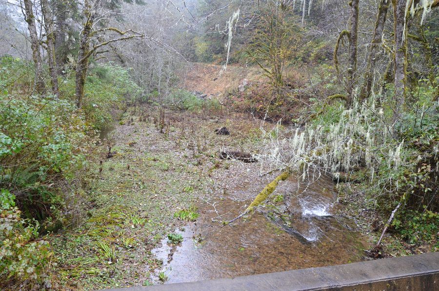 1st Riparian Buffer, frame 0982, 2017-11-08

David Gould (1)
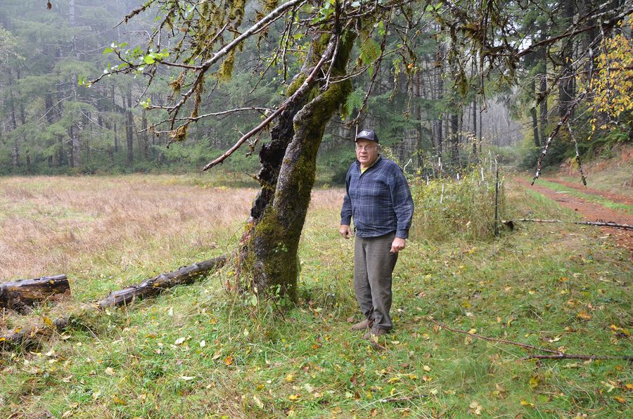 David Gould, frame 0968, 2017-11-08

Deans Mountain (2)
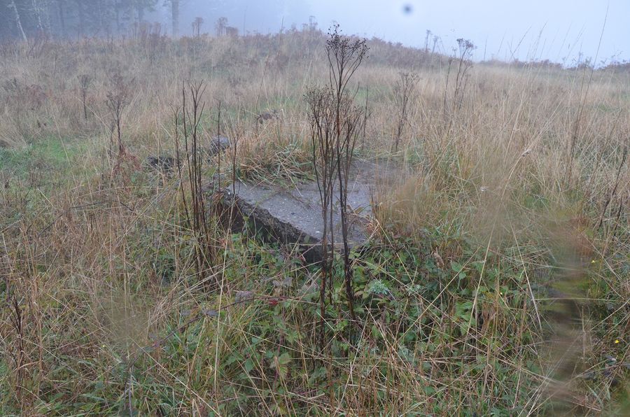 Deans Mountain, frame 0989, 2017-11-08
 Deans Mountain, frame 0990, 2017-11-08


Divide Spring (1)
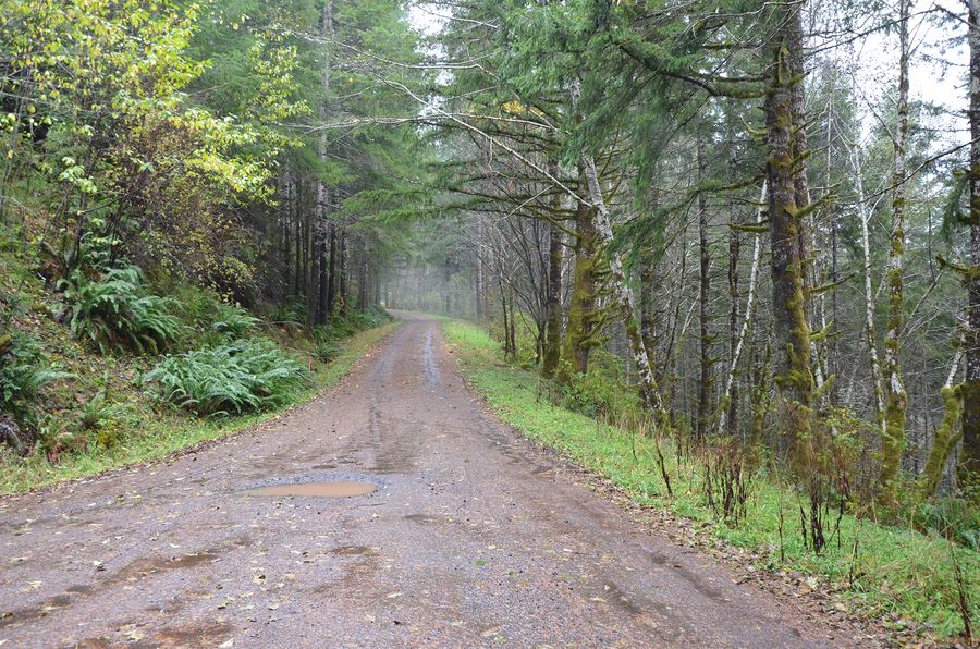 Divide Spring, frame 0988, 2017-11-08

Divide Spring Camp (1)
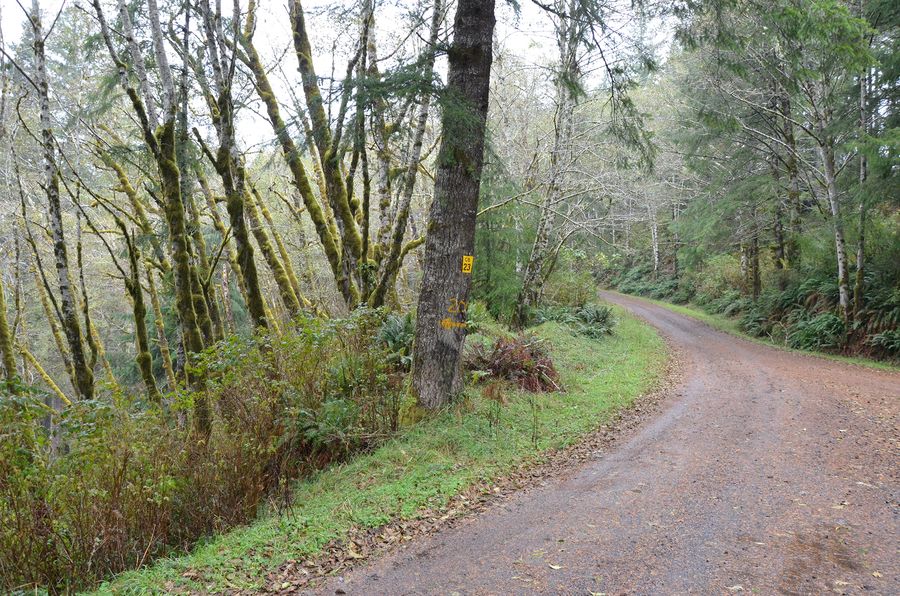 Divide Spring Camp, frame 0987, 2017-11-08

Fishing Camp (6)
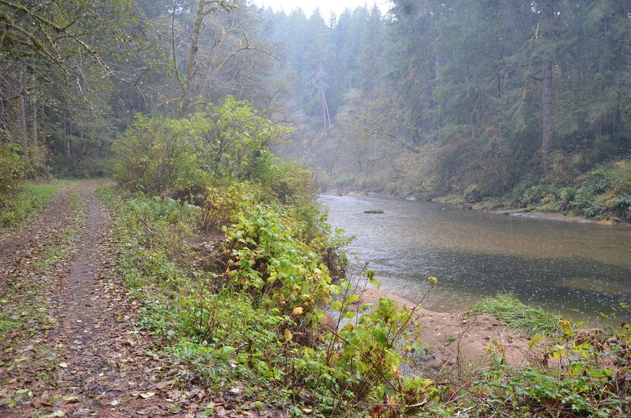 Fishing Camp, frame 0951, 2017-11-08
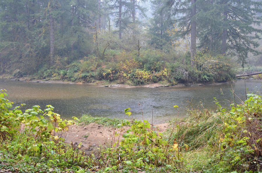 Fishing Camp, frame 0952, 2017-11-08
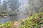 Fishing Camp, frame 0953, 2017-11-08
 Fishing Camp, frame 0954, 2017-11-08
 Fishing Camp, frame 0955, 2017-11-08
 Fishing Camp, frame 0956, 2017-11-08


Gould Barn (2)
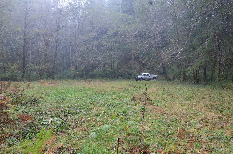 Gould Barn, frame 0960, 2017-11-08
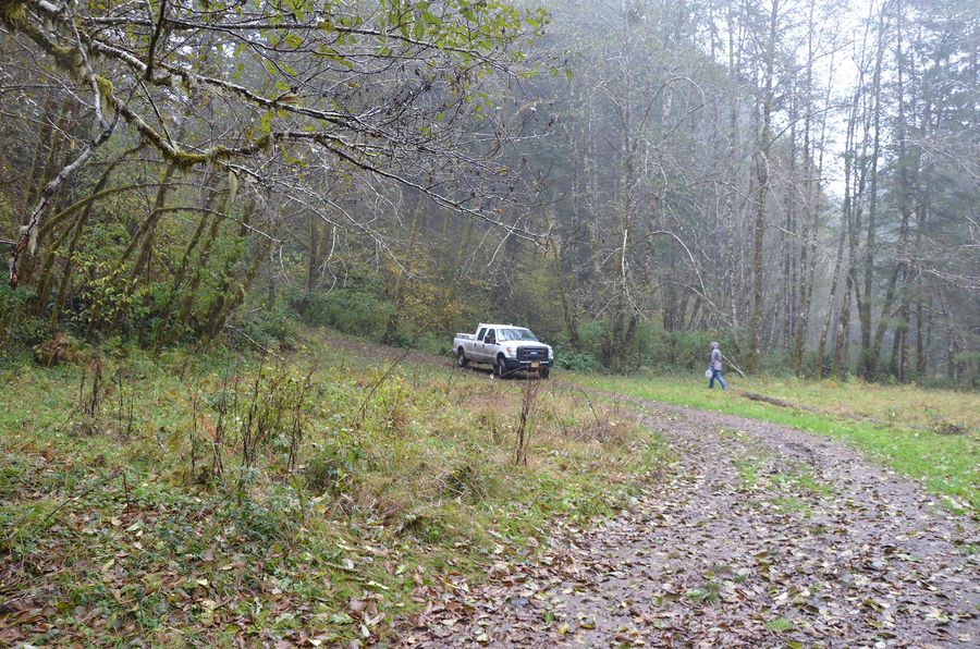 Gould Barn, frame 0962, 2017-11-08


Gould Bridge (1)
 Gould Bridge, frame 0957, 2017-11-08

Gould Lake (3)
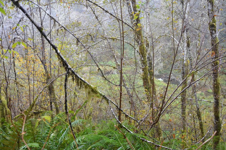 Gould Lake, frame 0971, 2017-11-08
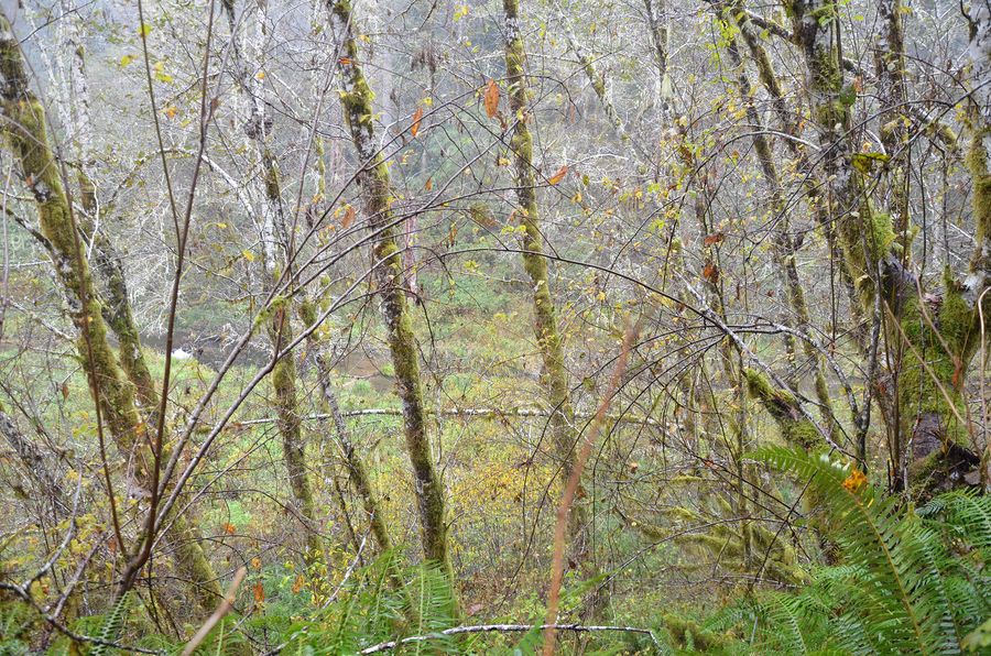 Gould Lake, frame 0973, 2017-11-08
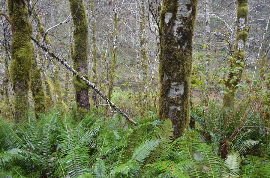 Gould Lake, frame 0974, 2017-11-08


Gould Lake?? (1)
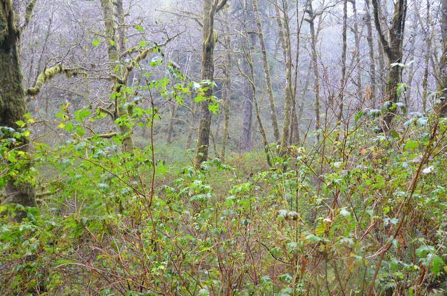 Gould Lake??, frame 0978, 2017-11-08
Gould Orchard (4)
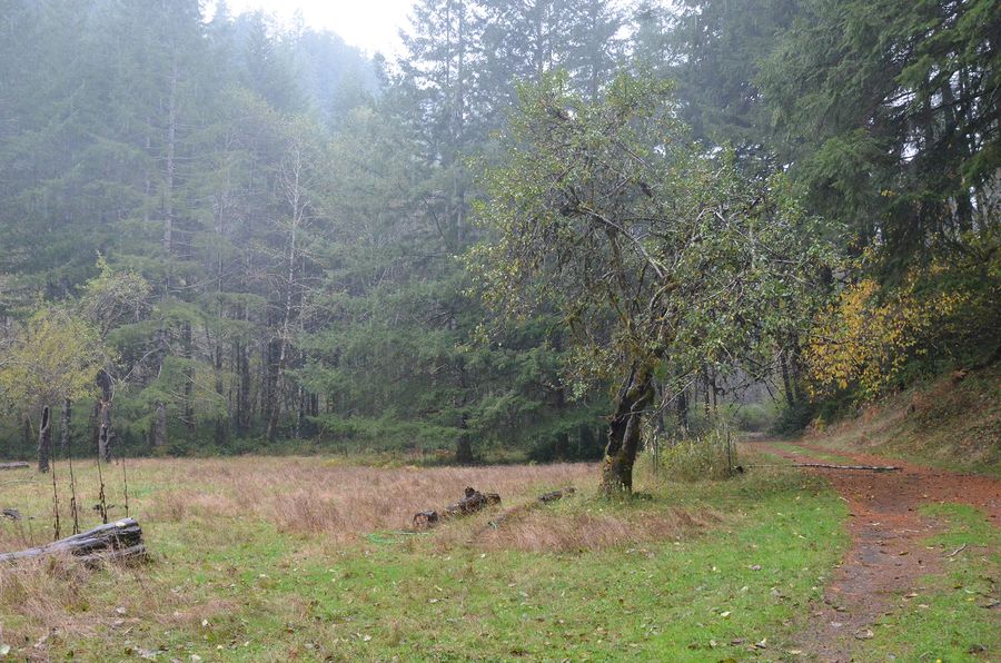 Gould Orchard, frame 0964, 2017-11-08
 Gould Orchard, frame 0966, 2017-11-08
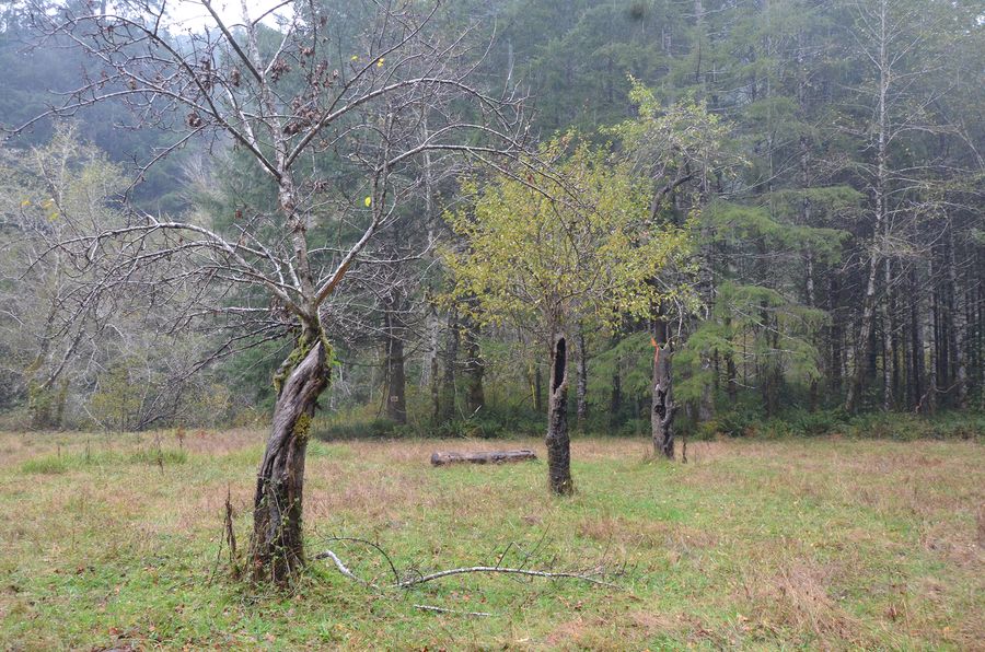 Gould Orchard, frame 0967, 2017-11-08
 Gould Orchard, frame 0969, 2017-11-08


Gould Rose (1)
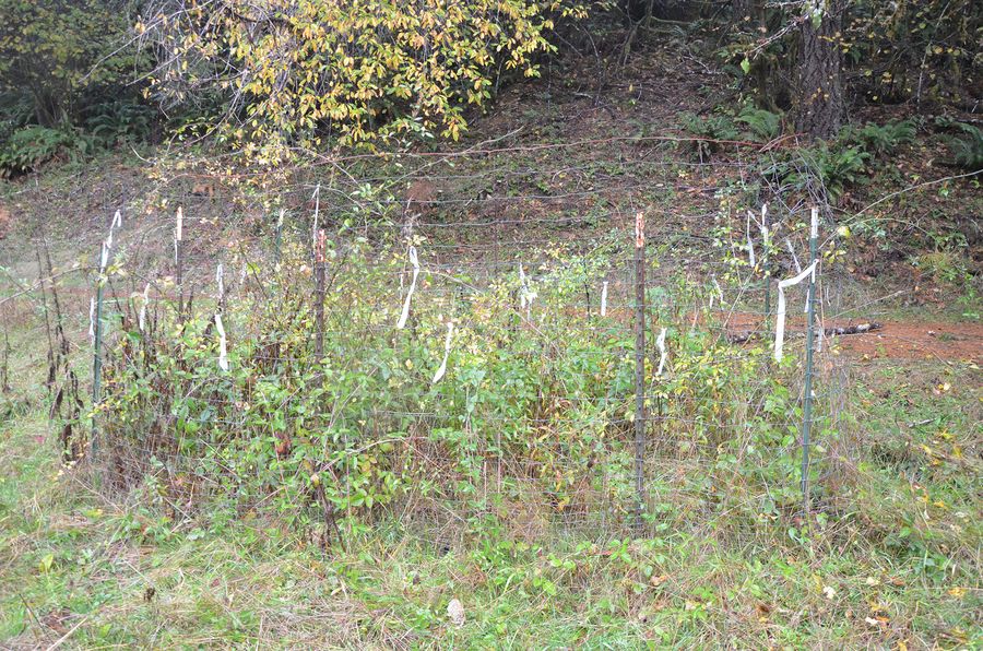 Gould Rose, frame 0965, 2017-11-08

Human Scale (2)
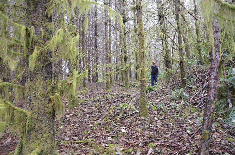 Human Scale, frame 0949, 2017-11-08
 Human Scale, frame 0991, 2017-11-08


Muddy Spring (4)
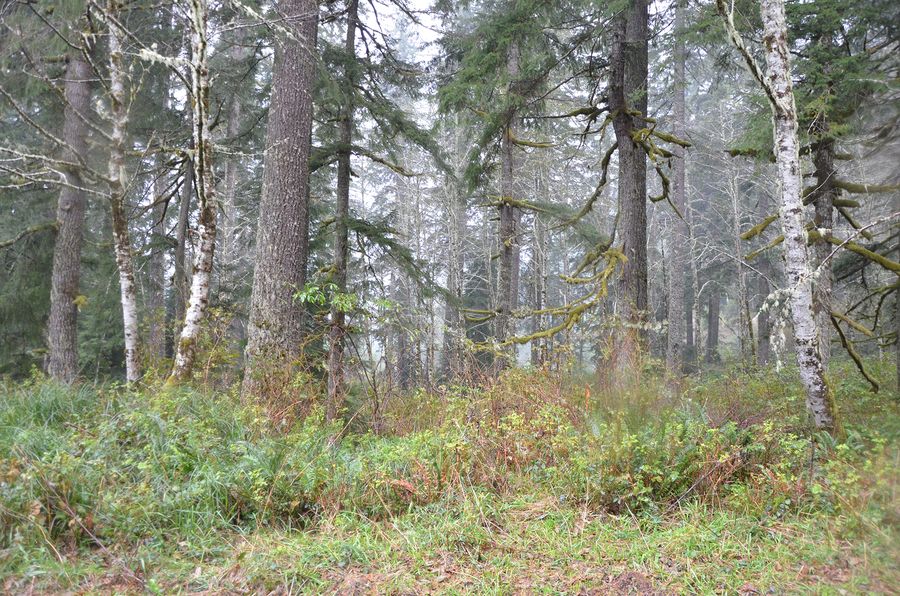 Muddy Spring, frame 0996, 2017-11-08
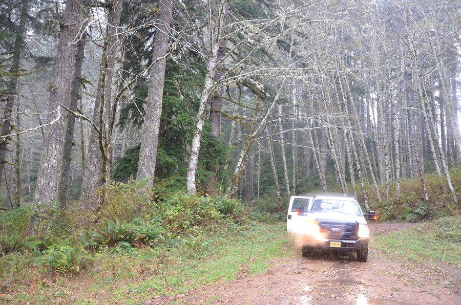 Muddy Spring, frame 0997, 2017-11-08
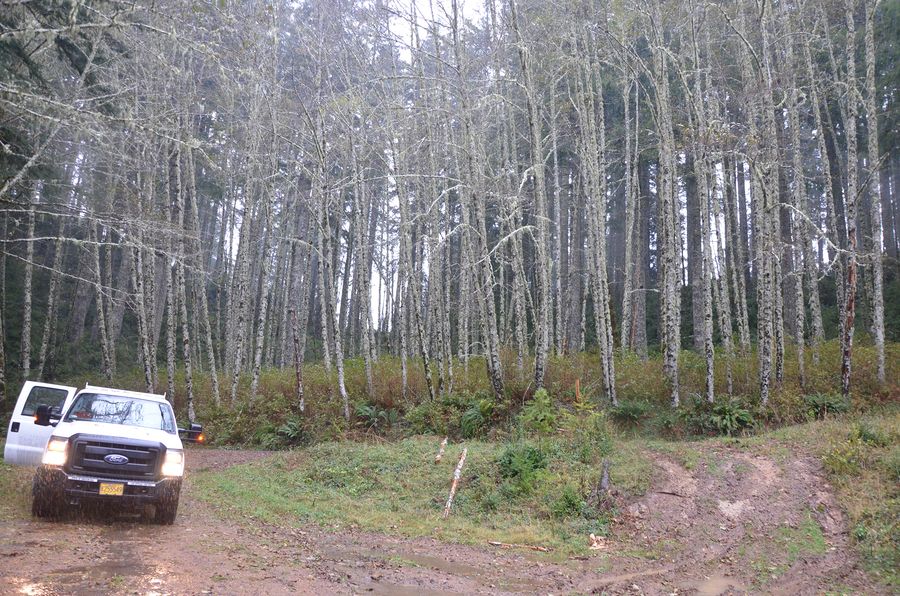 Muddy Spring, frame 0998, 2017-11-08
 Muddy Spring, frame 0999, 2017-11-08


Old Maids Cabin (3)
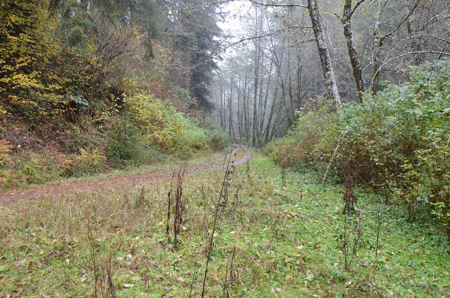 Old Maids Cabin, frame 0979, 2017-11-08
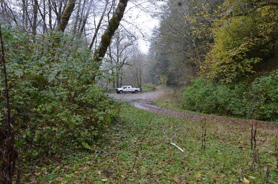 Old Maids Cabin, frame 0980, 2017-11-08
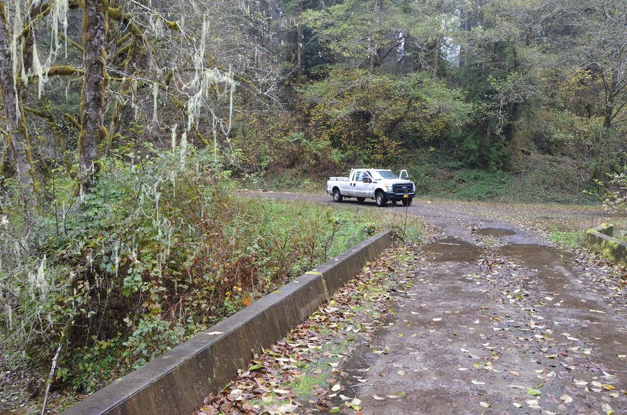 Old Maids Cabin, frame 0983, 2017-11-08


Old-Gowth Alder (1)
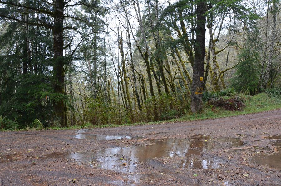 Old-Gowth Alder, frame 0986, 2017-11-08

Radio Tower (1)
 Radio Tower, frame 0992, 2017-11-08

Spawning Gravel (1)
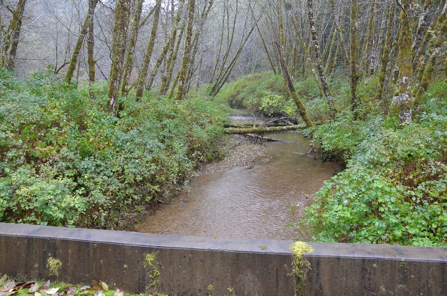 Spawning Gravel, frame 0984, 2017-11-08

Sullivan Ridge Spring (1)
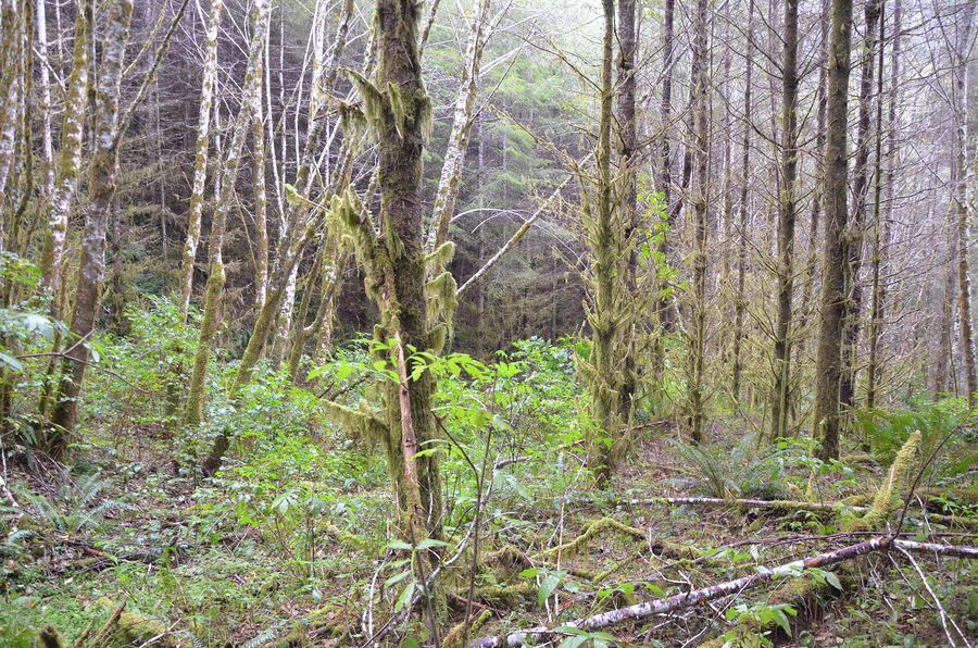 Sullivan Ridge Spring, frame 0947, 2017-11-08

Sullivan Ridge Waterhole (1)
 Sullivan Ridge Waterhole, frame 0950, 2017-11-08

Where a photograph carries no printed caption, the label shown is the place and frame number from the file itself, not a caption by the photographer.
How to cite this item
The first line is the citation as it is printed in the original. Use it when you cite the work itself. Use the second when you cite this page.
- As printed
- David Gould editing notes on the November 8, 2017 Elliott field trip oral history interviews with Jerry Phillips
- This page
- Elliott State Forest interviews, November 8, 2017:<page>. America's School Trust Library, The Zybach Collection. https://schooltrusts.org/collections/zybach/elliott/interviews/20171108-gould-edits/
More on citing this collection: How to cite the Zybach Collection.
Bob Zybach did not print a citation string for the Elliott interviews. The form above is assembled from his own project title and the title he gave this interview; the short form is this library's, citing the printed page.
Something wrong on this page? Submit a correction — the form opens with this page already filled in, the same control that sits at the foot of every page in the Library. How corrections work.

