
The Zybach Collection · Series
Elliott State Forest
Six recorded interviews, nineteen videos that walk the same ground, and the photographs, maps and sound files that go with them.
In the autumn of 2017 Bob Zybach drove the roads of the Elliott State Forest with a tape recorder running, and stopped wherever there was something to say. Jerry Phillips, David Gould, Bob Jacobson, Roger Johnson and Gary Vonderohe talked at the stops — a 1958 clearcut, a landslide, a fishing camp, a lookout — and every stop was tied to a minute on the tape, a page in the transcript, and a point on the map.
Then he went back with a camera. Nineteen videos on his own playlist walk the same ground: field trips down the forest roads in the spring of 2020, class sessions for a community-college forestry course, and, in 2024, four more, including a two-and-a-half-hour history of the forest.
The Elliott was school trust land for most of a century, until the State Land Board decoupled it from the Common School Fund in 2022. That is why a school-trust library keeps this part of the record.
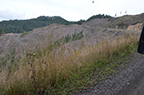
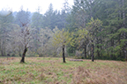
Come along
19 videos, with 531 time-coded entries in the creator's own descriptions, so a reader — or a class — can jump straight to the minute he marked. Each video page cues the embed to that moment. The whole playlist is on ORWWmedia.


The interviews
6 interviews on 28 tape sides, which the creator indexed in 2019 into 112 stops — each one a place, a minute and a transcript page. That index is kept here exactly as he made it; nothing has been renumbered.
-
#1. Interview #1. October 6, 2017: Coos Bay Test Interview: Jerry’s Book Characters
With Jerry Phillips, Bob Zybach
-
#2. Interview #2. October 10, 2017: Elk Ridge Road to Loon Lake & Umpqua River
With Jerry Phillips, Bob Zybach, Amber Ross, Randy Wiest
-
#3. Interview #3. November 8, 2017: Larson Slough to Elkhorn Ranch & Gould’s Lake
With Jerry Phillips, David Gould, Bob Zybach, Amber Ross, Randy Wiest
-
#4. Interview #4. November 28, 2017: Bob Jacobson & Fishing the Elliott
With Bob Jacobson, Bob Zybach
-
#5. Interview #5. December 6, 2017: West-Side Elliott Creeks & Ridgelines
With Jerry Phillips, Roger Johnson, Bob Zybach, Amber Ross, Randy Wiest
-
#6. Interview #6. October 10, 2018: Elliott Landslides, Fish Habitat & Fisheries
With David Gould, Gary Vonderohe, Bob Zybach
Map of 2017 Elliott Forest Oral History Interview Routes with Jerry Phillips and Bob Zybach, October-December, 2017. Map by Bob Zybach, ORWW and Amber Ross, DSL.
All 13 transcripts, with a permanent link on every printed page
Filed alongside
Recordings and transcripts the creator kept in the same folder without making them part of the project: older tapes he gathered from other people, interviews recorded elsewhere, and working copies. Each has its own page, described as it stands.
- Interview,
- Herman Larson Interview by John and Maralee Brelage 1962-63 October 8, 1962 · 11 pages
- Side A: Interview with Herman Larson (age 98 years at the time) by Dennis Signalness and Leroy Hanson circa 1965 - transcribed from tapes November 11, 1965 · 9 pages
- The OSU Extension Service Centennial Oral History Collection: Bob Jacobson, May 3, 2008 May 3, 2008 · 17 pages
- Bob and Kaety Jacobson Oral History Interview, “A Family Dynasty in Marine Extension”, January 20, 2015 January 20, 2015 · 16 pages
- David Gould editing notes on the November 8, 2017 Elliott field trip oral history interviews with Jerry Phillips November 8, 2017
- November 11, 2019. Interview with David Gould about his oral/family history in The Elliott State Forest, boundaries and beyond, and more complete history of forest fires in the region. November 11, 2019 · 6 pages
The ground
Every place below carries a coordinate and the method used to get it. Select a point for its place page: what was said there, on which tape, at which minute, on which transcript page, and which photographs were taken.
The map could not load. The list below carries the same places.
- Interview stop
- Field-trip stop
- Other place named
Places in this series (89)
Coordinates and the method behind each one are shown on the place page.
- Adams Creek — stream43.54595, -124.15567
- Alder Gulch — valley43.59127, -124.08239
- Allegany — populated place · 1 stops43.42595, -124.03233
- Ash Valley — valley · 1 stops43.57999, -123.82534
- Ash Valley School — school site · 1 stops43.53776, -123.82676
- Baltimore Crane House — cabin site · 1 stops43.56004, -123.94392
- Benson Creek — stream43.56428, -124.10483
- Bickford Creek — stream43.56410, -123.83047
- Big Creek — stream · 1 stops43.59150, -124.10622
- Big Saddle — saddle · 2 stops43.51123, -123.93080
- Bob Jacobson Fishing Camp — fishing camp · 1 stops43.53173, -123.96352
- Brandy Bar — bar43.67901, -123.92955
- Buck Creek — stream43.56345, -123.96760
- Buehner's Logging Camp — historic logging camp · 1 stops43.44557, -124.03074
- Cedar Cabin — cabin site · 1 stops43.54581, -123.98296
- Charleston — populated place43.34011, -124.33012
- Charlotte Creek — stream · 1 stops43.66067, -123.91872
- Charlotte Ridge — ridge43.65680, -123.95607
- Clarence Gould Cabin — cabin site · 1 stops43.56004, -123.94392
- Coos Bay — populated place43.36650, -124.21789
- Cougar Pass — gap / fire lookout site · 1 stops43.59839, -123.86579
- Dean Creek — stream43.69400, -124.00011
- Dean Mountain — summit · 2 stops43.61444, -123.97971
- Deer Creek — stream43.58150, -123.96149
- Deer Head Point — summit43.69390, -123.91379
- East Fork Millicoma River — stream43.42428, -124.03038
- Elk Creek — stream · 2 stops43.58289, -123.93149
- Elk Peak — summit · 2 stops43.54044, -123.90980
- Elkhorn Ranch — historic ranch / homestead · 3 stops43.54584, -123.96355
- Elkton — populated place43.63762, -123.56815
- Fish Creek — stream43.58206, -123.92010
- Footlog Creek — stream43.64290, -123.86788
- Glenn Creek — stream43.45456, -123.95621
- Golden Creek — stream43.66845, -123.79149
- Golden Falls — falls43.48512, -123.92788
- Gould Lake — lake · 3 stops43.53686, -123.94444
- Hakki Creek — stream · 1 stops43.68762, -124.00594
- Howell Creek — stream43.51956, -123.88455
- Indian Charlie Creek — stream43.66845, -123.92372
- Indian Point — point / Indian allotment · 1 stops43.62993, -123.85573
- Indian Trail Spring — spring · 1 stops43.50316, -123.95176
- Jerry Phillips Private Reserve — forest reserve · 1 stops43.50316, -123.95176
- Joes Creek — stream43.57317, -123.96344
- Johnson Creek — stream43.54400, -124.11622
- Kelly Creek — stream43.58095, -123.90705
- Knife Creek — stream43.58706, -123.94483
- Lakeside — populated place · 1 stops43.57567, -124.17511
- Larson Creek — stream43.47817, -124.14122
- Larson Slough — stream/slough43.46234, -124.19483
- Little Mill Creek — stream43.65456, -123.82649
- Little Salander Creek — stream43.58567, -123.84232
- Loon Lake — lake · 2 stops43.58682, -123.83709
- Luder Creek — stream43.65067, -123.90177
- Marlow Creek — stream · 1 stops43.43400, -124.02566
- Mill Creek — stream · 2 stops43.65539, -123.87427
- Millicoma River — stream43.38011, -124.09816
- Millicoma River Rearing Pond — hatchery · 1 stops43.43789, -123.94896
- Nesika County Park — county park43.44011, -123.99538
- North Bend — populated place43.40650, -124.22428
- North Marlow Ridge — ridge / 1958 clearcut · 1 stops43.50314, -123.97158
- North Tenmile Lake — lake43.59054, -124.15164
- Panther Creek — stream43.57456, -123.91788
- Piledriver Creek — stream · 1 stops43.47261, -124.00427
- Reedsport — populated place43.70234, -124.09678
- Roberts Creek — stream43.54234, -124.07844
- Salander Creek — stream43.58289, -123.84204
- Scholfield Creek — stream43.69833, -124.10782
- Scholfield Ridge — ridge · 1 stops43.61388, -123.98360
- Schumacher Creek — stream43.48011, -124.03983
- Scottsburg — populated place43.65401, -123.81677
- Silver Creek — stream43.48150, -123.93094
- Silver Falls — falls43.48845, -123.93455
- South Slough — gut/estuary · 1 stops43.31511, -124.32317
- Stulls Falls — falls · 1 stops43.51095, -123.99566
- Sullivan Creek — stream43.47817, -124.14122
- Surprise Creek — stream43.52484, -123.85815
- Tenmile — populated place43.57623, -124.19567
- Tenmile Butte — summit · 1 stops43.52550, -124.09424
- Tenmile Creek — stream43.56178, -124.23206
- Tenmile Lake — lake · 1 stops43.55002, -124.12343
- Tenmile Lake County Park — county park43.57345, -124.17067
- Trail Butte — summit · 3 stops43.50115, -124.03729
- Trout Creek — stream · 2 stops43.52234, -123.97621
- Umpcoos Ridge — ridge · 2 stops43.60628, -123.89309
- Umpqua Wayside — state wayside43.67744, -123.93306
- West Fork Glenn Creek — stream43.51373, -123.89316
- West Fork Millicoma River — stream · 3 stops43.42428, -124.03010
- West Fork Silver Creek — stream43.48539, -123.93399
- Winchester Bay — populated place43.67706, -124.17484
All 124 places — 89 of them mapped
The rest of it
- Photographs — 156 frames, by date and place.
- Maps — 43 maps from the creator's own map page, with his captions as he wrote them.
- Recordings — 36 sound files, with size, estimated duration and date.
- Places — 124 places, with the method and confidence behind each coordinate.
How big it is
- 6recorded interviews
- 28tape sides
- 112indexed stops
- 717transcript pages
- 19videos
- 531time-coded video sections
- 156photographs
- 43maps
- 124places named
- 36sound files
Tape sides are counted as the creator's own 2019 index counts them. Oregon State's description of the same material lists 15 audiocassettes.
About this series
What it is
Elliott State Forest 2017-2019 Oral History Project . Final reports and attachments by Bob Zybach, September 30, 2019. Report prepared for Anthony Davis and Stephen Fitzgerald, OSU Forestry and Larry Landis, OSU Archives Special Collections.
Interviewees: Jerry Phillips, David Gould, Bob Jacobson, Roger Johnson, Gary Vonderohe. Interviewer(s): Bob Zybach, with Amber Ross and Randy Wiest.
Provenance
- Creator. Dr. Bob Zybach.
- Originals. The recordings, transcripts, photographs and maps are the creator's own public files on orww.org, where he has published them since 2019. The videos are on his own playlist. The Library links to them for every recording, video and full-size photograph; the small photographs shown inline are display copies of his images.
- Described by. Oregon State University Libraries Special Collections and Archives Research Center describes this material as OSU SCARC finding aid, OH 047.
- Accession. Accessioned from Bob Zybach’s upload to the shared Drive, 2026-08-23.
Rights and reuse
Rights are stated series by series on the rights page. Nothing on these pages asserts who holds copyright, and the Library will take down or correct anything on request. Rights, use and takedown.
Citing this series
How to cite · Provenance · Errata · Colophon · The whole collection
Something wrong on this page? Submit a correction — the form opens with this page already filled in. How corrections work.
