The Zybach Collection · Jedediah Smith
Guidebooks and the 2023 Rendezvous
Four days in April 2023 driving the route of 1828, with a guidebook for each day built out of the journals.
The creator’s own summary: “The Jedediah Smith Society 2023 Rendezvous took place over four days, from April 2 to 5, and replicated Smith’s routes from Smith River, California to Fort Vancouver in 1828.” Fifty-odd stops in four days, and at each one the party read what Smith, Rogers or McLeod had written at that place on the corresponding day of 1828.
The four guidebooks
One for each day. Each opens with the same introduction, then works through the campsites in order — the name the project gave the place, the date in 1828, and the journal entries for that day. The creator wrote in his instructions that they “were intentionally designed to be used on a local basis in future times by JSS members, students, researchers, and others with an interest in local history and historical locations.” All four are printed here page by page.
-
Guidebook #1: California Redwoods, 2 May – 22 June 1828
Day one of the Rendezvous: “Travels Through the Lands of Hoopa, Yurok, and Tolowa, by Jedediah Smith and Harrison Roger.” Sixteen named campsites, each with the journal entries for that day.
-
Guidebook #2: Oregon Coast, 23 June – 13 July 1828
“Travels Through the Lands of Tolowa, Tututni, Nasomah, Miluk, Hanis & Quuiich, by Alexander McLeod, Jedediah Smith & Harrison Rogers.” Twenty campsites from the Winchuck River to the entry of 13 July 1828, the last day Rogers wrote in his journal.
-
Guidebook #3: HBC California Trail, 8 August – 10 December 1828
“Travels Through the Lands of Chinook, Kalapuyan, Umpqua, Quuiich, Siuslaw & Hanis, by John McLoughlin, Alexander McLeod & Jedediah Smith.” The Hudson’s Bay Company brigade’s march south and the return along the coast, including the entry for 28 October 1828.
-
Guidebook #4: Fort Vancouver, 26 December 1828 – 30 October 1830
The aftermath in correspondence: George Simpson’s letters to Smith of December 1828, his March 1829 dispatch, the London committee’s letter to McLoughlin of October 1830, and Smith, Jackson & Sublette’s letter to Secretary of War Eaton of 30 October 1830.
Five indexed map sheets were made for the guidebooks by Vyla Grindberg of Douglas County GIS. They are on the maps page.
The itinerary, stop by stop
From the creator’s working schedule of 30 March 2023. Each row is a stop and the theme he set for it. His sheet also carries driving distances, the names of the people leading each stop, and one telephone number; the Library prints the stops and the themes, and no contact details. His own file.
Day 1 — Sunday 2 April 2023
| Time | Stop | Theme |
|---|---|---|
| 9:15–9:45 | Crescent Beach Overlook | Smith’s history to this point |
| 9:45–10:30 | Walker Road headquarters | |
| 10:30–11:15 | Jedediah Smith State Park | Mural review; photographs |
| 11:15–11:30 | Smith River camp | Templeman Grove / Tanoak Drive |
| 11:30–1:00 | Brookings — lunch | Early trade relations |
| 1:00–2:00 | Harris Beach | Topography and birds |
| 2:00–2:30 | Cape Ferrelo Viewpoint | Smith’s route change; photographs |
| 2:30–3:15 | Gold Beach | Rogue River viewpoint |
| 3:15–4:15 | Humbug Mountain | Native foods, camping, pasture |
| 4:15–5:00 | Nasomah Memorial | Beach Loop Road |
Day 2 — Monday 3 April 2023
| Time | Stop | Theme |
|---|---|---|
| 9:00–9:45 | Seven Devils Beach | Topography and pasture |
| 9:45–10:30 | South Slough interpretive centre | Vegetation and topography |
| 10:30–11:00 | Cape Arago Viewpoint | Photographs; topography |
| 11:00–12:00 | Shore Acres and Sunset Bay | Trade and pasture |
| 12:00–12:30 | The Hollering Place | A local village |
| 12:30–2:30 | Coos History Museum — lunch | The Youst archive; McLeod’s history |
| 2:30–4:00 | Umpqua Bay lighthouse | Topography and campsite |
| 4:00–5:00 | The 1828 ground | Discussion: an appropriate memorial |
Day 3 — Tuesday 4 April 2023
| Time | Stop | Theme |
|---|---|---|
| 9:00–9:30 | BLM elk viewing | Pasturage |
| 9:30–11:00 | Fort Umpqua | Hudson’s Bay Company fort construction |
| 11:00–11:20 | Drain | The California Trail: the Forks |
| 11:20–11:45 | Curtin | Elk (Pass) Creek staging area |
| 11:45–12:00 | Lorane | Mountain La Biche |
| 12:00–12:30 | Veneta | The Applegate Trail |
| 12:30–12:45 | Cheshire | The California Trail |
| 12:45–2:00 | Monroe — lunch | Long Tom camp |
| 2:00–3:00 | Tampico | Soap Creek ford; County Road No. 1 |
| 3:00–3:15 | Airlie | The California Trail |
| 3:15–4:00 | Bridgeport School | The Hudson’s Bay Company Luckiamute crossing |
| 4:00–4:30 | Dallas | Lodging |
Day 4 — Wednesday 5 April 2023
| Time | Stop | Theme |
|---|---|---|
| 9:00–11:00 | Champoeg | Artifacts, campsites, horses |
| 11:00–12:15 | Willamette Falls | Museum of the Oregon Territory |
| 12:15–2:30 | Fort Vancouver | Tour and summaries |
| 2:45 | The Beaches Restaurant | Final stop |
One stop on the second day is given in his sheet as the ground of the 1828 events, with the theme “Discussion: Appropriate Memorial.” That discussion is where the memorial stone came from. The Library names the stop and not the place.
The Coos History Museum, Fort Umpqua and the OCTA talks
Three stops generated papers of their own, and two talks were given to the Northwest Chapter of the Oregon-California Trails Association — one seven weeks before the Rendezvous and one three days after it ended. The April talk is printed here slide by slide.
-
Daily itinerary, 2–4 April 2023
The working schedule for the four days: each stop, its theme, the driving distance and the person leading it. The Library prints the stops and themes below; one line giving a private telephone number is not reproduced.
The creator publishes this himself; the Library’s copy is a display copy; permission being recorded.
-
Rendezvous circular, 1 March 2023
The announcement sent out before the Rendezvous. Third-party work; identified by reference.
Third-party work; identified by reference.
-
Notes for the Coos History Museum visit, 22 March 2023
Five pages prepared for the museum stop on the second day. Third-party work; identified by reference.
Third-party work; identified by reference.
-
Index to the Youst Collection, Coos History Museum, 2023
A twenty-seven-page finding aid to the collection the party was shown. Third-party work; identified by reference.
Third-party work; identified by reference.
-
Fort Umpqua tour script, 2023
The script used for the Fort Umpqua stop on the third day. Three pages, scanned without a text layer. Third-party work; identified by reference.
Third-party work; identified by reference.
-
Presentation to the Northwest Chapter, Oregon-California Trails Association, 10 February 2023
The talk given seven weeks before the Rendezvous. 18.2 MB — above the Library’s copying threshold, so it is linked and described rather than published page by page.
The creator publishes this himself; the Library’s copy is a display copy; permission being recorded.
The eight illustrations, and their captions
For his article in the Society’s journal the creator chose eight pictures and wrote a caption for each. The captions are printed here as he wrote them. Two pictures are his own and one is a painting from 1845; those are shown. Three were made by other photographers on the trip, and those are named and linked rather than reproduced. Two are withheld: their captions give the place. His caption sheet.
-
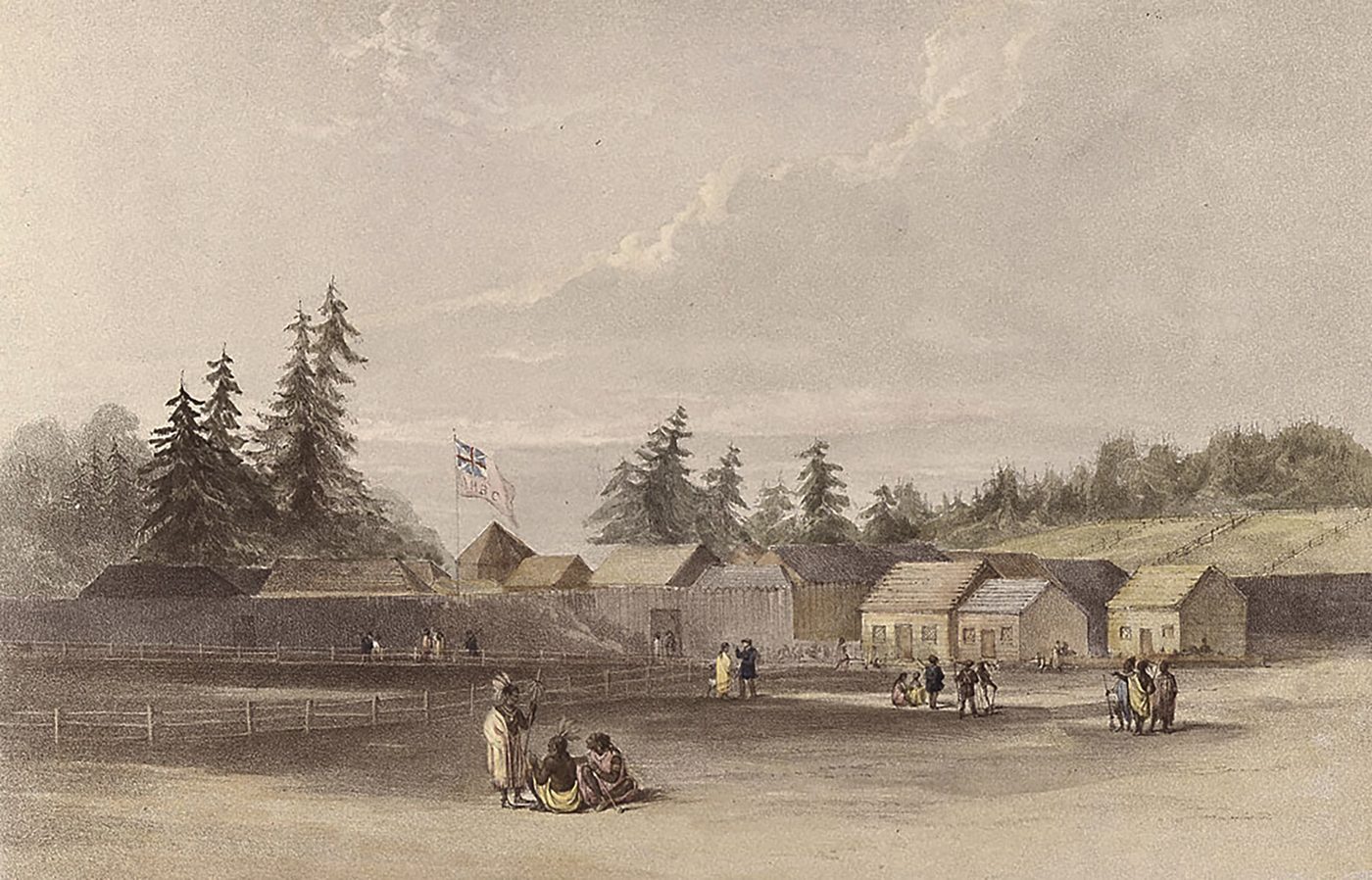
This painting of Fort Vancouver was made in 1845 or 1846 by British military spy, Henry Warre, while under orders to "obtain a general knowledge of the capabilities of the Oregon Territory in a Military point of view" in "perfect secrecy, so far as possible." The fort was being constructed during Smith’s winter 1828-29 stay there and he may well have been among its first occupants. Illustration 1; 1_Warre_1845-8.jpg, 1.8M. -
Harris Beach looking south. The geological effects of the 1700 Cascadia earthquake and subsequent tsunami are still apparent today and formed formidable barriers to Smith’s expedition. Note the people and driftwood at the base of the cliff for scale. April 2, 2023 photo by Peter Meyerhof.
Illustration 2. Photograph by another hand; identified by reference and not reproduced here. 2_Meyerhof-IMG-8.jpg, 1.4M.
-
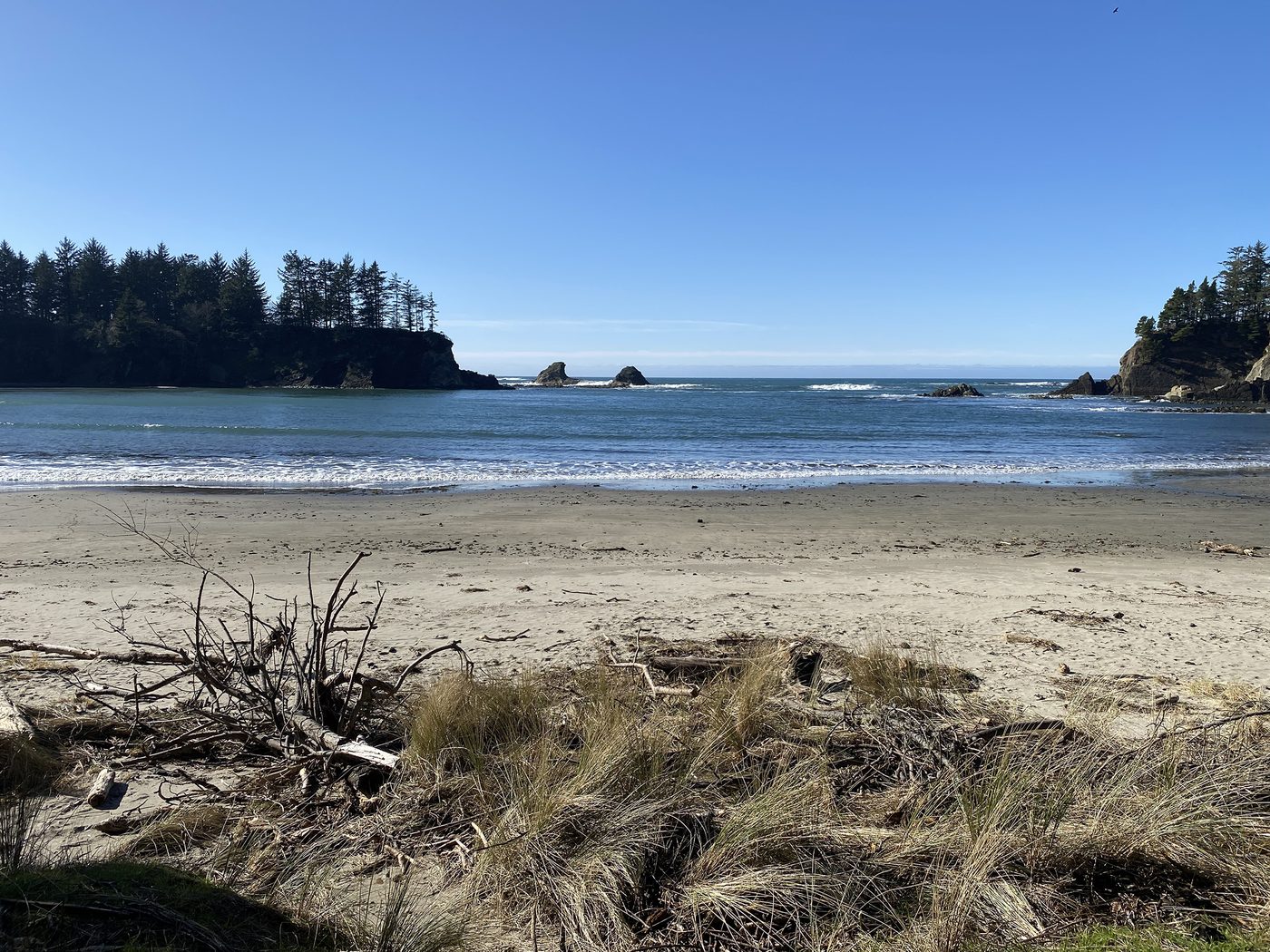
Sunset Bay. The expedition spent two days here, with good forage and need to forge a difficult two-mile path through coastal brush and bogs to reach present-day South Slough and Coos Bay. February 2, 2023 photo by Bob Zybach. Illustration 3; 3_Zybach-1422_Sunset_Bay-8.jpg, 3.4M. -
Withheld from this edition pending review. The item keeps its place in the register and its permanent link.
Illustration 4. Its caption identifies the place of the 1828 attack and the burials, and is not reproduced. 4_Tsp_21S_Rng_12W_1858-8.jpg, 437k. The entry keeps its number and its link is not published. -
Withheld from this edition pending review. The item keeps its place in the register and its permanent link.
Illustration 5. Its caption identifies the place of the 1828 attack and the burials, and is not reproduced. 5_Moore-Umpqua_Site-8.jpg, 3.0M. The entry keeps its number and its link is not published. -
Fort Vancouver restoration by the National Park Service (NPS) as it appears today: to the same dimensions and appearance seen by Smith while being constructed in 1828, and as painted by Warre in 1845-46. April 5, 2023 photo by Peter Meyerhof.
Illustration 6. Photograph by another hand; identified by reference and not reproduced here. 6_Meyerhof-IMG_9818-8.jpg, 2.2M.
-
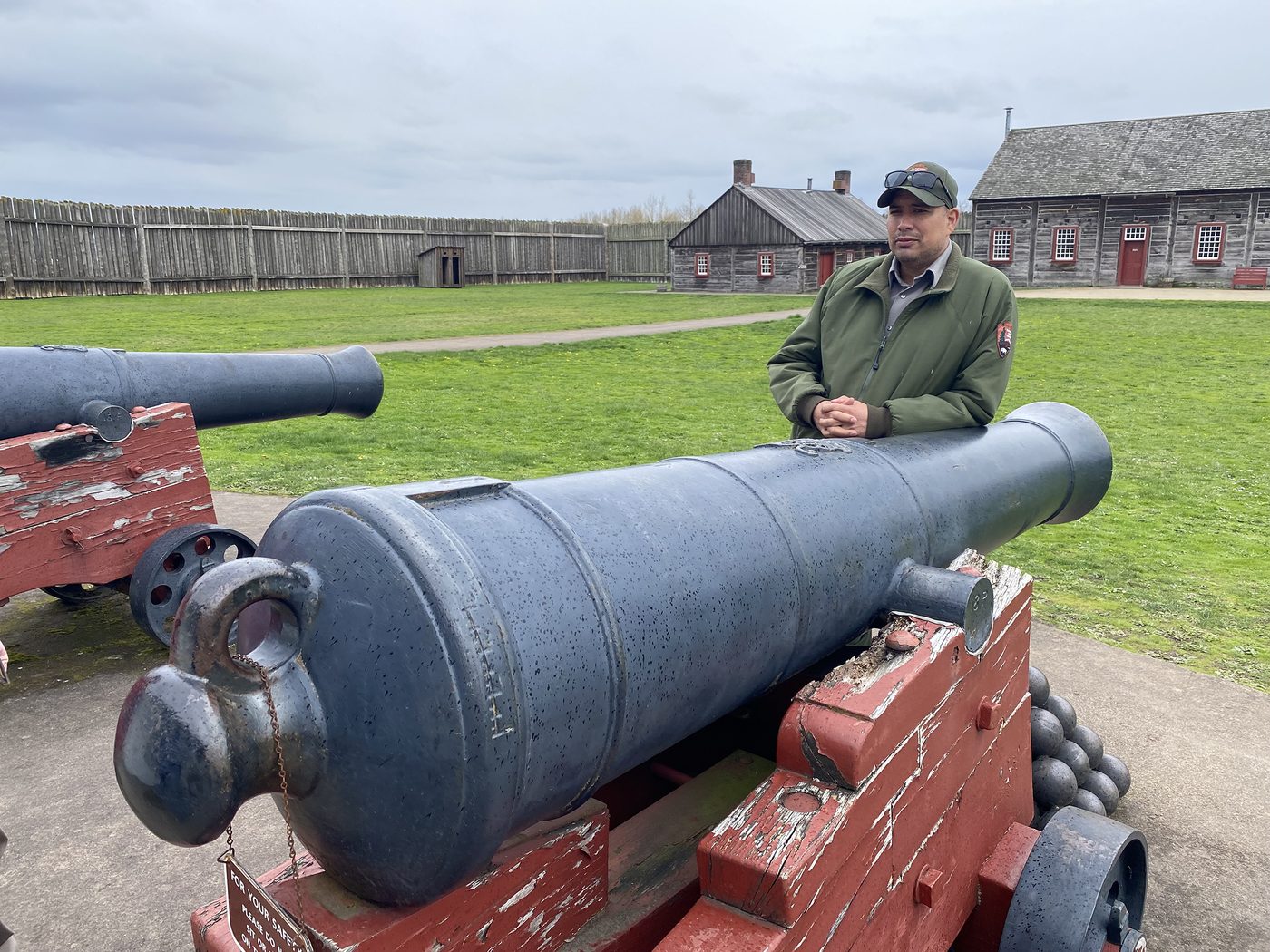
Aaron Ochoa, Fort Vancouver Chief of Interpretations, providing information about the cannons in front of the Chief Factor’s house. April 5, 2023 photo by Bob Zybach. Illustration 7; 7_Zybach-1479-8.jpg, 2.9M. -
The final stop at Fort Vancouver Chief Factor’s house on the way to a parting regale at The Beaches Restaurant on the Columbia River. (L-R) Rob Foxcurran, me, Jim Anderson, Suzi Schoensee, Aaron Ochoa, Virginia Jaquez, Eric Tschuy, and Peter Meyerhof. April 5, 2023 photo by Matt Dalimata.
Illustration 8. Photograph by another hand; identified by reference and not reproduced here. 8_Matt_Dalimata_1480-8.jpg, 2.1M.


The photographs, day by day
Participants pooled their photographs into four folders, one per day. The full registers — every file, its date and its size — are on the photographs page.
- Day 1 — 2 April 2023, Crescent City to Bandon 41 photographs
- Day 2 — 3 April 2023, Bandon to Reedsport 31 photographs
- Day 3 — 4 April 2023, Reedsport to Dallas 26 photographs
- Day 4 — 5 April 2023, Dallas to Fort Vancouver 35 photographs
Provenance
- Creator
- Bob Zybach, assisted by Joe Molter; for the Jedediah Smith Society
- Dates
- 2–5 April 2023
- Rights
- The guidebooks, the itinerary and the OCTA talks are the creator’s own work. Everything else on this page is identified by reference.
Series · The guidebooks page by page · Maps · Chronology · Submit a correction



