Soap Creek Valley · 1989 Auto Tour
STOP #4 SOAP CREEK [Settlers]
Stop 4 of the 1989 Historic Soap Creek Valley Auto Tour, printed page 13.
15.5 miles from the Peavy Arboretum entrance on the 1989 route. Open these pages in the original PDF · Read the text below
The text, as printed
Find this stop and nearby places on the map
The map could not load. The list below carries the same places.
- Tour stop
- Other place named
On this map
Auto Tour stops(3)
Ridges, peaks and buttes(1)
Roads(1)
Valleys(2)
city(1)
town (former)(1)
Named at this stop
Places. Airlie Road · Coffin Butte · Soap Creek Valley · Oregon · Oregon City · Tampico · Willamette Valley · Kentucky
People. George Stump · William Berry · David Carson · Letitia Carson · George Roberts · Green Berry Smith · David D. Davis
Narrators who speak of this place
- #1 Lorna Grabe p. 7, p. 14, p. 12, p. 58
- #3 Donald Dickey p. 15, p. 25, p. 43
- #4 Edward Sekermestrovich p. 3, p. 31
- #5 John Jacob & Wilma Rohner p. 1, p. 4, p. 7, p. 12, p. 13, p. 16, p. 17, p. 21, p. 26, p. 37, p. 40, p. 44, p. 46, p. 56, p. 61, p. 63, p. 66, p. 69, p. 79, p. 81, p. 82, p. 86, p. 88, p. 11, p. 13, p. 27, p. 28, p. 42, p. 51, p. 53, p. 83, p. 84
- #6 James Hanish p. 23, p. 34, p. 30
- #7 Charlie Olson p. 18, p. 22, p. 24, p. 123, p. 124, p. 125, p. 126, p. 127, p. 1, p. 2, p. 17, p. 58, p. 60, p. 83, p. 39, p. 50, p. 83, p. 90, p. 91, p. 123, p. 124, p. 125, p. 127, p. 129, p. 22
- #8 Neil Vanderburg p. 1, p. 2, p. 27, p. 39, p. 53, p. 63, p. 70, p. 79, p. 85, p. 86, p. 120, p. 124, p. 126, p. 127
- #9 Eugene Glender p. 5, p. 10, p. 12, p. 22, p. 26, p. 51, p. 95, p. 98, p. 1, p. 3, p. 4, p. 5, p. 56, p. 3, p. 8, p. 13, p. 38, p. 39, p. 56, p. 93, p. 111, p. 112, p. 117, p. 16, p. 101, p. 109
- #10 Velma Carter Rawie p. 5, p. 9, p. 10, p. 37, p. 56, p. 68, p. 70, p. 3, p. 5, p. 35, p. 57, p. 67, p. 74, p. 75, p. 84, p. 97, p. 98, p. 115
- #11 Bessie Murphy p. 31, p. 47, p. 84, p. 88, p. 50, p. 25, p. 93, p. 94
- #12 Wanda Marcks Cook p. 32, p. 51, p. 52, p. 74, p. 13, p. 18, p. 24, p. 28, p. 30, p. 32, p. 51, p. 54, p. 55, p. 66, p. 73, p. 74, p. 84, p. 9, p. 44
- #13 WILLIAM A. DAVIES p. 17, p. 19
- #14 Charles and Norman Hindes p. 3, p. 1, p. 3, p. 5, p. 19, p. 25, p. 26, p. 52, p. 3, p. 17, p. 19, p. 23, p. 34, p. 40, p. 52
- #15 Marvin Rowley p. 91, p. 30, p. 34, p. 35, p. 36
Photographs printed with this stop
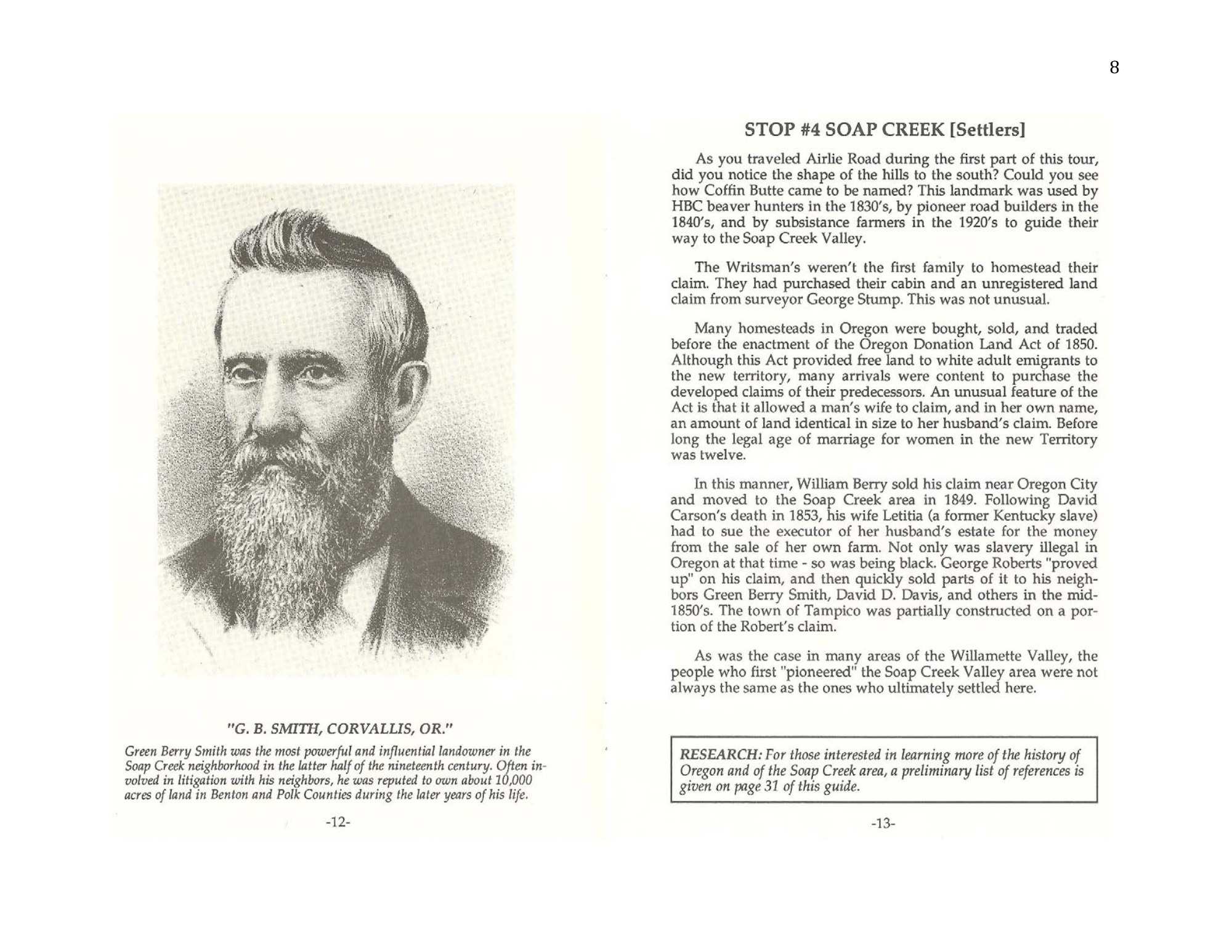
- Green Berry Smith was the most powerful and influential landowner in the Soap Creek neighborhood in the latter half of the nineteenth century. Often involved in litigation with his neighbors, he was reputed to own about 10,000 acres of land in Benton and Polk Counties during the later years of his life.
Citation and source history
Collection source history · The complete booklet and its credits
How to cite this item
The first line is the citation as it is printed in the original. Use it when you cite the work itself. Use the second when you cite this page.
- As printed
- Zybach, Bob 1989. Historic Soap Creek Valley Auto Tour. Oregon State University Research Forests and College of Forestry, Corvallis, Oregon: 32 pp.
- This page
- Zybach 1989. America's School Trust Library, The Zybach Collection. https://schooltrusts.org/collections/zybach/soap-creek/auto-tour/stop-4/
More on citing this collection: How to cite the Zybach Collection.
Something wrong on this page? Submit a correction — this page is already selected. See how that works.
